Brace for a change, Canada: Pattern flip-flop as we fall into winter

While areas east of the Rockies have so far seen an autumn dominated by warmth, we expect a major pattern reversal as we look ahead to the end of the fall and the start of the winter season in Canada.
Warmer than normal temperatures have dominated the fall season so far east of the Rockies. The various shades of orange on the temperature anomaly map below highlight the areas that were warmer than normal during September and the first half of October.
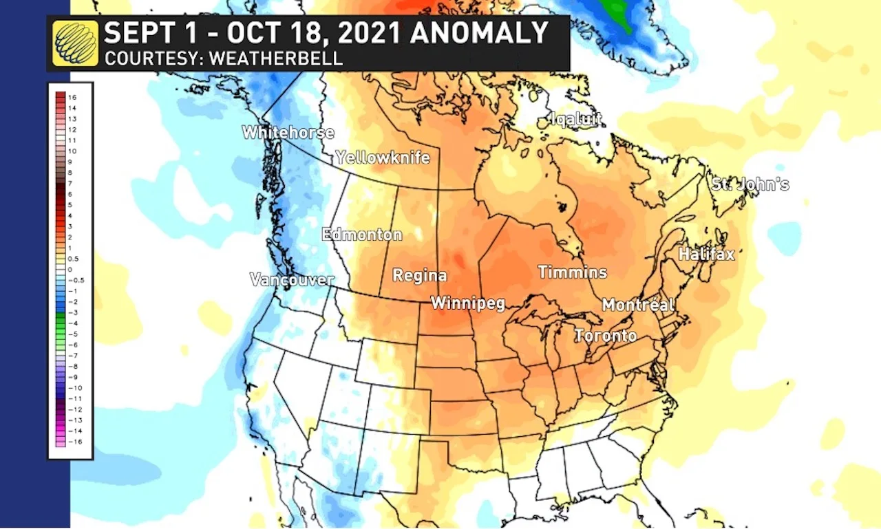
Meanwhile, it has been a different story for B.C. and the Yukon Territory, where temperatures have been colder than normal.
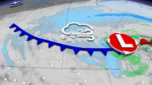
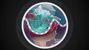
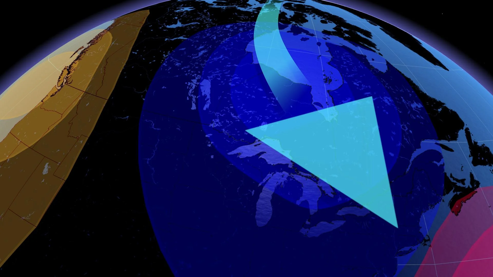
However, as we look ahead to the end of fall and the beginning of winter, we expect a major pattern reversal. Here is the jet stream pattern that we expect will develop during the second half of November and then dominate during the month of December.
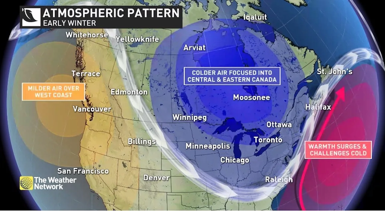
This should bring a period of above seasonal temperatures to B.C. and the Yukon, and a delay in the arrival of consistent cold weather for the western Prairies. Meanwhile, a colder pattern is expected to extend from the eastern Prairies to the Maritimes.
It is still too early to be highly confident as to whether this jet stream pattern will just give this region a more traditional start to winter (a rarity in recent memory) or whether this will result in a much colder than normal start to winter, especially for Ontario and Quebec. However, there are currently a few signals in the global pattern that point to a more wintry pattern leading up the holidays than many have become accustomed to in recent years.
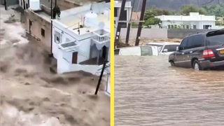
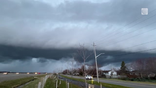
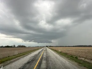
Regardless, we should see an abundance of lake-effect snow across the traditional snowbelt areas east and southeast of the Great Lakes. Water temperatures are exceptionally warm for this time of year, so even "typical cold" air could produce a few high-impact lake-effect snow squall events. This should help most ski areas to build a great snow base before the holidays.
RELATED: Waterspouts, lake-effect showers likely in Ontario as Great Lakes run a fever
ANOTHER PATTERN CHANGE FOR JANUARY AND FEBRUARY
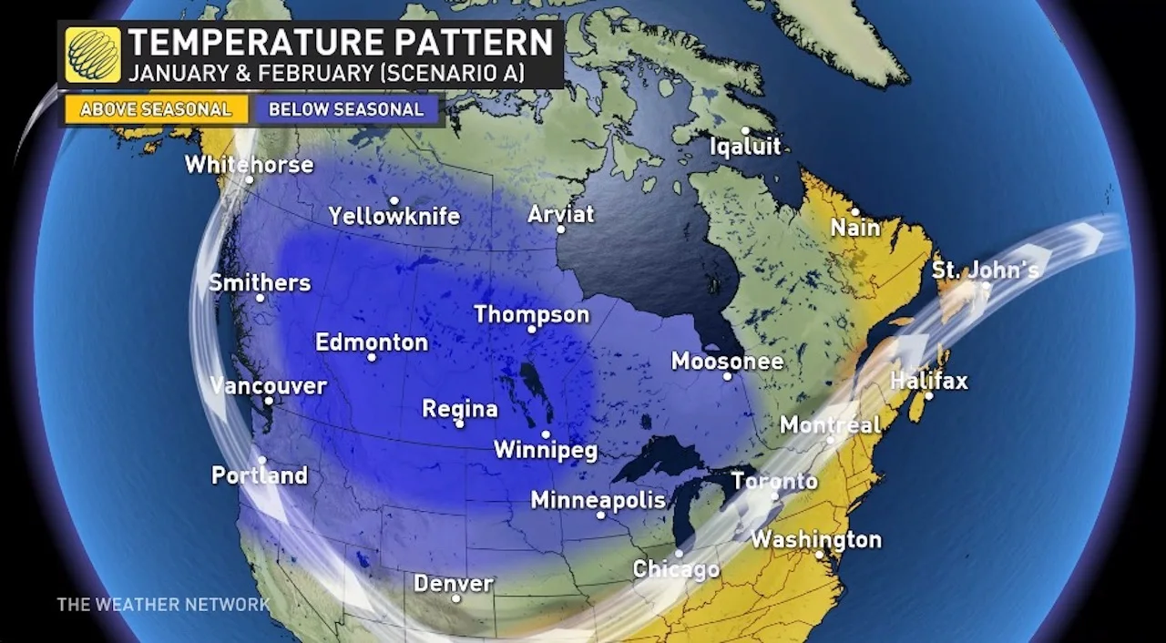
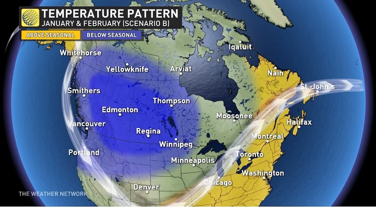
However, as we get into the heart of the winter season, we expect another major change in the jet stream pattern. This should cause the focus of the coldest weather to shift to Western Canada for January and February, with a heightened risk for extended periods of severe cold.
Meanwhile, a rather mild pattern is expected to develop across much of the eastern United States and that will attempt to surge north into southern Ontario, southern Quebec and Atlantic Canada.
The question is, where exactly will the battleground setup? That will make a huge difference as to how this winter will be remembered near the 401 corridor, and also for Ottawa and Montreal. There are the two possible scenarios that we will be evaluating as we develop our final winter forecast, which we will release on November 29.
Scenario A features an active storm track near the 401 corridor and into southern Quebec. With this scenario, southern Ontario and southern Quebec would see frequent messy systems, with an abundance of snow and ice, and even rain at times. However, we would not see consistent severe cold.
Scenario B features a more northerly storm track into the upper Great Lakes and across northern or central Ontario. This would bring a very snowy winter to northern Ontario and extended periods of very mild weather to southern Ontario, and at times into southern Quebec and Atlantic Canada. This extended thaw would be very hard on the ski industry, backyard rinks, etc.
At this point, we expect that we will see Scenario A for part of the time and Scenario B for part of the time, but it is too early to make a call on which will dominate.
Regardless, we expect that B.C. and the Prairies will be colder than normal during January and February, and above normal precipitation and snowfall is expected for the south coast of B.C.
For Atlantic Canada we expect less severe cold than we typically see during winter, and temperatures should tip to the warm side of normal. Near normal snowfall is expected across the region, but we will have a heightened risk for storms that bring a mix of snow, ice and even rain at times.
WHAT COULD GO WRONG?
With any seasonal forecast there is a risk that the dominant pattern drivers will not develop as expected. This year we are confident that we will be in a weak to moderate La Niña pattern through winter. However, there are other factors that will contribute to how this winter plays out.
MUST SEE: La Niña revives to impact winter and the finale of hurricane season
The biggest monkey wrench at this time appears to be the sea surface temperature pattern in the North Pacific, which is currently conducive for a stronger than normal Pacific jet stream.
If this pattern continues into winter, then we will see milder Pacific air spread across the country more frequently and shorter periods of frigid Arctic air. This is something that we will watch very closely during the weeks leading up to the release of our final winter forecast on November 29.