February shows its hand early as pattern change repeats this month

The month of February starts off with Arctic air returning to Western Canada while milder temperatures will infiltrate eastern sections from the Great Lakes to the Maritimes.
We are kicking off the month of February with a pattern that looks very different from what we have seen over the past few weeks. Arctic air has returned to Western Canada and milder air is surging north from the Great Lakes to the Maritimes.
The map below is the temperature anomaly map for the first two days of February with the various shades of orange, brown and white highlighting above normal temperatures, while the various shades of blue, green and purple highlight colder than normal temperatures. The coldest weather can be found across the Prairies.
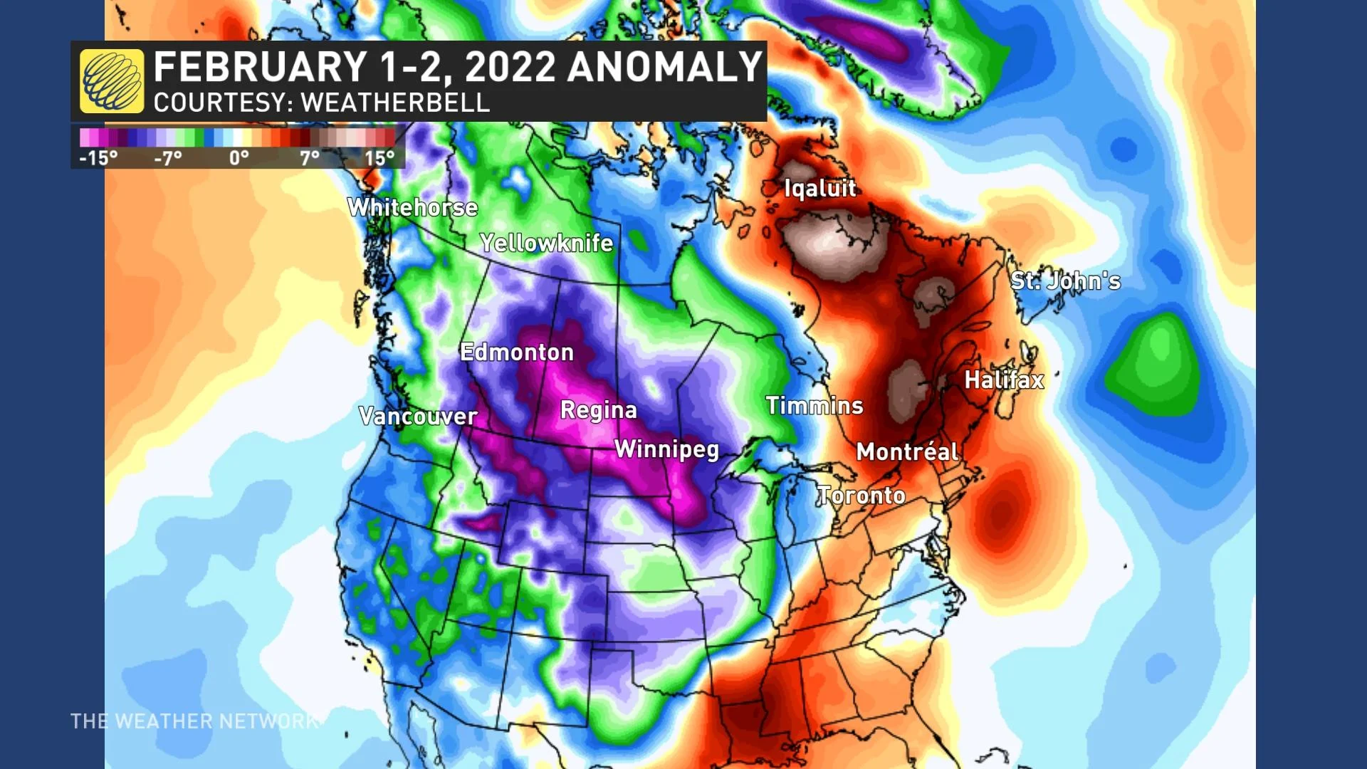
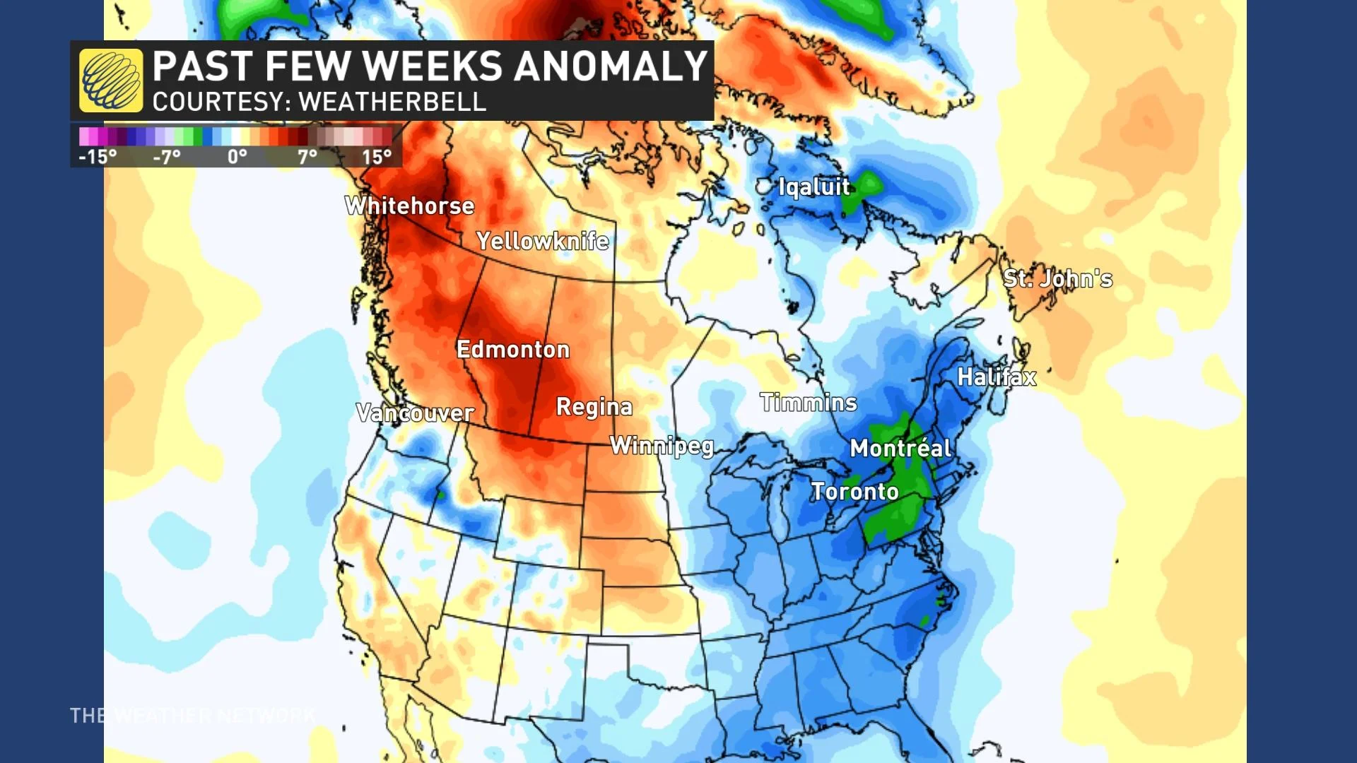
This is opposite to the pattern that we have seen over the past three weeks. The image below highlights that January turned very cold from the Great Lakes to the Maritimes, while above seasonal temperatures dominated west of Manitoba, across Newfoundland and most of far Northern Canada.
However, as you probably already know, if you have checked your seven-day forecast, this pattern will not last long at all. The Arctic air is on the move and will very quickly bring a return to harsh mid-winter conditions to areas that have been cold for the past three weeks. Meanwhile, milder weather will return to Western Canada.
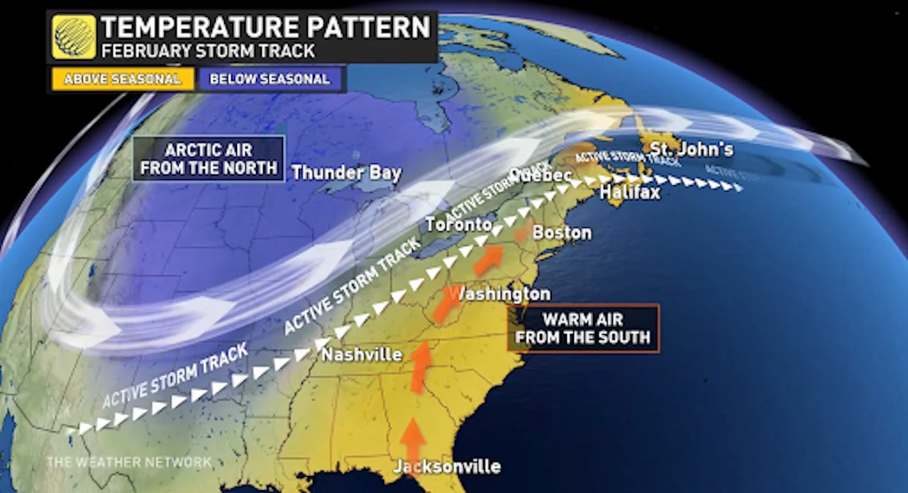
Quick changes in the weather pattern, like what we are seeing this week, look to be the theme for the rest of the month of February. Warmer weather will attempt to take over the pattern across the eastern U.S. and Canada as we progress through the month, but frequent shots of Arctic air across Central Canada will also fight back and attempt to spread east. Therefore, it appears unlikely that we will lock into a consistent temperature pattern during the month.
This should result in a rather active pattern through February, from the Great Lakes to Atlantic Canada, with a threat for more snowstorms and also messy systems that will bring a heightened risk for ice and rain.
We also expect an active pattern at times across the Prairies with several clippers tracking across the region.
It is difficult to draw up a forecast map for a month that will feature such a temperature roller-coaster across much of the country. However, this map highlights the expectation that the temperature flip-flops will tip to the cold side of seasonal from the central Prairies to the Great Lakes. Meanwhile, temperatures should tip to the warm side of seasonal across B.C., the Yukon and Atlantic Canada.
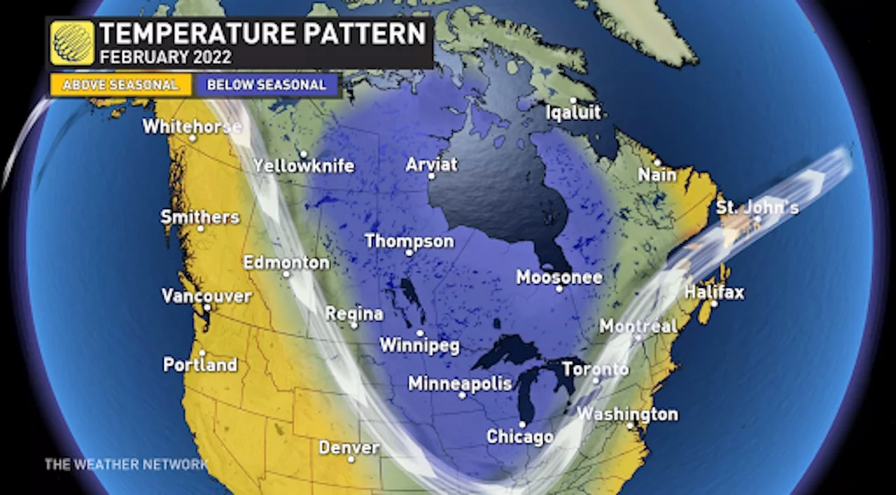
Elsewhere, the back-and-forth temperature swings should come close to offsetting each other.
As we progress through the month, we expect that the focus of the coldest weather will slowly shift west and a warmer pattern will eventually get established into southern Ontario and Quebec. However, the pattern change is not expected to just snap into place.
More likely it will be a three-steps-forward, two-steps-back scenario as Arctic air will continue with its attempts to spread back into the eastern half of Canada at times through the month of February.
Stay tuned to The Weather Network as we continue to update the forecast across Canada through the month of February.
Subscribe to 'This Day in Weather History': Apple Podcasts | Amazon Alexa | Google Assistant | Spotify | Google Podcasts | iHeartRadio | Overcast