Breathtaking image shows extent of staggering Greenland ice melt
It's one thing to read about dramatic changes and rapid melting in the Arctic but, as they say, sometimes a picture is worth a thousand words.
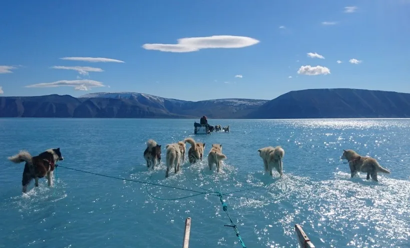
Steffen Olsen, a climate scientist at the Danish Meteorological Institute, took just such a picture last week on his way to retrieve research equipment from a station in northwestern Greenland.
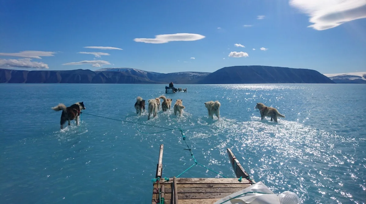
On the way to a sea ice station in northwest Greenland, June 14 2019. Image courtesy Steffan Olsen/@SteffenMalskaer
The station sits atop sea ice in the Inglefield Gulf -- at least, it usually does. After an early start to the melt season and a tremendous surge in melting just last week, Olsen and his sled dogs had to splash through ankle-deep water to reach their destination. Below the surface meltwater, Olsen estimated the remaining sea ice layer was about 1.2 m thick.
The Danish Meteorological Institute announced in early May that melt season had begun for Greenland -- nearly a full month early versus the average -- and it's shown little sign of slowing down thus far. On Thursday June 13 alone, more than 40 per cent of the island experienced melting, adding up to an estimated 2 gigatons of ice lost in a single day.
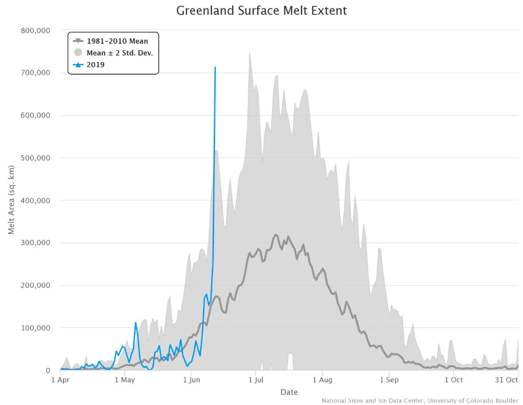
Image courtesy University of Colorado Boulder
While the extent and the timing are troubling, this isn't the first time scientists have observed a spike in melting in Greenland. Last week's melt sets a new record for mid-June, but a few previous years have had melt events of similar magnitude this early in the season.

Tracking the four highest June melt years for Greenland ice and snow. Image courtesy University of Colorado Boulder.
It's worth noting, however, that while we've seen this kind of melt before, it's all relatively recently. "We've seen a sequence of these large melt seasons, starting in 2007, that would have been unprecedented earlier in the record," climate scientist Thomas Mote told CNN. "We didn't see anything like this prior to the late 1990s."
Early-season melting also makes accelerated melting through the rest of the warm season more likely by allowing the ground and water to soak up more heat from the sun. Even before last week's event, many scientists who follow Greenland's climate expected 2019 to be a big year for melting on the island.
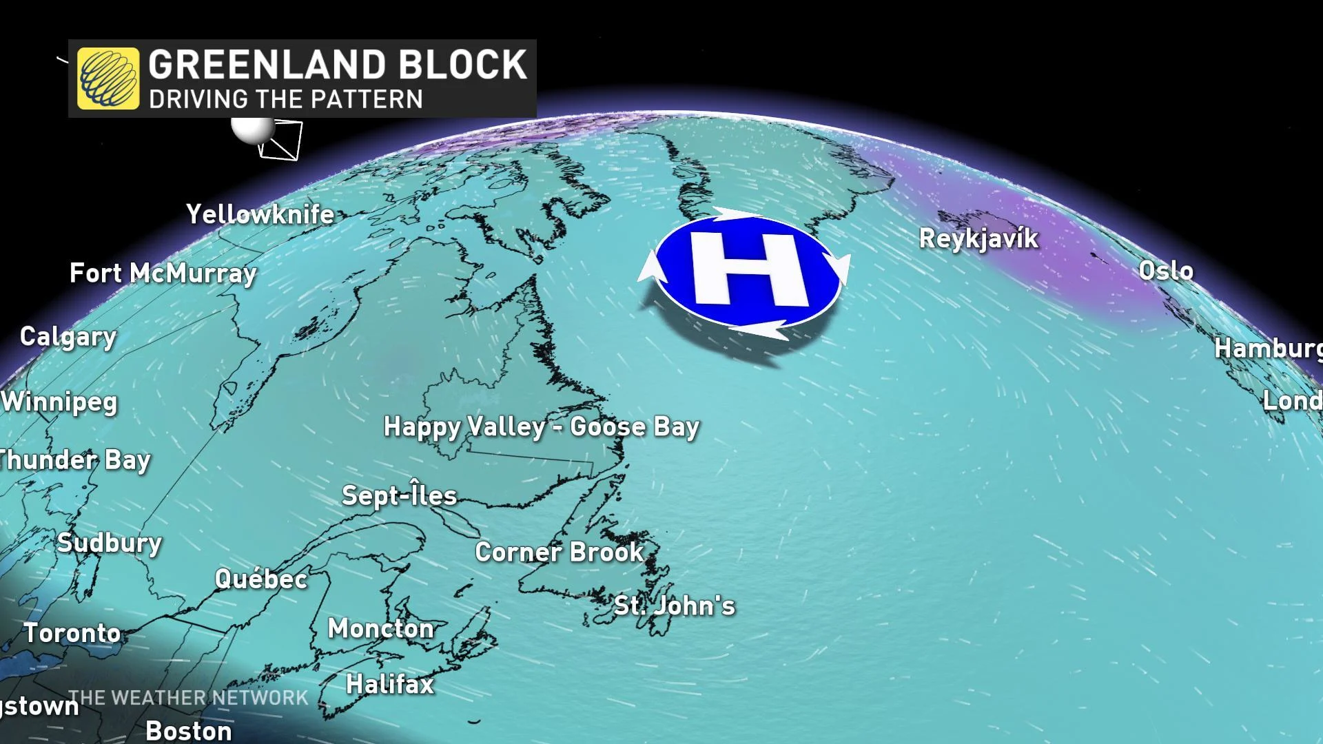
Greenland's above-average warmth is linked to the lacklustre spring we've been seeing in eastern Canada. A blocking ridge of high pressure in place over the island has seen temperatures surge, while the trough of low pressure stuck behind it has in turn kept things cold and damp for much of Ontario, Quebec, and Atlantic Canada.
Sources: Polar Portal | Mashable | CNN |


