
Heat builds in Ontario with a heightened threat for severe storms, tornadoes

Stay weather-aware Wednesday in southern Ontario and Quebec as the threat of severe storms includes the chance of damaging wind gusts, large hail, heavy rain, and even tornadoes.
Wednesday will be a day to stay close to home and pay attention to the weather in southern Ontario and Quebec. A disturbance making its way east will bring a heightened threat of severe thunderstorms to Central Canada. Special weather statements are in place in southern Ontario for the risk, which includes potentially damaging wind gusts, large hail and tornadoes. For more on the ongoing heat and Wednesday's severe weather risk, read on.
MUST READ: Everyone needs a home emergency kit. Here’s how to stock yours
Wednesday: Elevated risk for severe weather includes tornado potential
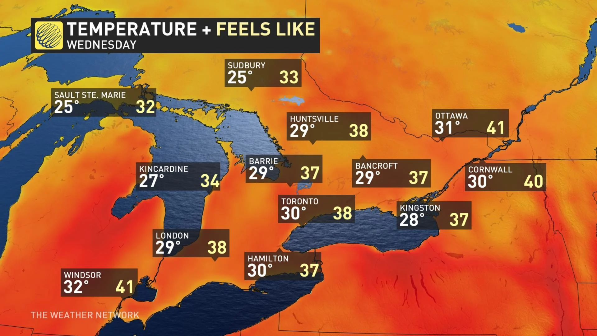
Heat warnings are still in place across a stretch of southern Ontario including Windsor, Toronto and Cornwall. The muggy warmth will stick around for Wednesday, as well, with high humidity sending humidex values into the upper 30s again during the afternoon hours.
In addition to the heat, a strong disturbance barrelling through the mid-levels of the atmosphere will track into the Great Lakes, shifting the threat for dangerous storms into southern Ontario. Special weather statements are in place for parts of the region.
Heat and atmospheric instability will build through the day across the south, while northern Ontario will see storms continue to rumble through the morning.
By late afternoon, a front will slice into this unstable atmosphere, acting as a trigger mechanism for the development of powerful storm cells. Supported by wind shear from the approaching trough, some storms will have the potential for rotation -- leading to a threat for tornadoes.
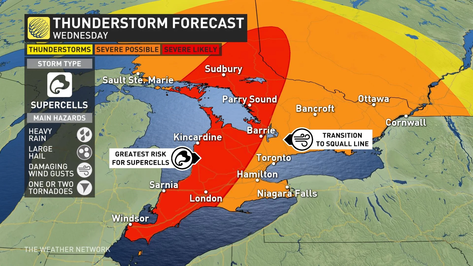
This threat will be greatest for areas near the Huron shores and south towards Windsor. In addition to the tornadic threat, these storms will pose a risk for large hail, heavy rain, and damaging straight-line wind gusts.
As the storms progress, they will grow upscale into a squall line, which may barrel through parts of the Greater Toronto Area (GTA) in the late afternoon through the early evening hours. The main hazard at this time will be damaging winds, though some tornado threat may still exist.
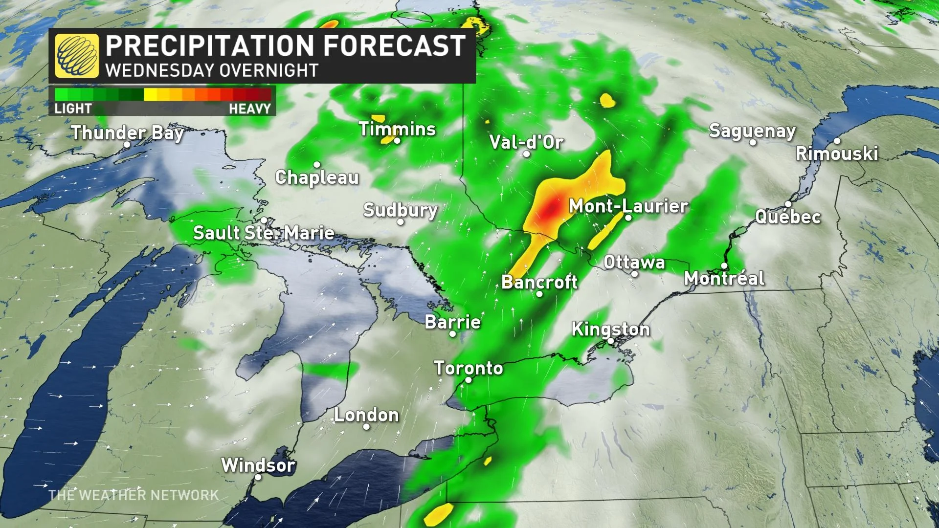
Storms will continue to blast eastward into the evening and overnight, but will lose intensity with the loss of daytime heating.
Power outages are also likely, so it's a good idea to make sure electronics, such as cellphones and laptops, are fully charged ahead of the storm.
It’s important to make sure that any loose yard objects, such as umbrellas, furniture and toys, are secure and that inflatables are put away ahead of the storm
Thumbnail courtesy of Sally Souch Souch.
Stay tuned to The Weather Network for the latest on conditions across Ontario.