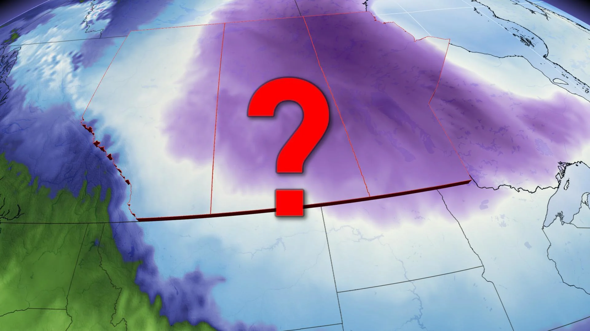
Strongest cold anomaly on the planet located in Alberta

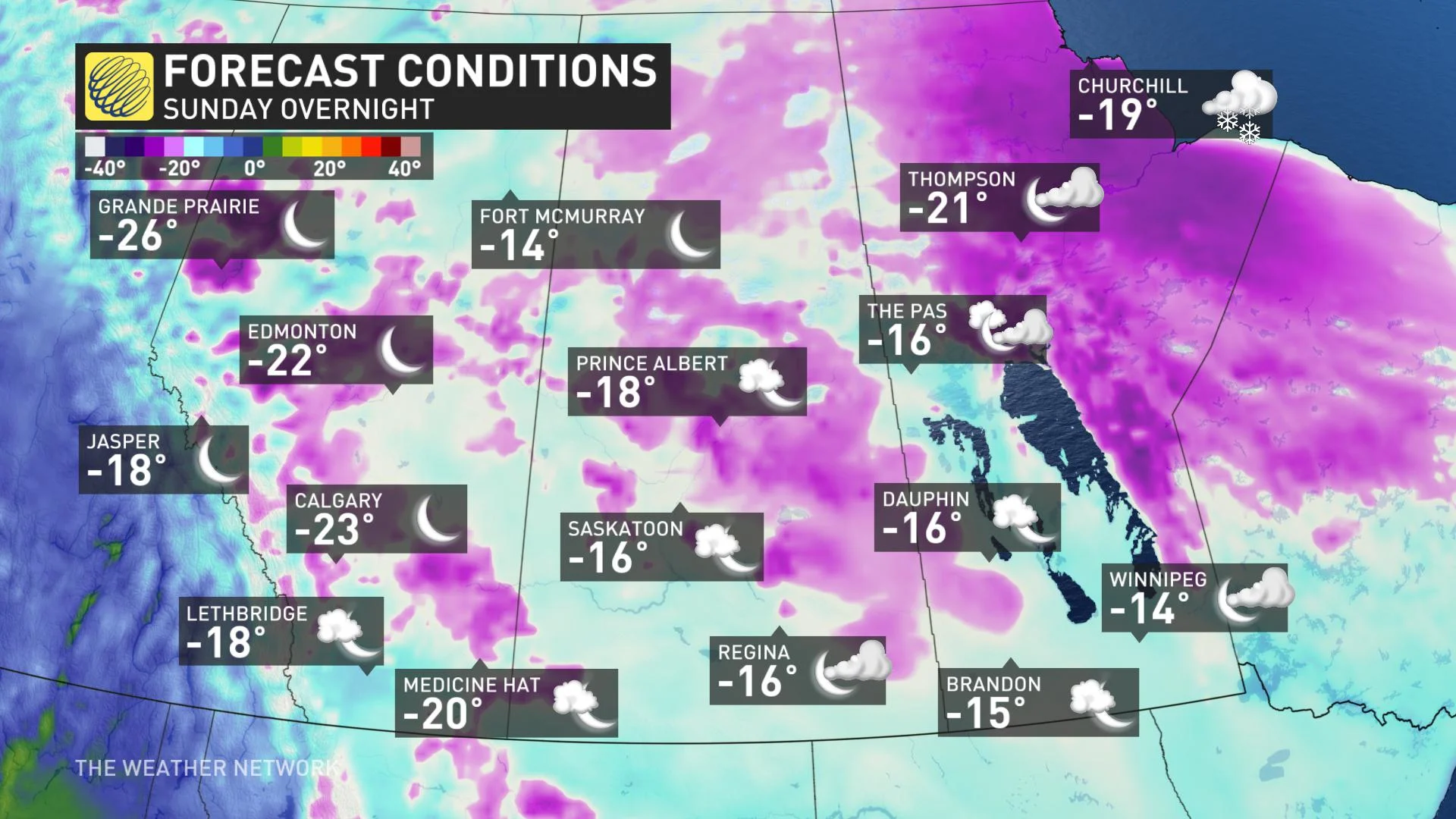
Temperatures will feel brutally cold in this location by Monday morning.
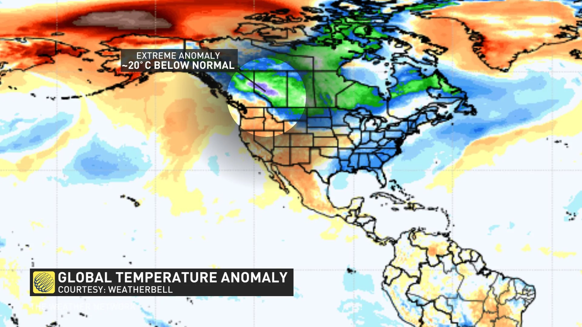
Scouring the globe for the most unusual temperature readings is no small task, but after some careful analysis, Alberta can proudly brag about this Arctic air intrusion being a step above the rest.
Persistent ridging over Alaska has been the theme for several months, with sea ice coverage taking a significant beating in the Chukchi Sea. This weekend featured the two most extreme temperature anomalies on the planet within relative proximity of each other.
Arctic air barrelling down from the North Pole has settled east of the Rocky Mountains. The temperature plunge started Saturday evening, and by Monday morning some temperatures are anticipated to flirt with -30°C -- a temperature that's extremely cold even for the heart of winter.
The periods of snow ahead of the potent Arctic front will be the first inkling of a changing airmass. After the freshly fallen snow settles, this can work to enhance the bitterly cold airmass and dip temperatures into record territory by Monday morning for Grande Prairie and Edmonton. After the passing of the snowy frontal system, that's when temperatures are set to plummet.
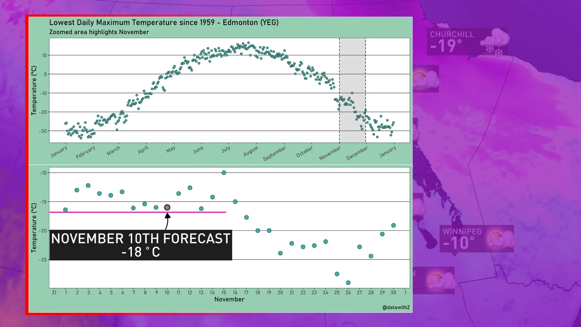
How unusual is this for Edmonton?
Let's use a graph to illustrate how rare it is to suppress temperatures below -15°C for daytime highs for this time of year. Data going as far back as 1959 suggests a high of -16 or -17°C is about as cold a day as you can muster for the first half of November. For reference, the Edmonton average daily high temperature this time of year is roughly 1°C.
Canada, if you think the Arctic air will remain neatly bottled up in the Prairies...think again. The Arctic air will move like molasses and eventually encompass most of eastern Canada by the second week of November.


