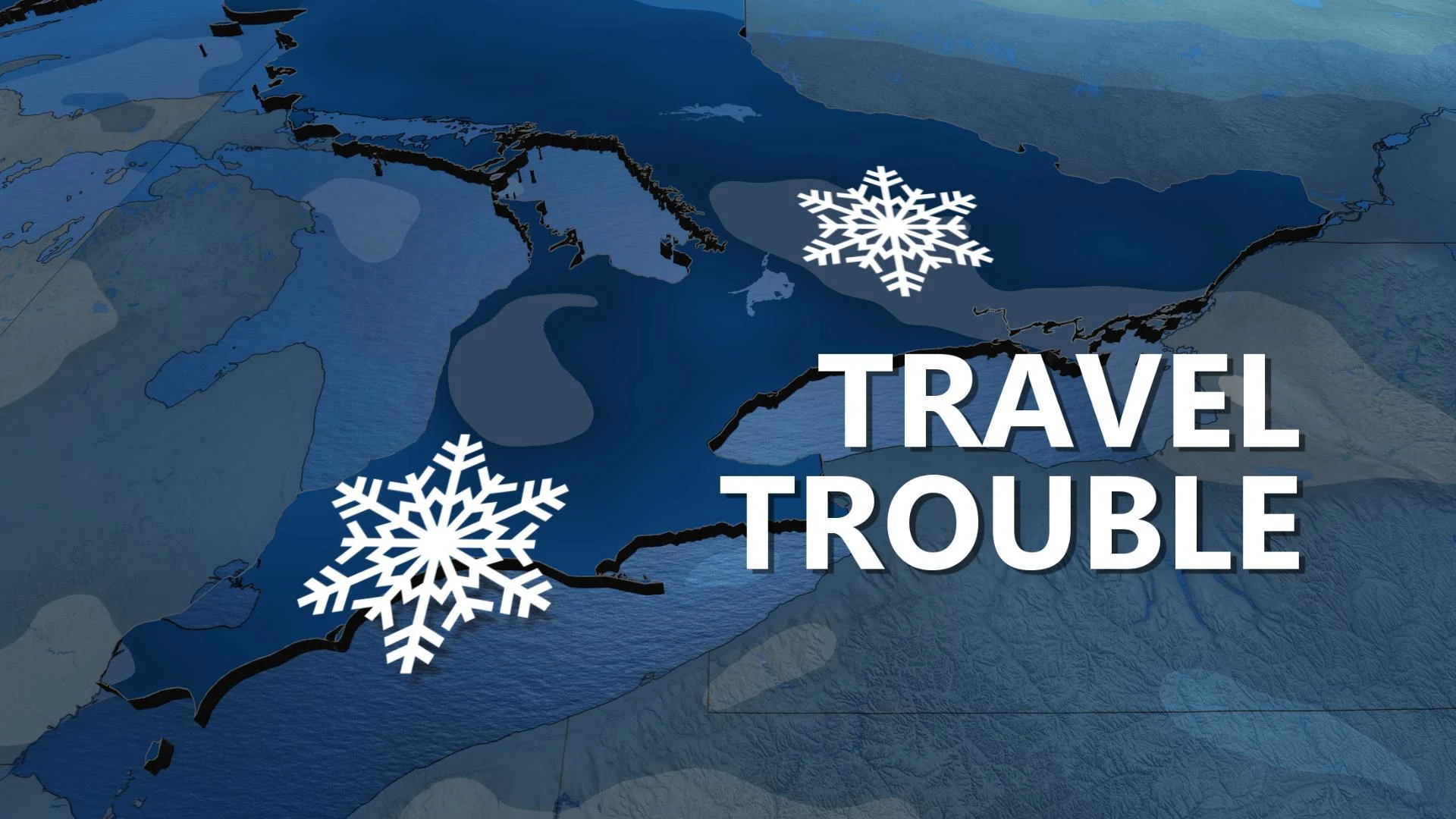
Ontario: Snowfall warnings blanket region ahead of heavy snow

Saturday's storm across southern Ontario expected to be the most significant snowfall to hit the region since November
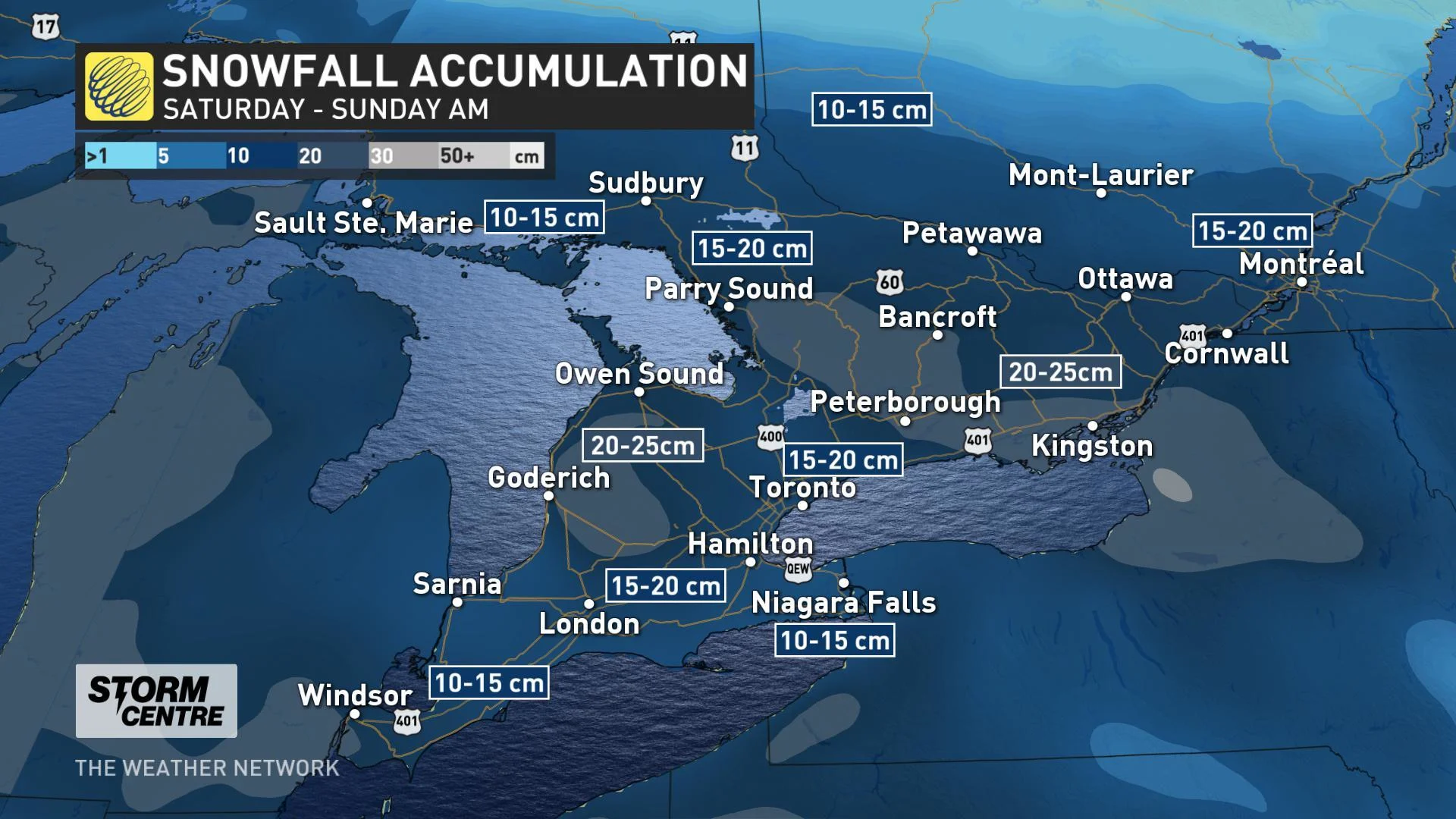
Winter weather warnings and advisories blanketed almost all of Ontario on Saturday morning, courtesy of an immense Colorado low sweeping through the Great Lakes. For southern Ontario, it's snowfall warnings that take centre stage, covering the entire region from Windsor to Ottawa with up to 20 cm of snow on the way. We break down what you need to know below.
WEATHER HIGHLIGHTS:
Widespread snow through southern, central Ontario
Widespread accumulations of 15 to 20 cm
Lake-effect snow, blowing snow threat follows for Sunday
Road and air travel impacts possible
Stay up-to-date on the ALERTS in your area
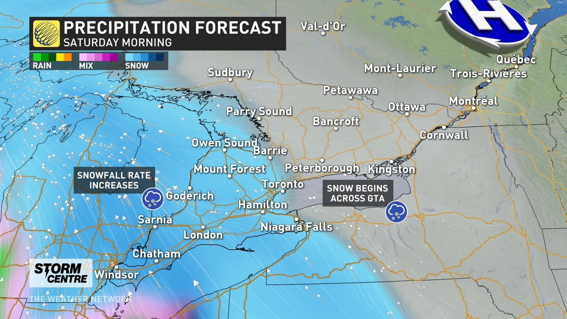
SATURDAY MORNING: WIDESPREAD HEAVY SNOW MOVES INTO SOUTHERN ONTARIO
The heaviest snow we've seen since November sat right on southern Ontario's doorstep before dawn on Saturday morning. That snow will build into the region through the morning hours, spreading to cover the GTA and Niagara by noon.
"This will be a widespread high-impact event for the region, especially after a long period since the last significant snowfall on December 3 and before that, November 11," says Weather Network meteorologist Nadine Hinds-Powell.
MUST SEE: Massive weekend snowstorm spans more than 2500 km
SATURDAY AFTERNOON: 1 TO 3 CM OF SNOW PER HOUR
Snowfall rates will increase as the system begins its march across the region, with 1 to 3 cm of snow per hour possible at times, making for treacherous and rapidly changing weather conditions on area roads.
While heavy snow continues across much of central and southern Ontario through the afternoon, the mid-to-late afternoon will see milder temperatures start to creep into southwestern Ontario. With that taste of warmth comes a changeover to a mix of rain and snow, then rain showers, for places like Windsor and Sarnia by late afternoon.
SEE ALSO: Historic storm brings Newfoundland to a standstill
SATURDAY EVENING/OVERNIGHT: QUICK CHANGE TO MIX/RAIN FOR PARTS OF GTA BEFORE SNOW RESUMES
The tiny push of milder air will make its way into the Golden Horseshoe and western GTA through the late afternoon and early evening. That will make for a slushy mix of rain and snow for places like Hamilton, Burlington, St. Catharines, and Downtown Toronto between early evening and midnight, while snow continues farther north and east.
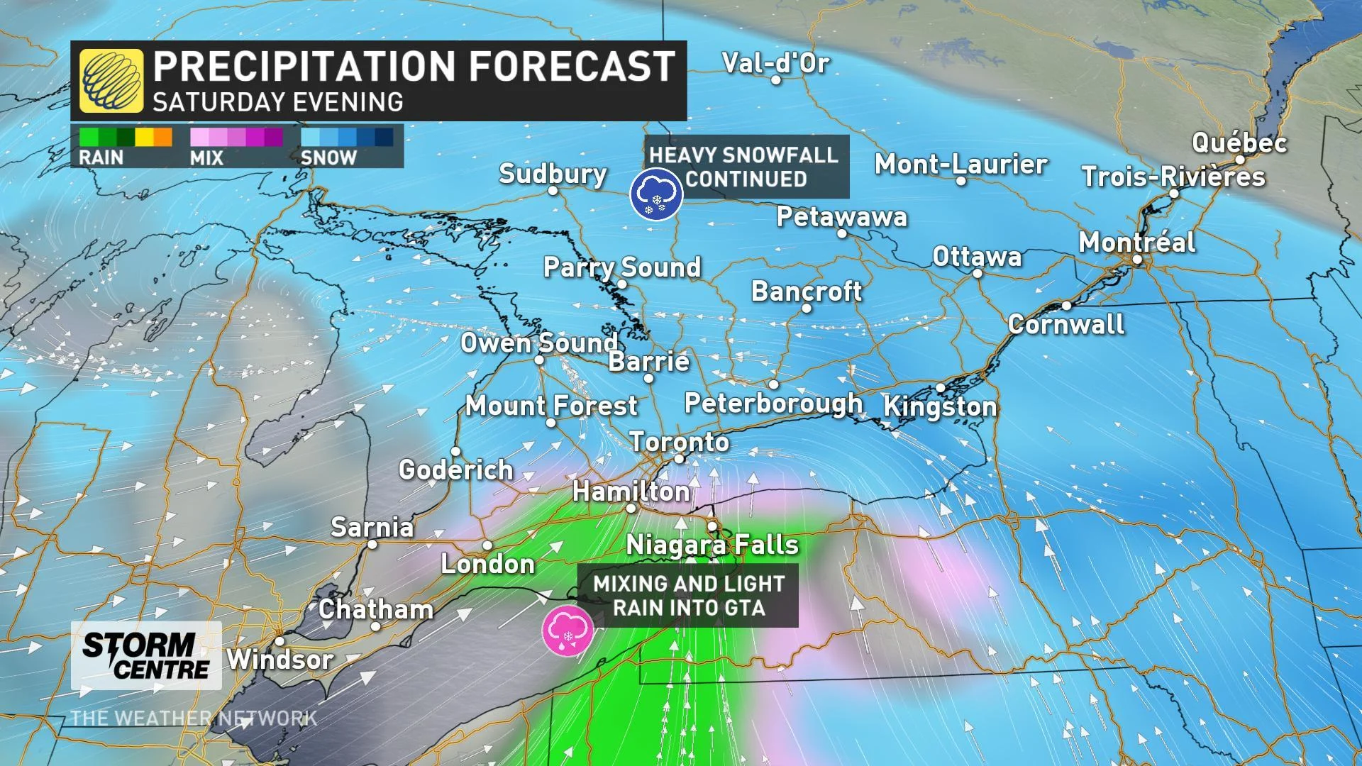
While the heaviest snow through the evening and overnight will pile up over places like Peterborough, Bancroft, and Ottawa, the Golden Horseshoe will see a change back to snow after midnight as cold northwest winds erode the small pocket of milder air.
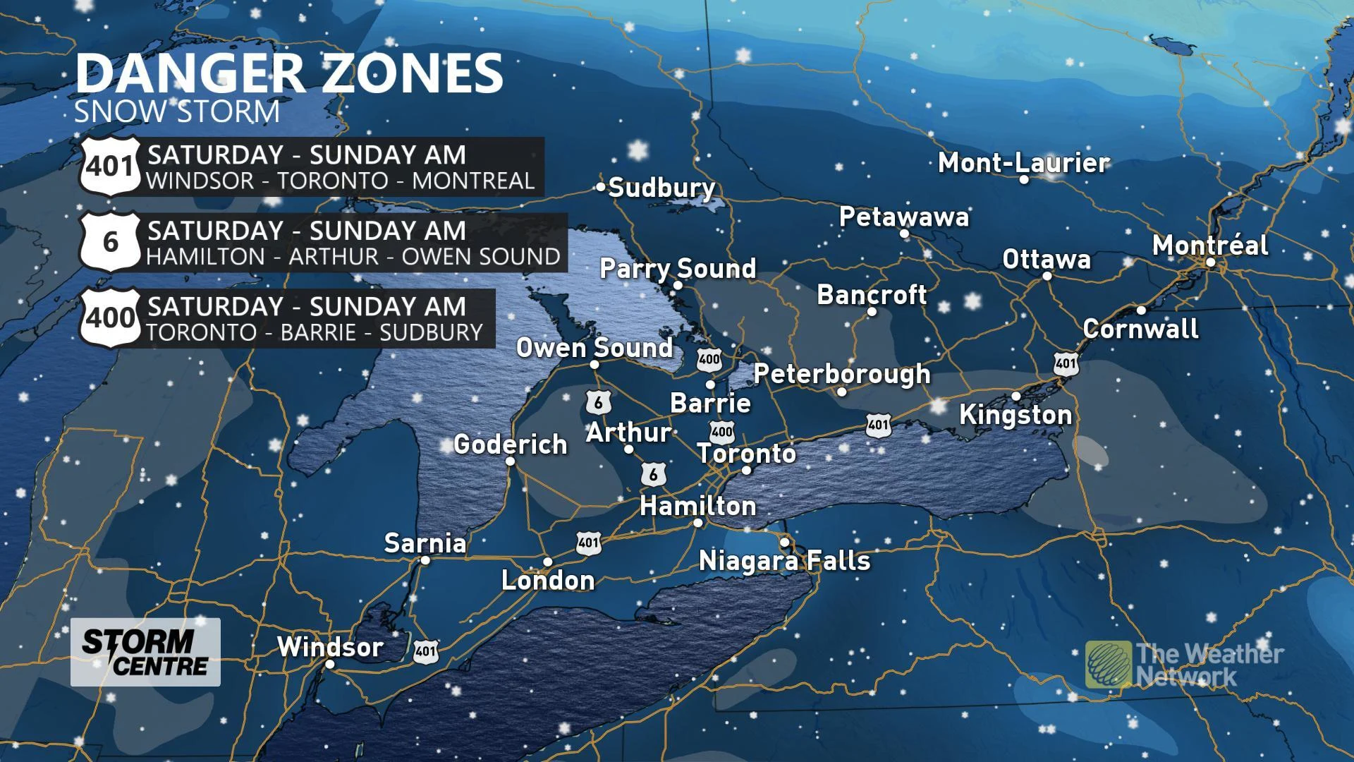
All told, a widespread 15 to 20 cm of snow is expected across southern Ontario, with the highest amounts expected over the higher terrain of the northern Niagara Escarpment and the Kawartha Highlands. 20 to 25 cm is expected for those areas.
The winds will be the story of Saturday night and Sunday for many, as blustery winds gusting in the 60-80 km/h range develop. The strongest of these gusts will be adjacent to the lakeshores, especially for Prince Edward County, and could create reduced visibility in areas of blowing snow.
The majority of the storm will have cleared out of the region before dawn on Sunday, but that doesn't mark an end to the snow for everyone.
SUNDAY: ARCTIC AIR SETTLES IN, MORE LAKE-EFFECT SQUALLS
While flurries will linger through eastern Ontario, including Ottawa into Sunday morning, the snow story for Sunday comes courtesy of blustery winds and lake-effect snow.
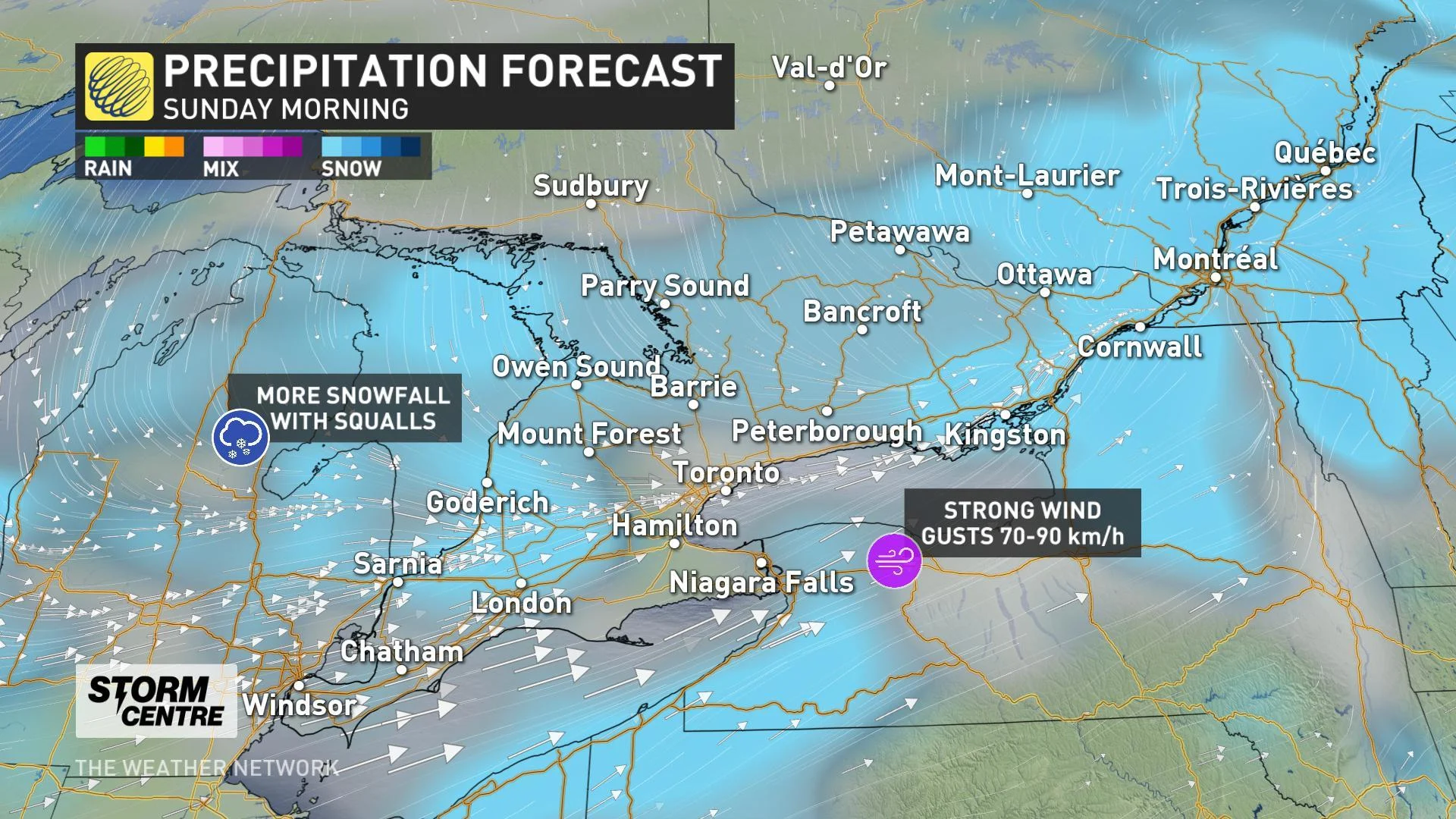
"Sunday will be blustery and cold with blowing snow and bands of lake effect snow squalls southeast of Lake Huron and Georgian Bay are expected," says Weather Network meteorologist Dr. Doug Gillham.
Arctic air sinks back into the region for the start of the new workweek, meaning much of the region will be holding onto that fresh snow for at least the first half of the week.
Stay with us here at The Weather Network for your latest forecast updates.