Polar vortex back where it belongs, huge temperature swing for Canada

Since the beginning of February, an extreme cold weather alert has been in effect for at least some parts of the Prairies provinces, though for the last couple of weeks, a good chunk of the region was being warned of the dangerously cold conditions. On Tuesday, after 13 consecutive days, all of the alerts had finally dropped.
SEE IT: Widespread Canadian chill of the century
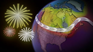
A prominent lobe of the polar vortex had settled over western Canada through the first half of February, creating some of the coldest Canadian temperatures in years. Numerous new record lows were also set, with parts of the Prairies even setting all-time records for the inhumane temperatures reached.
Couple that with an icy wind chill, and some places were feeling like the -40s and -50s for days.

"The weather pattern we've seen through February so far has brought long-lived extreme cold to much of Canada," says Weather Network meteorologist Michael Carter. "That's thanks to a disruption of the polar vortex that started in the upper atmosphere, and sent a frigid eddy of arctic air south across North America."
POLAR VORTEX RETREATS, FINALLY!
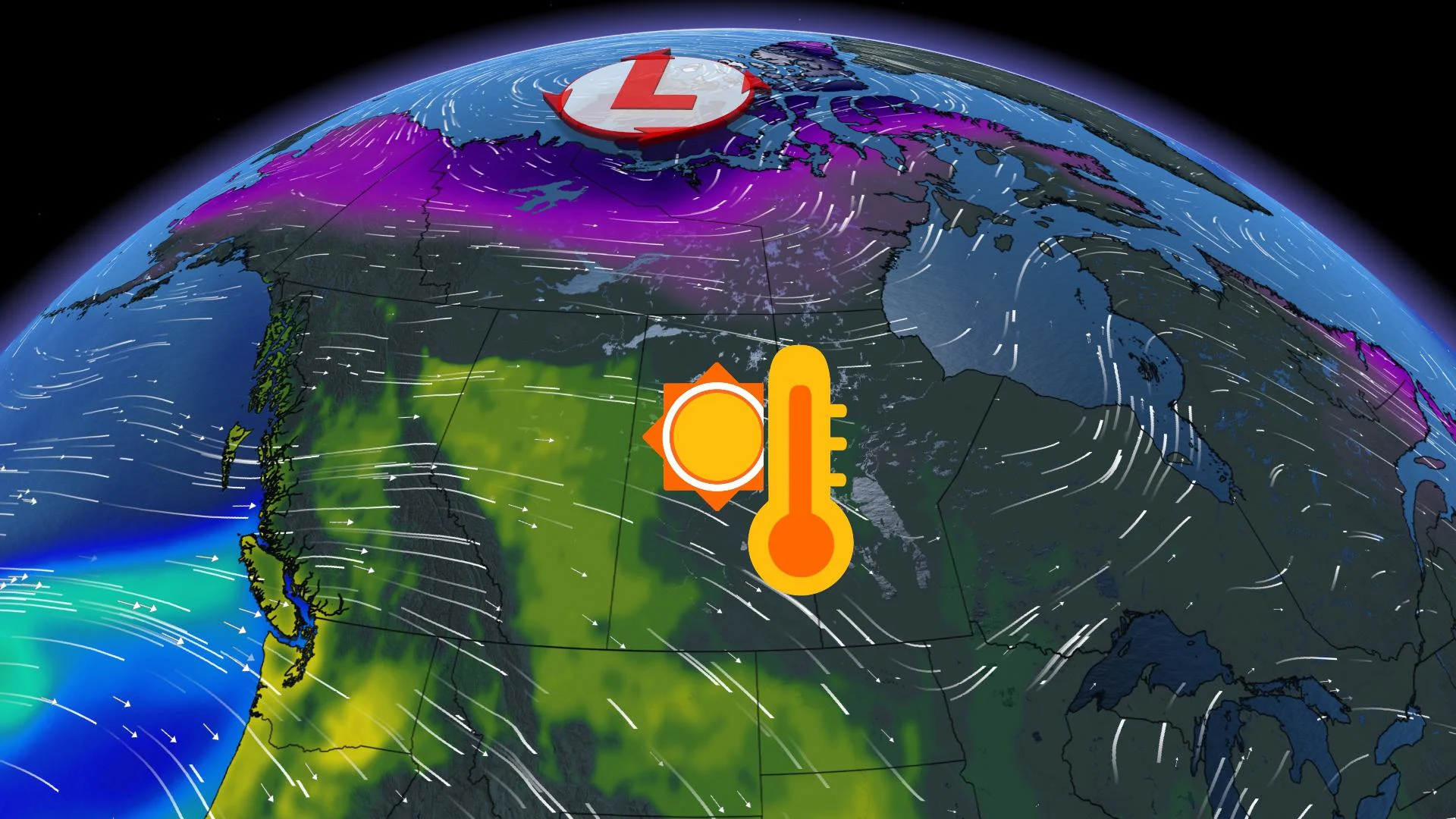
While temperatures will still remain chilly across the Prairies through the first half of this week, they're certainly no where near the frighteningly low values that have been felt already this month. That's as the frigid pattern breaks down and the arctic air slowly gets flushed out, being replaced by much milder Pacific air by the end of the week and into the weekend.
"Like all extreme patterns, this one will be coming to an end as the atmosphere returns to a more balanced state and the polar vortex retreats to it's normal location over the pole," Carter says.
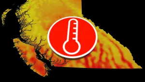
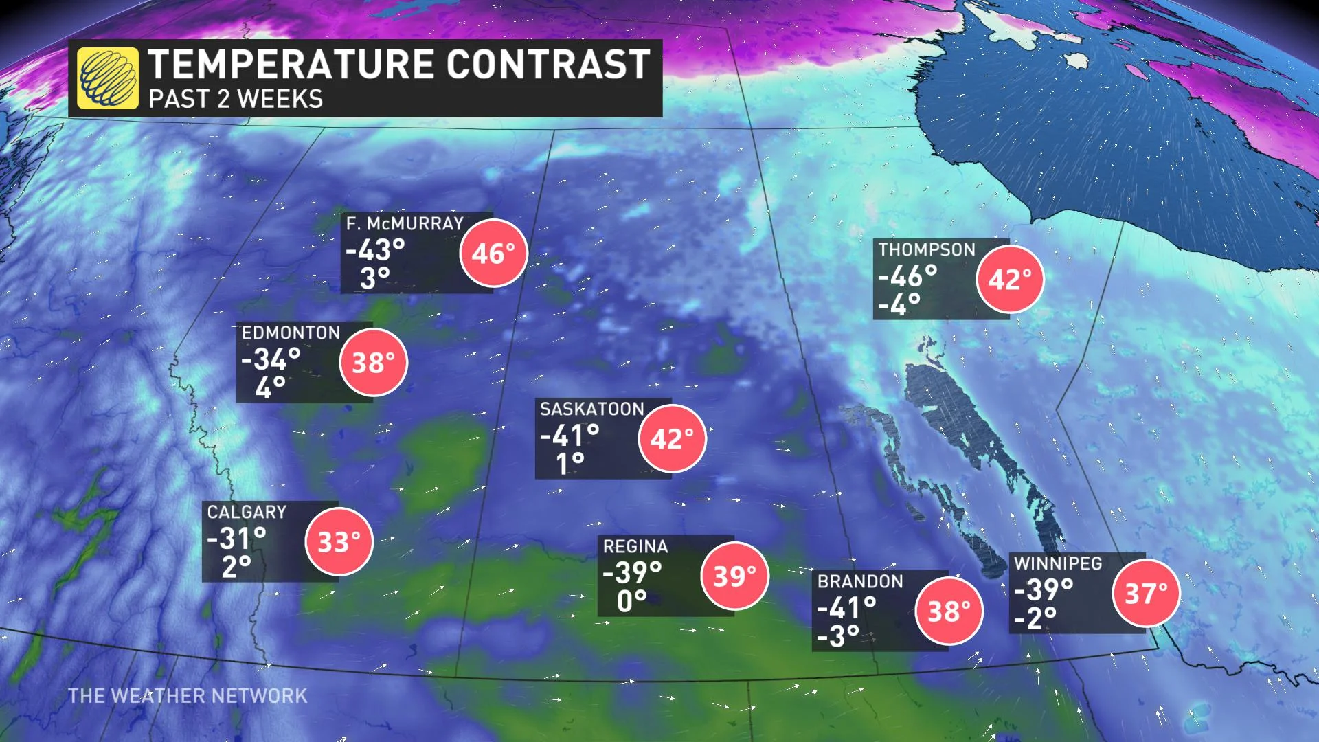
As the arctic surge loses its hold, milder Pacific flow will once again wash across Canada from west to east, allowing for temperatures to return to near, or even above normal in these areas that have been gripped by bitter cold. In fact, some parts of the Prairies are in store for a 40°C warm-up by the weekend.
Fort McMurray, Alberta for example saw a brutal low temperature of -43°C over the past two weeks, and by Sunday, the city will be sitting at a balmy daytime high of 3°C. A difference of 46°C!
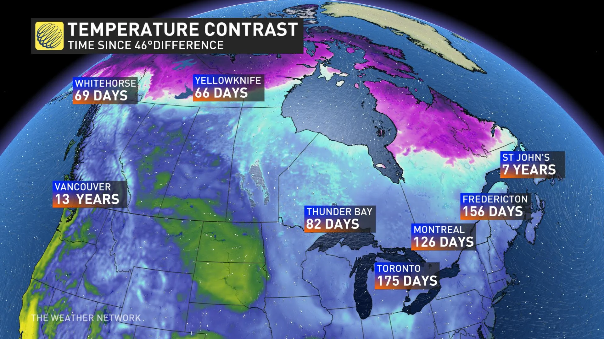
These types of extremes can be common across the country throughout the winter months, but to really put that type of temperature contrast into perspective, it's been years since coastal regions like Vancouver, B.C. and St. John's, Newfoundland have seen that much of a flucuation.
Arctic air is expected to return during the second half of next week and continue into early March across the Prairies, so be sure to get out and enjoy the brief reprieve that's expected this weekend.
MUST SEE: Four weird things that happen when it gets way too cold