Thunderstorms hit southern Ontario, risk continues and spreads east into Quebec
Thunderstorms bubbled up across parts of southern Ontario late Tuesday night, with the risk continuing into Wednesday, spreading east into parts of southern Quebec, as well. Be sure to remain weather-aware
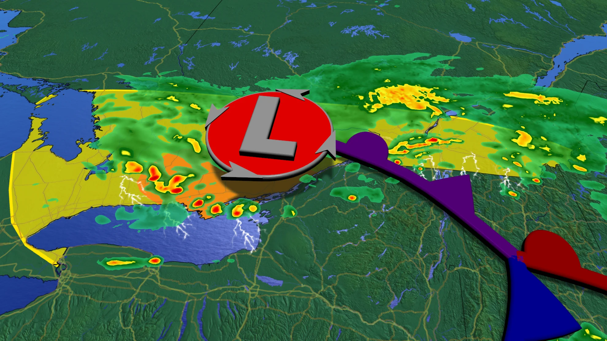
Late night thunderstorms rumbled through parts of southern Ontario on Tuesday, with periods of heavy rain, strong winds and frequent lightning reported. While the ingredients were there, conditions didn't turn severe as the storms tracked north across the border.
SEE ALSO: Oklahoma tornadoes kill at least one person, injure five
The line of storms diminished through the overnight hours, though the risk for more thunderstorms continues into Wednesday and even Thursday for some. Parts of the Greater Toronto Area (GTA), cottage country, eastern Ontario and southern Quebec could all see storms bubble up as the system moves east. Large hail and strong winds will be the greatest threats with storms that develop.
If you live in the risk areas, be sure to plan ahead and be weather-alert through the day on Wednesday.
Wednesday: Thunderstorm risk shifts east with potential for large hail, strong winds
Aside from some rumbles of thunder and frequent lightning, the storms that moved across southwestern Ontario Tuesday night remained non-severe in nature.
Forecasters watched this setup closely, as severe thunderstorms producing tornadoes sat just 100 km south of the border.
While most of southern Ontario will see another calm and warm day on Wednesday, the thunderstorm risk lingers over the region as the system makes its way east.

Areas at risk of seeing a storm include cottage country, the GTA, eastern Ontario, including Ottawa and parts of southern Quebec.
Severe storms with nickel to quarter-sized hail, and gusty winds as high as 70-80 km/h are possible east of Newmarket, including Peterborough and the Kingston region, during the mid-afternoon hours.

RELATED: Why nocturnal thunderstorms can be particularly dangerous
Stretch of cooler weather begins Thursday, periods of weekend rain showers
Enjoy the warm weather on Wednesday, as a stretch of cooler temperatures will start Thursday and continue right through the weekend. Rain showers look to develop Thursday, as well, but should remain primarily near and south of the 401. Rain totals are no longer forecast to be substantial for the GTA, and areas north of the 401 could remain dry.

There is also the chance for additional thunderstorms to bubble up across the southwest on Thursday, with a slight chance for some rumbles of thunder in the GTA through the evening and overnight hours.
Mother’s Day weekend will be cloudy with sunny breaks and scattered showers, but neither day will be a washout, and most of the time it won’t be raining. Temperatures will be several degrees cooler than seasonal on Saturday and closer to seasonal on Sunday.
MUST SEE: Your Mother's Day weekend plans may need extra attention to the forecast
Heat-seekers will be disappointed to know that there will be no consistent warm weather expected through the May long weekend.
Stay tuned to The Weather Network for the latest forecast updates for southern Ontario.