Meteorological marvel: Typhoon-infused low taunts B.C. this week

This storm looked super unremarkable on satellite in recent days, but its impact on the jet stream and the upper-level pattern will supercharge the setup to produce the exceptional low, which gets an enhanced infusion of subtropical moisture.
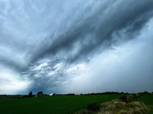
The pattern will favour dark and stormy skies over the next couple of weeks across coastal British Columbia, but this one low, hours away from rapid intensification, is going to steal the show as quite the meteorological marvel.
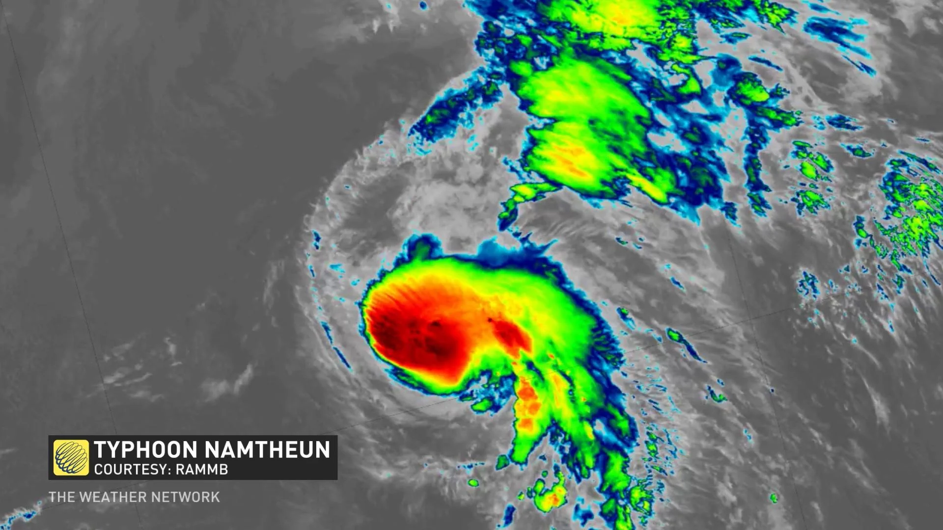
TROPICAL STORM NAMTHEUN
Likely a storm you haven't heard much about until now.
This storm looked super unremarkable on satellite in recent days, but its impact on the jet stream and the upper-level pattern will supercharge the setup to produce the exceptional low, which gets an enhanced infusion of subtropical moisture.
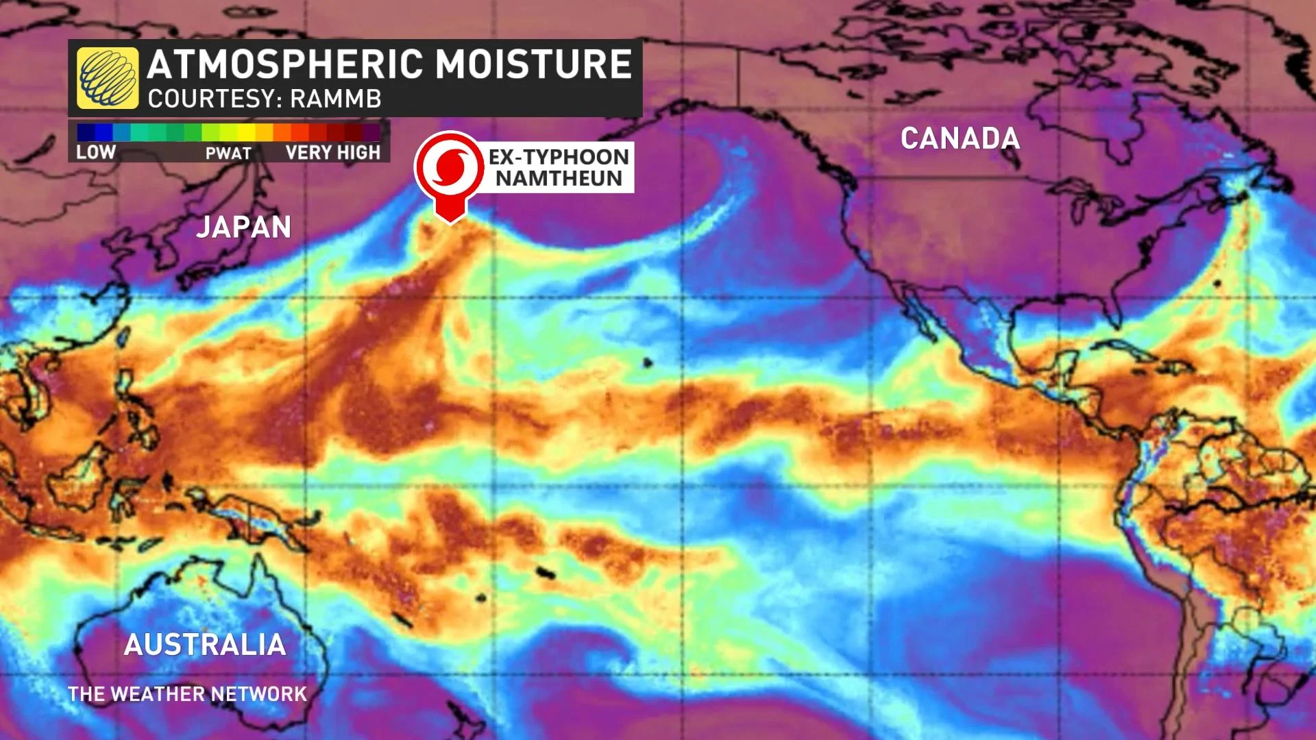
By Wednesday morning, you can see that the remnants of Namtheun nestled in an unsuspecting wave of low pressure.
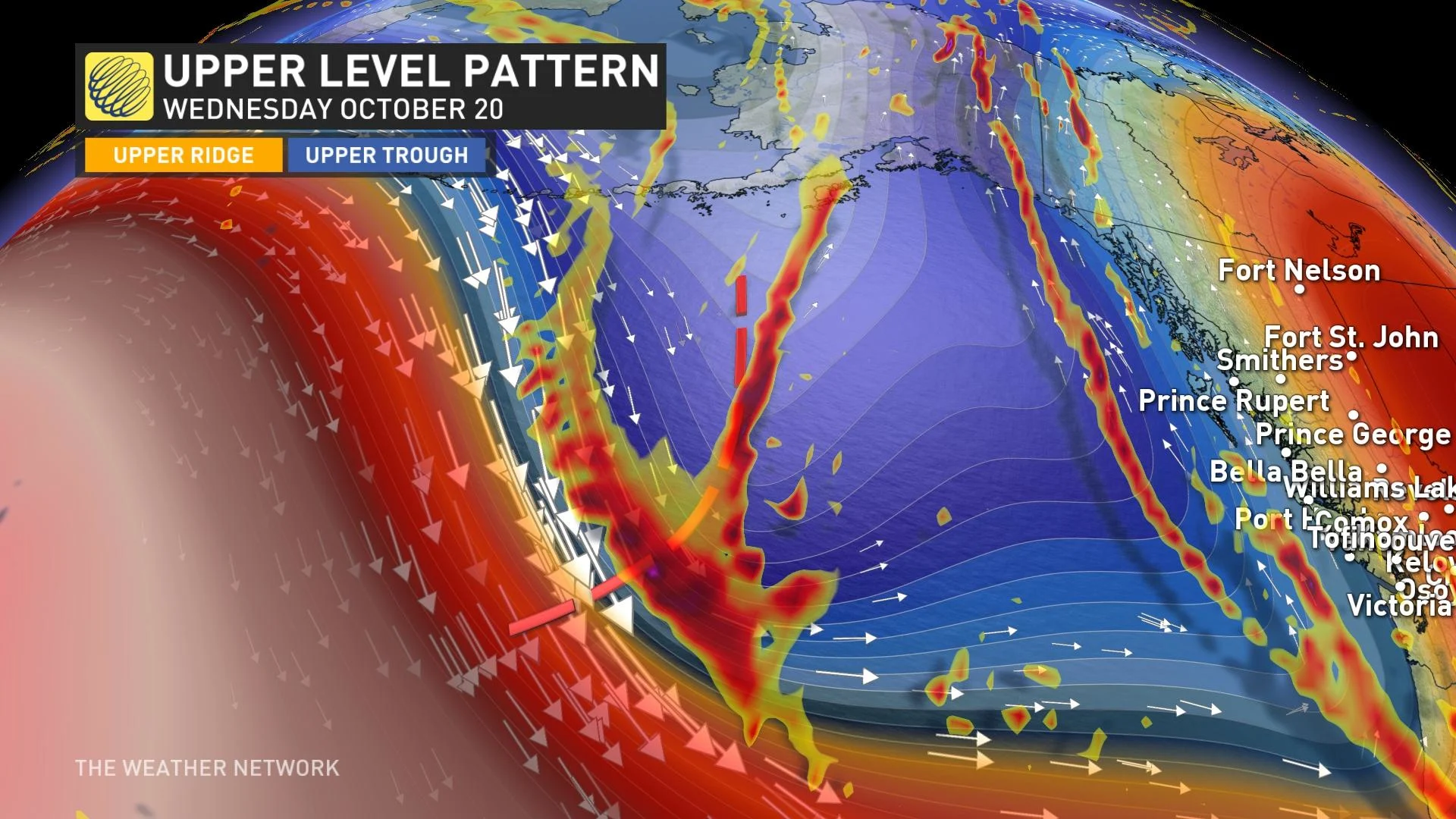
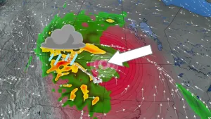
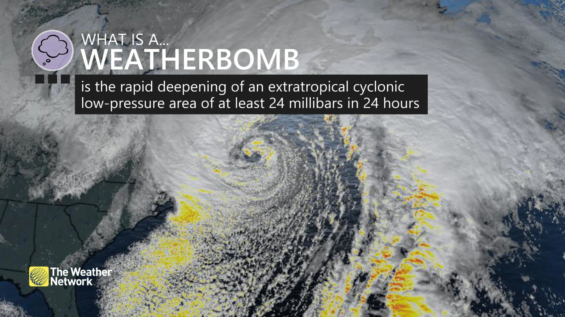
Like a fuse, this pocket of energy, with enhanced moisture, will interact with an upper-level disturbance to create a powerful ‘bomb cyclone’ – a storm that meets this bombogenesis criteria where it deepens at 24 millibars of atmospheric pressure in 24 hours or less.
This low will attempt to double these criteria.
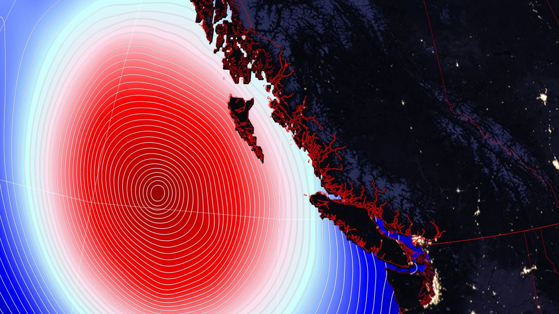
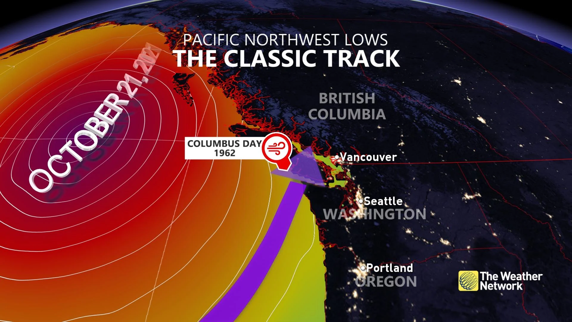
The fact we can forecast such a powerful low with such precision is a testament to how far numerical weather precision has come over the past couple of decades. And, models are in agreement this doesn’t pose a significant threat, even though the low will have a lower pressure than the Columbus Day Storm of 1962.
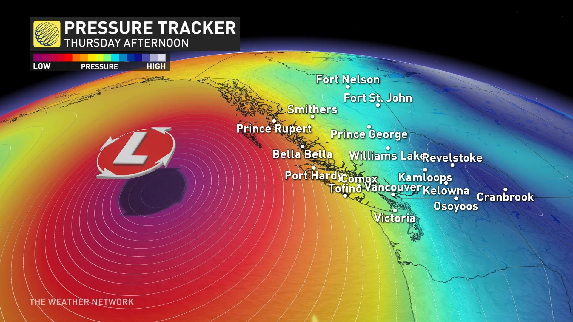
With the position of the low pressure being over 700 km west of Vancouver Island, the impacts will be underwhelming, particularly a low that underwent bombogenesis. The track is over 700 km farther to the northwest than some of the more prolific windstorms in Pacific Northwest history.
The associated frontal system will be detached and far removed from the low, and gusty southerly winds will occur on Thursday along with mild temperatures, even as high as 16°C or 17°C. The strongest winds are for the northwestern tip of Vancouver Island and southern sections of Haida Gwaii, where hurricane-force wind gusts are possible.
This time around, the associated atmospheric river is well south and aims at Northern California through Friday.
The antecedent conditions have been wet, soaking wet, with upwards of 300 mm of rainfall with a punchy atmospheric river; this increases the propensity to uproot deciduous trees to finish off October.
Stay tuned to The Weather Network for the latest forecast updates on B.C. this week.