May outlook: Spring into summer or a stalling spring ahead, Canada?
Is the May pattern set to sputter or spring into summer? We have your monthly outlook details
Will May see us spring into summer? Or, will spring hit the pause button?
How about neither, Canada? This will be a pleasant May for many Canadians, with just a few bumps along the way.
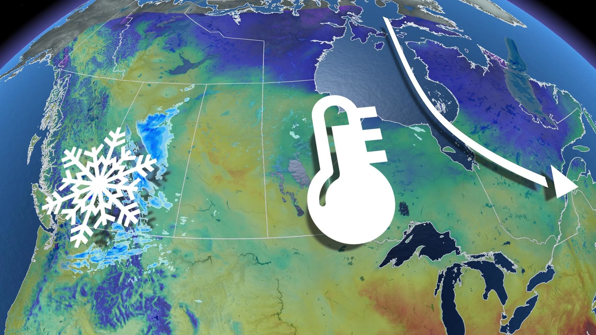
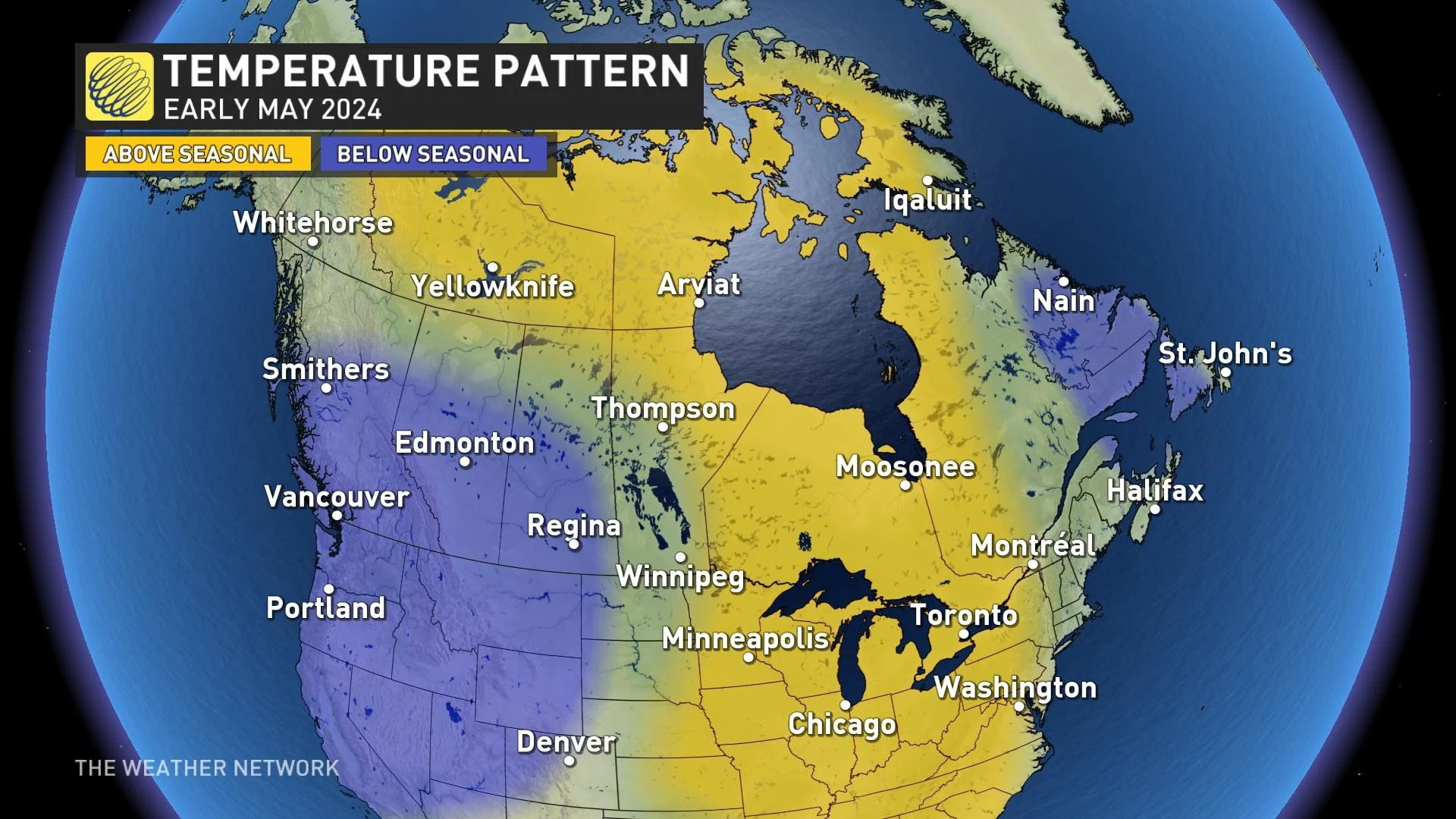
There is a higher tendency that troughs will hug both coasts of Canada during periods in May, with a large region of above-seasonal temperatures across the heart of the country.
DON'T MISS: Toronto just broke a 32-year-old rainfall record
Regions that need rain will also get their wish. Read on to find your provincial details.
Western Canada
B.C. and Alberta
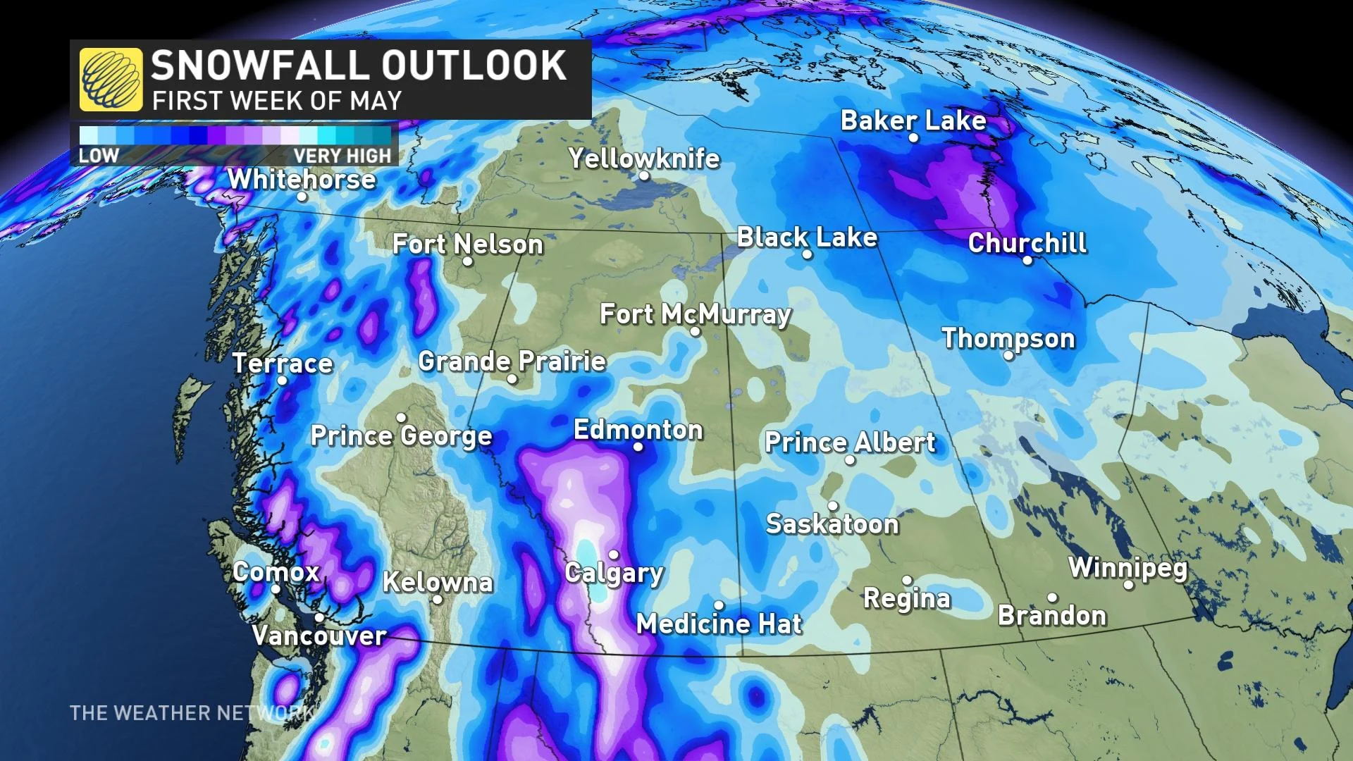
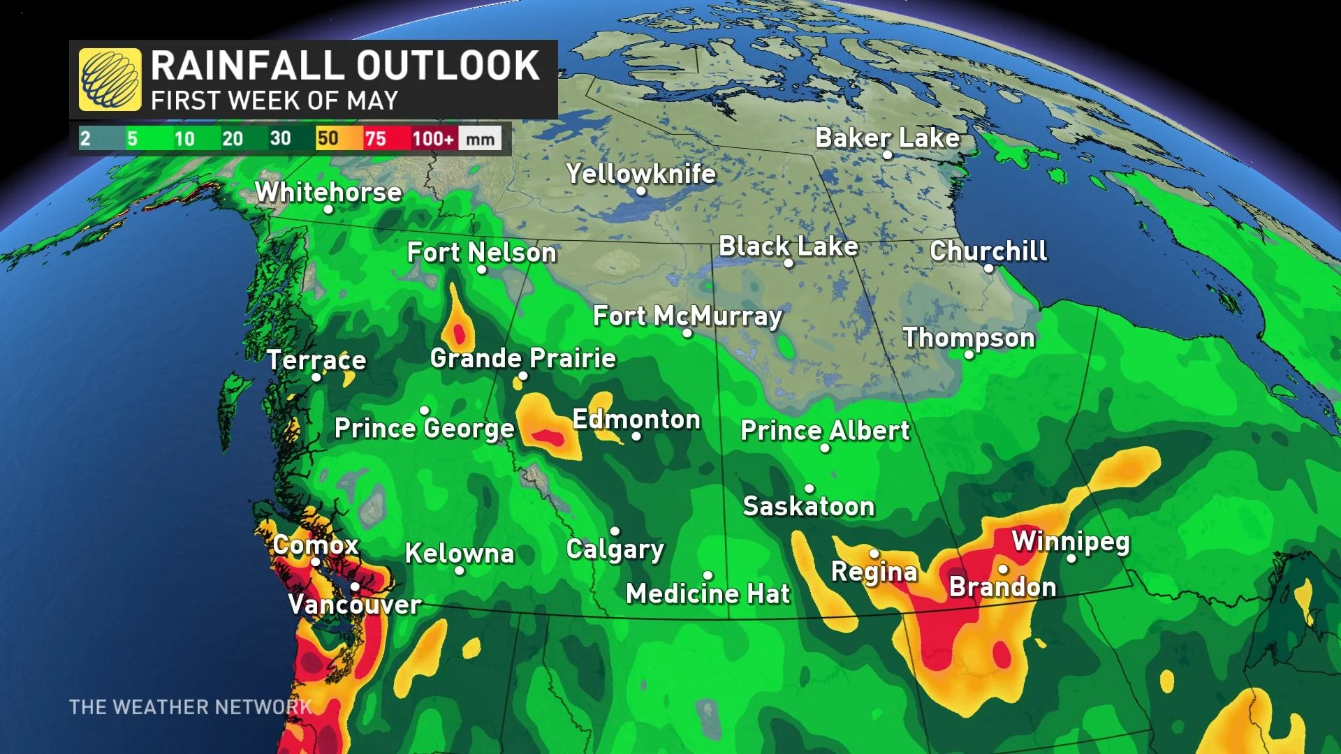
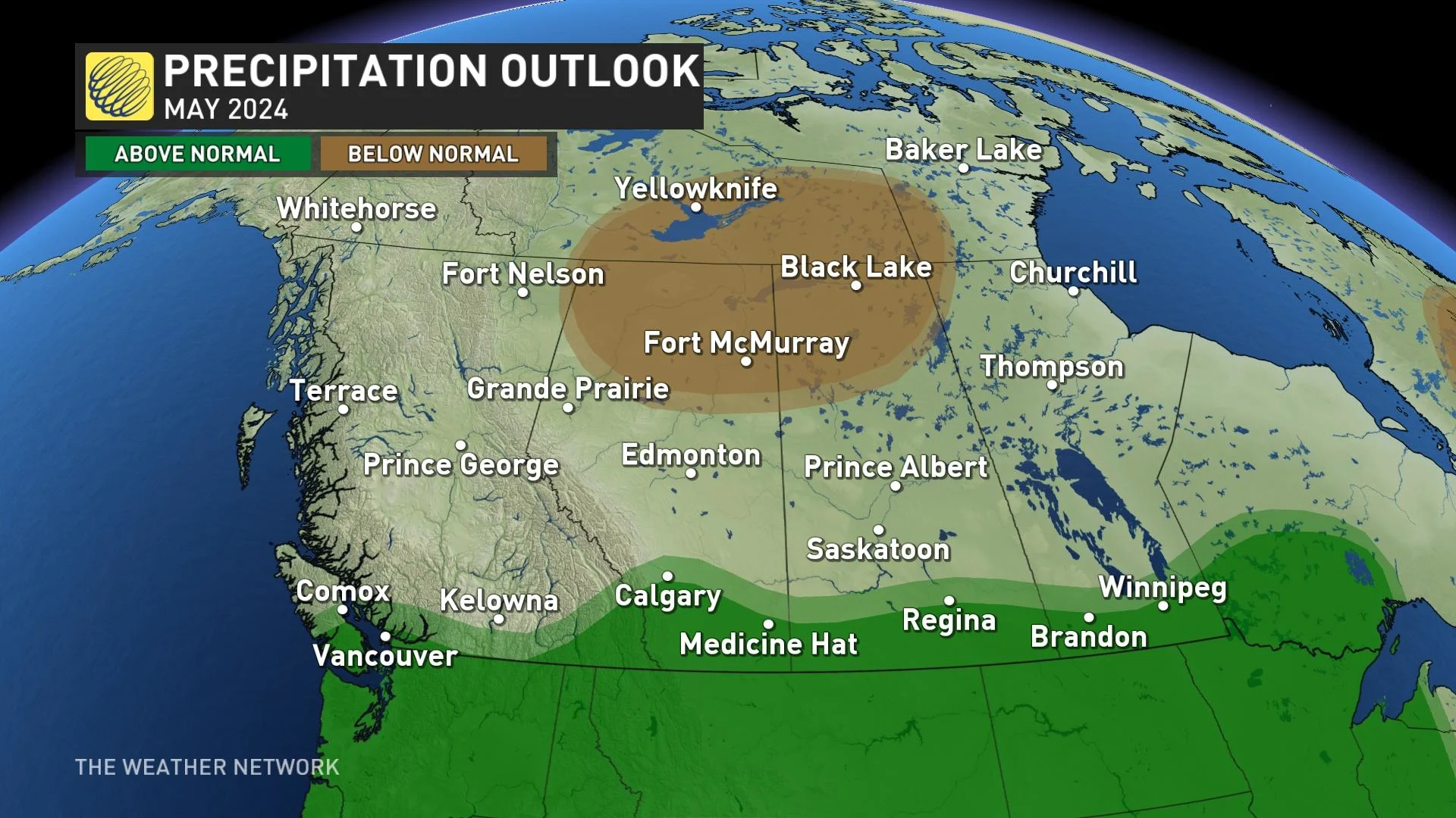
As we tumble into May, we’re still seeing accumulating snowfall across the higher terrain, particularly in the Rockies and foothills. It’s a hopeful pattern for where pervasive drought conditions persist. The first half of May looks on the wet side across British Columbia and Alberta, with continued upslope precipitation events in Alberta chipping away at a long-standing drought.
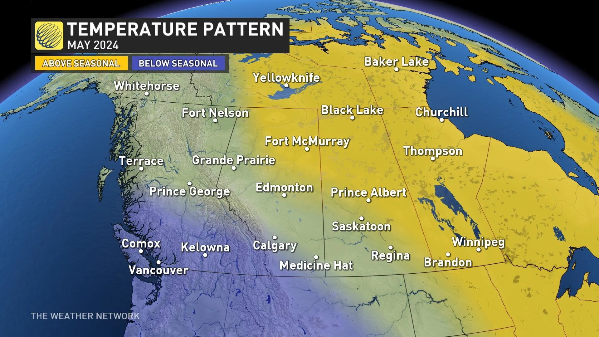
An onshore flow will continue in May, meaning more coastal precipitation for British Columbia. With the cool start to the month, it’s most likely B.C. finishes with temperatures within about half a degree of normal.
In short, it’s a far cry from May 2023 when we saw significant, warm anomalies across British Columbia and Alberta that initiated a historic wildfire season.
This May we’re forecasting temperatures to trend a little below normal for southwestern B.C. with more warm anomalies across the northeast Prairies:
Saskatchewan and Manitoba
There’s a higher chance of above-normal temperatures as you travel east of the Rockies, stretching across to Saskatchewan and Manitoba. Keep in mind, though, that the first week of May is looking quite wet across southern Prairies, including Manitoba, as the region will initially be in the crosshairs of an active storm track. That is great news for agriculture regions and crops.
Eastern Canada
Ontario and Quebec
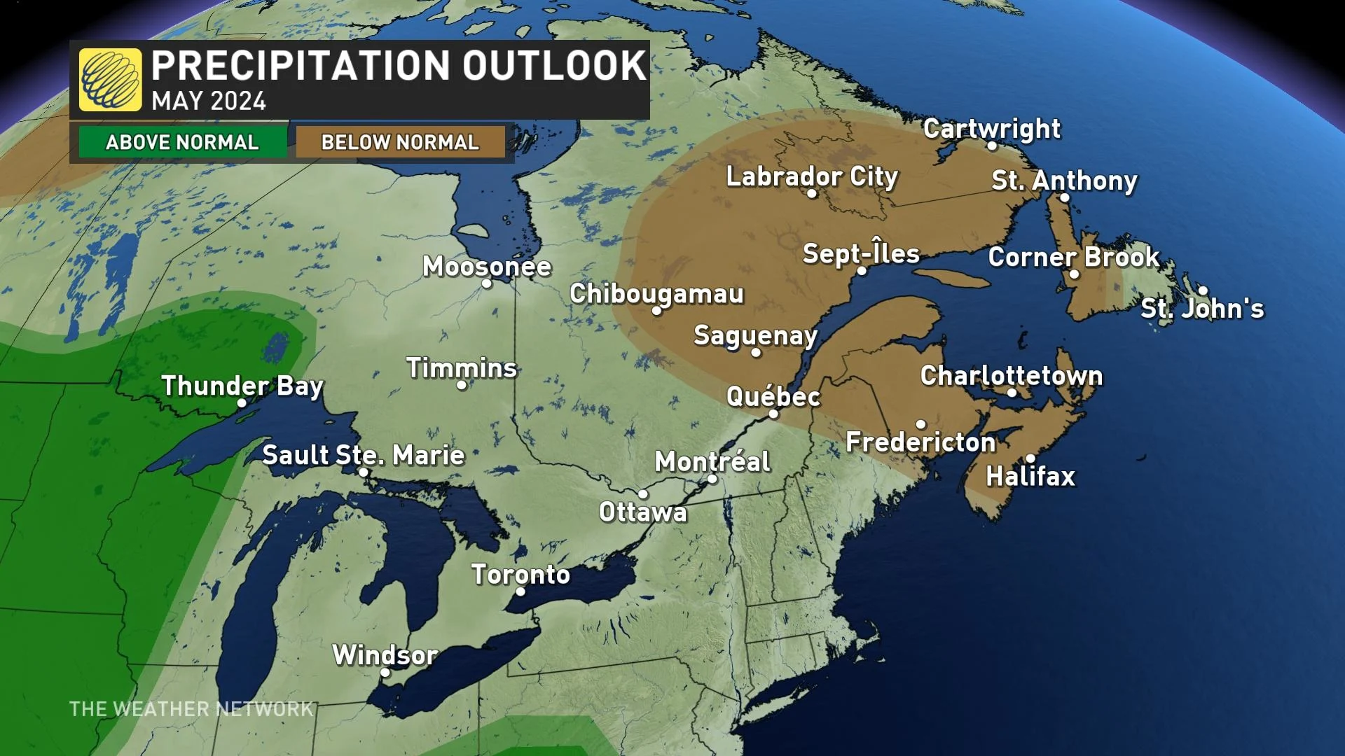
A surprising amount of rainfall pelted Ontario throughout April. May will feature a pattern with a more northwesterly flow, with less ability to tap into Gulf Moisture –– a much different vibe than April. May will likely not go down as an exceptionally rainy month, especially when compared to April.
The first week of May, however, looks quite wet across northern Ontario –– the same regions that have experienced tons of excess rain throughout April. An active storm track sets up off the base of the trough lingering over Western Canada.
We’ll be on guard for some cool fronts and backdoor shots of cold through May, especially with an upper trough lurking off the Atlantic Coast. There is no extreme heat on the horizon, or daytime highs that exceed 30°C.
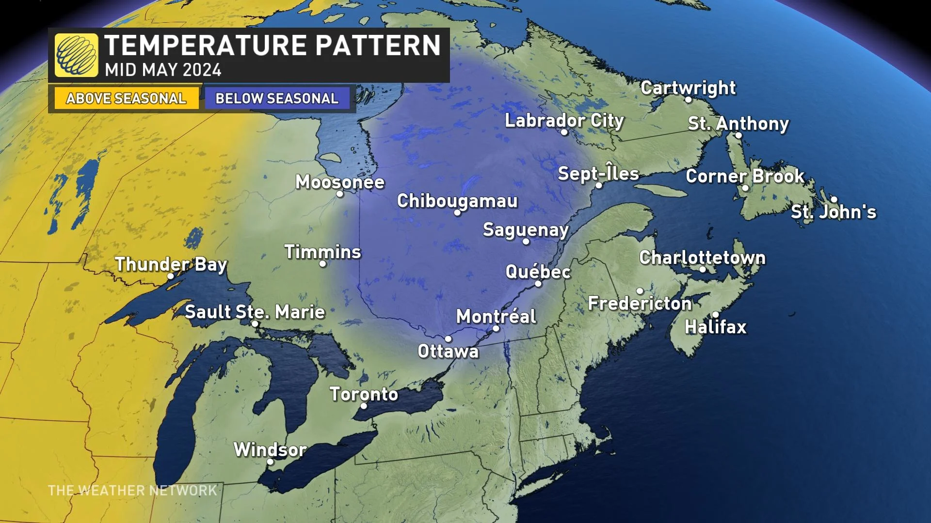
The middle of May has some signals for troughing, which could halt the typical, increasing temperatures experienced through May.
By the time the month wraps up, most of Ontario and Quebec will likely tip to the above-average side of the thermometer, especially farther west, with the coolest anomalies across eastern Quebec.
Atlantic Canada
A continued dry signal exists across the Maritimes to start May, too, as the taps shut off for the final week of April. No significant drought signal exists across the Maritimes, a far cry from our position in 2023. So, that will significantly lower extreme fire behaviour in May.
There is a likelihood that temperatures could sag a little bit below seasonal for the month, especially with the projected troughing pattern.
Northern Canada
There is high confidence for above-seasonal conditions across much of Northern Canada, including Nunavut. Northern Canada will likely have the warmest temperatures relative to normal in May.
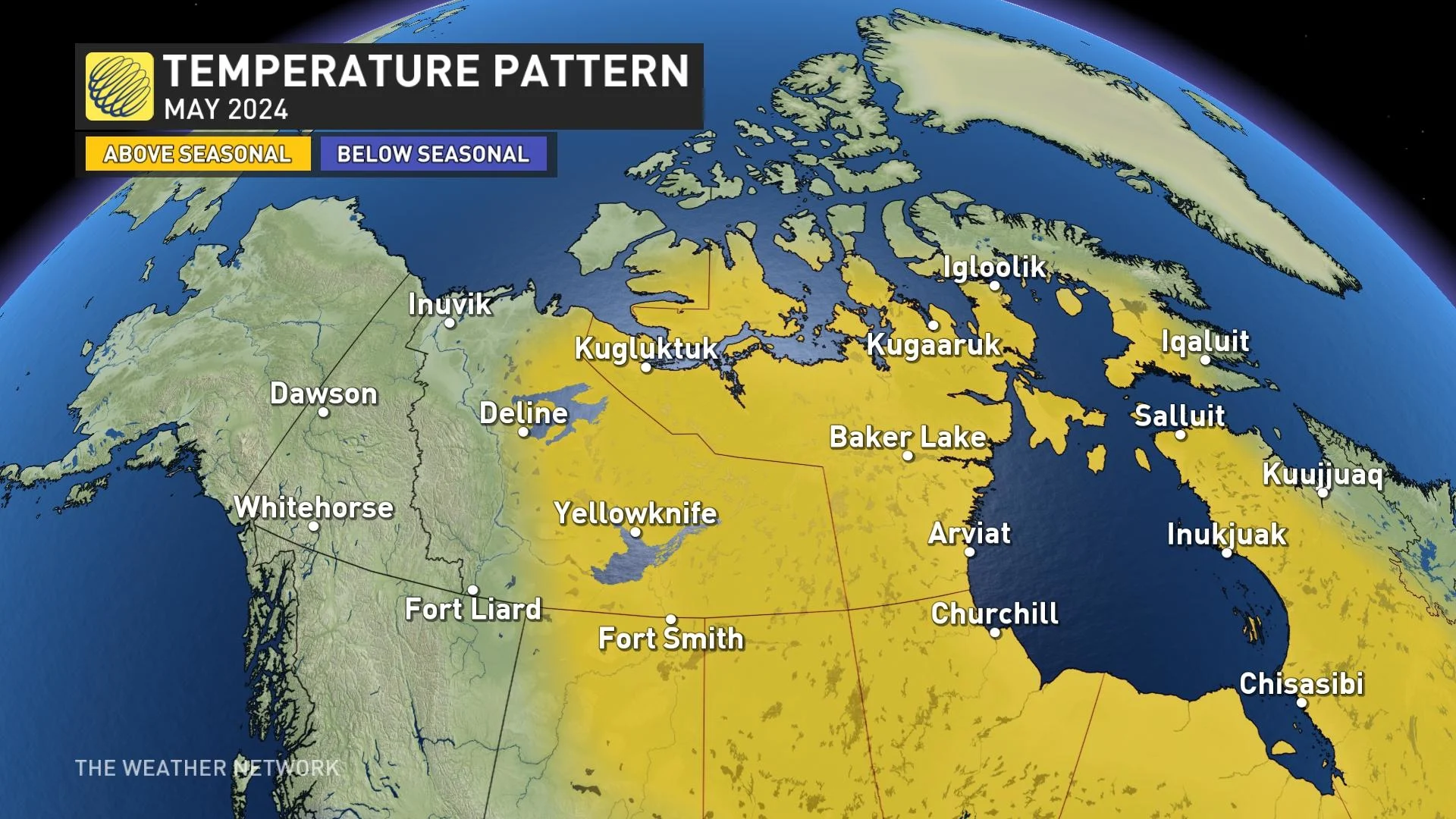
That is a continuation of the mild April where temperatures were a few degrees above normal for Iqaluit and most of the North. This May won’t see the extreme anomalies experienced in May 2023, where parts of the N.W.T. and Nunavut soared to above seven degrees above normal, staggeringly high for a monthly anomaly.
A severe drought is ongoing across the Northwest Territories, as Yellowknife recorded just 1 mm of precipitation over the past couple of months, a potential harbinger for an active wildfire season.


