January starts off feeling like October across Ontario and Quebec
If you’ve lived here all your life, you may never have experienced temperatures this warm in the month of January.
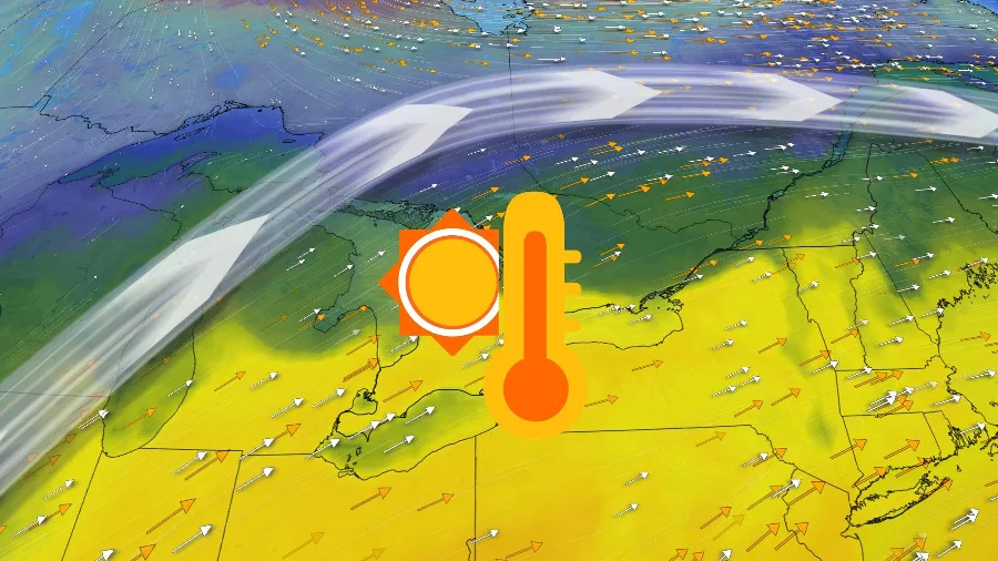
Ontario and Quebec will begin the first week of the new year basking in extreme warmth spreading over the region.
“Extreme warmth” is a relative term in the middle of January, of course. But temperatures coming in 15+ degrees above seasonal is no small feat for a time of year that usually requires multiple layers to take out the trash.
DON’T MISS: Spiders and a deadly derecho: wrapping up 2022 across Canada
An upper-level ridge over eastern North America is responsible for the warmer weather of late. This warmup already broke multiple record highs across Ontario, with Toronto’s temperature on Friday coming in at 13.1°C, a far cry from the city’s average high of -1°C for the date.

Also of note is the impressively warm low of 8.2°C that was documented at Toronto international airport on Friday -- the warmest December low since Dec. 5, 2001 (9.8°C). Its warmest low on record in the month was a balmy 12.8°C, set on Dec. 8, 1966.
A strong, low-pressure system will develop late this weekend and swirl toward the Great Lakes early next week, dragging even warmer air into the region.
The low sun angle makes it hard for temperatures to warm up much without some assistance, so our warmth will arrive courtesy of strong, southerly winds blowing ahead of this approaching storm.
DON'T MISS: 'It's quite remarkable': Halifax is about to set a record for lack of snow

Ontario’s warmest temperatures will arrive on Tuesday, when much of southern Ontario will see daytime highs climb as high as the mid-teens. It could be one of the warmest January days in recent memory, and there's an outside chance a few spots could come within a stone's throw of their all-time warmest temperatures on record for the month.

Toronto’s all-time warmest January temperature was a balmy high of 17.6°C set back in 2005. Monthly records range from nearly 20°C in southwestern Ontario to just into the double-digits at the mouth of the St. Lawrence.
This won’t be an enjoyable warmth, sadly, as steady rain and gusty winds will accompany the warm front as it moves across the area. Those winds could gust as high as 80 km/h.
Conditions will flip once again behind this system as winds swirl around and blow in colder air from the north. Daytime temperatures should quickly fall back to seasonal levels by the end of the week.
Thumbnail image courtesy of Owen Prosser.
Check back for the latest forecasts for Ontario and Quebec.


