The science of sinkholes. How do they form and why?
Sinkholes come in two basic types, each with their own dangers
Sinkholes are scary. As if we don't already have enough to worry about in life, the ground can suddenly collapse directly underneath us, sometimes with little to no warning. So, what's happening here? Exactly what are sinkholes, and how do they occur?
Sinkholes have one of the most straight-forward, self-explanatory names we've ever given to something. They are, quite literally, holes that form due to sinking earth.
The process behind how they form is fairly straight-forward as well. It just involves a combination of time, water, and specific combinations of topsoil and bedrock.
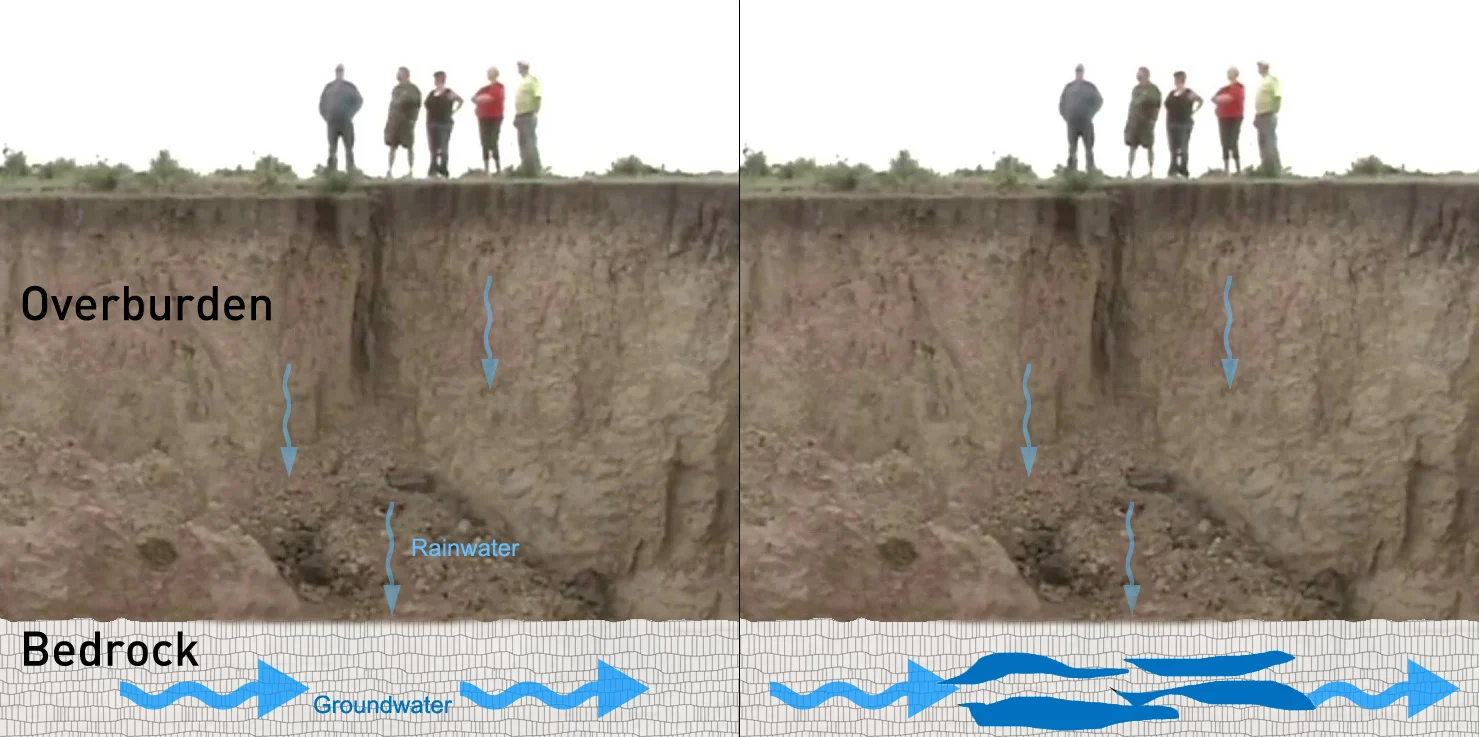
As water flows through the ground, it filters its way through both the topsoil (or 'overburden') and the underlying bedrock. Normally, this is a fairly stable situation. If that bedrock is composed of specific types of minerals, such as gypsum, limestone or dolomite, the flowing water can actually pick up those minerals and carry them away, eroding the bedrock over time.
It can take a long while for this to have a noticable impact, depending on how constant the source of water is, the specific type of minerals in the bedrock, and acidity of the water. Still, this process can carve large holes and even extensive cave systems through the bedrock. If the bedrock erodes enough that the topsoil collapses down into the holes, it will result in a gap in the overburden, which starts the process of sinkhole formation.
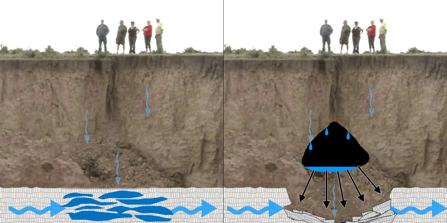
The type of sinkhole that forms, and how quickly it becomes a problem, depends on the type of topsoil in the overburden.
If the overburden is mostly sandy soil, the loosely-packed grains will quickly tumble down to fill in the gap. This will result in a cascade effect where the layers of soil will all slump downward, fairly quickly, leaving a depression at the surface. This is called a cover-subsidence sinkhole.
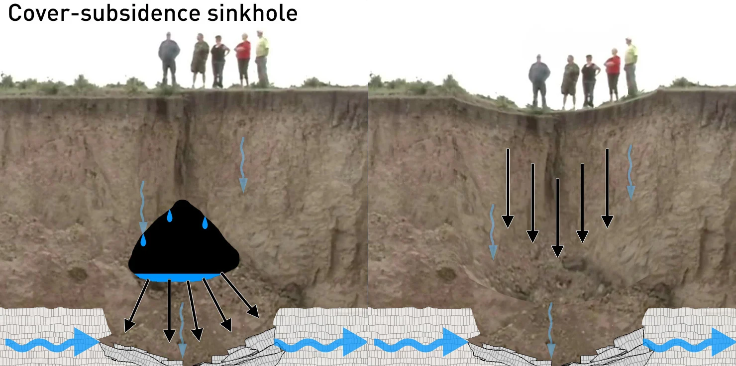
The extent and depth of the sinkhole will depend on how large of a cavity was carved into the bedrock before the topsoil slumped down into it. Thus, these can range from simple depressions to enormous sloped pits.
The far more dramatic and dangerous case is when the overburden topsoil is mostly composed of clay.
Since clay minerals stick together much easier than sandy soil, a clay overburden will be far denser and more stable. Often, when a clay overburden develops a gap due to a bedrock collapse, nothing will be immediately noticable at the surface. Even with a gap forming in the topsoil, as the bottom-most layers of clay slump down and are dissolved by the water and carried away, the layers above the gap will remain in place and retain much of their strength.
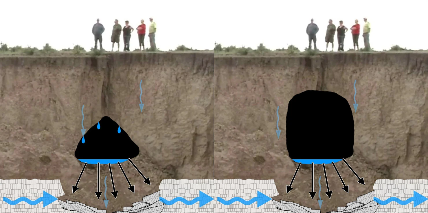
Over time, the gap will continue to grow until there is only a thin layer of clay directly under the surface. When the strength of the remaining layer can't hold up to gravity pulling it down or the weight of something pressing down on it from above, the surface will suddenly give-way into the abyss below. Appropriately, this is known as a cover-collapse sinkhole.
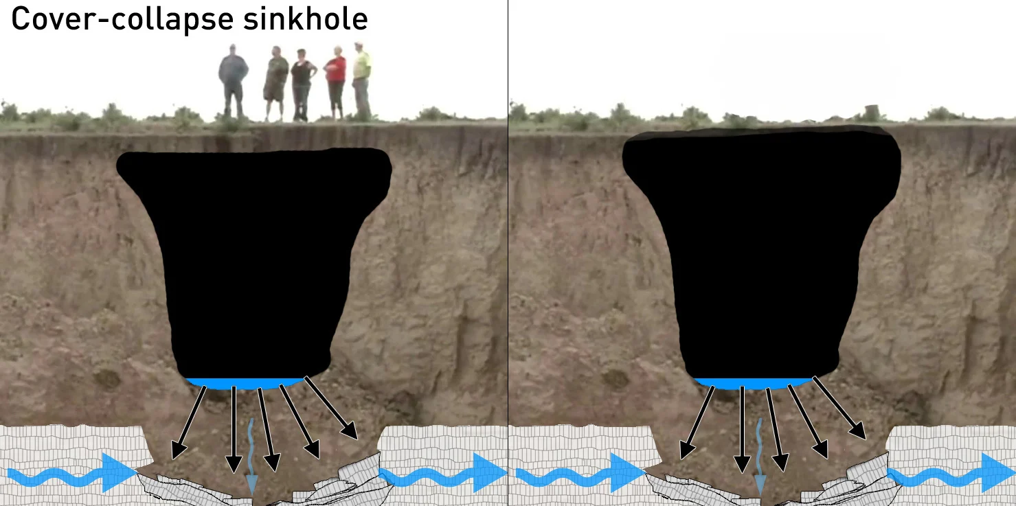
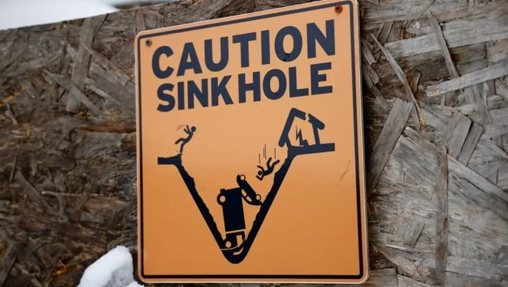
In fortunate cases, there won't be anything but open ground above the deep pit that suddenly opens up. In worst case scenarios, this can instantly swallow a showroom full of valuable cars, or open up underneath a car driving down the road, under someone's home, or even under their feet.
Where sinkholes form is something that is not as straight-forward as their name and how they form. Scientists have a good idea of the areas that are most prone. Geological surveys can show us where the right combinations of topsoil and bedrock are located, such as the Karst landforms found in places like Île d'Anticosti, Québec, along the Bruce Peninsula and in Hamilton, Montréal and Ottawa, Ontario, and in Winnipeg, Manitoba.
One way to tell if you live in one of these 'prone' areas is if the region is known for having extensive cave systems carved into the bedrock. Geological surveys provide a wealth of information on the subject, but another more readily available source is from groups that seek these areas out as a hobby (ie: cavers).
Actually knowing when and where they're going to form, however, is another matter. There is some hope, though. In 2014, NASA announced that radar data from airborne missions and satellites had been used to monitor the movement of soil, to catch some sinkholes before they open up.
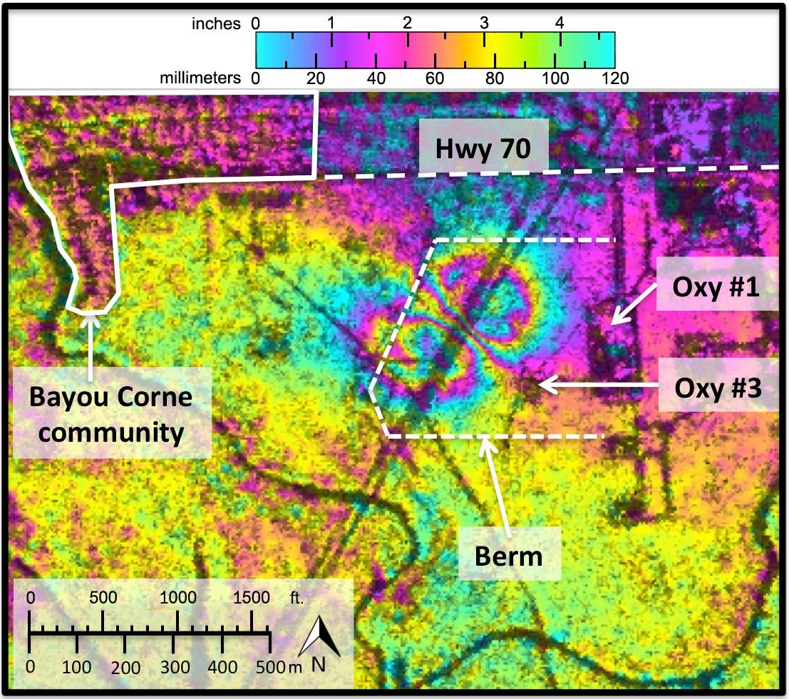
NASA's UAVSAR radar performed after the Bayou Corne, La., sinkhole formed show it was able to detect precursory ground surface movement more than a month before the sinkhole collapsed in Aug. 2012. Credit: NASA JPL
There's no telling when such a 'sinkhole forecast system' might actually become a reality, though, so until then it seems we're just going to have to stay informed and take our chances.


