Strongest storm of 2020, Typhoon Goni makes landfall in the Philippines
Officials in the Philippines ordered evacuations in southern Luzon ahead of Super Typhoon Goni's impact.
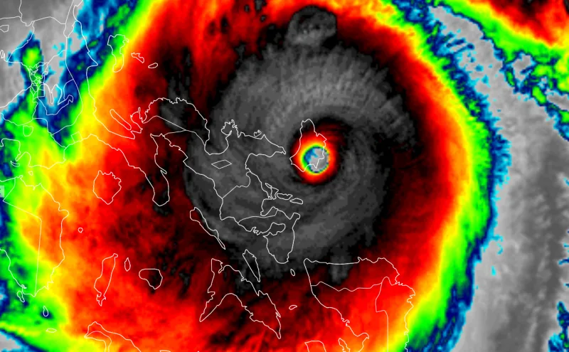
Super Typhoon Goni, the strongest storm on Earth and the strongest in all of 2020, is slamming the Philippines after making landfall at full-fledged Category 5 strength.
Super Typhoon Goni underwent rapid intensification during the week, and even strengthened slightly to feature 315 km/h sustained winds, with an astounding peak of 380 km/h.
It was more or less that strength when it made landfall near Baras on the island of Catanduanes early Sunday morning. It will still be staggeringly strong when it makes its direct hit on Luzon, the Philippines' most populous island that is also home to the capital Manila.
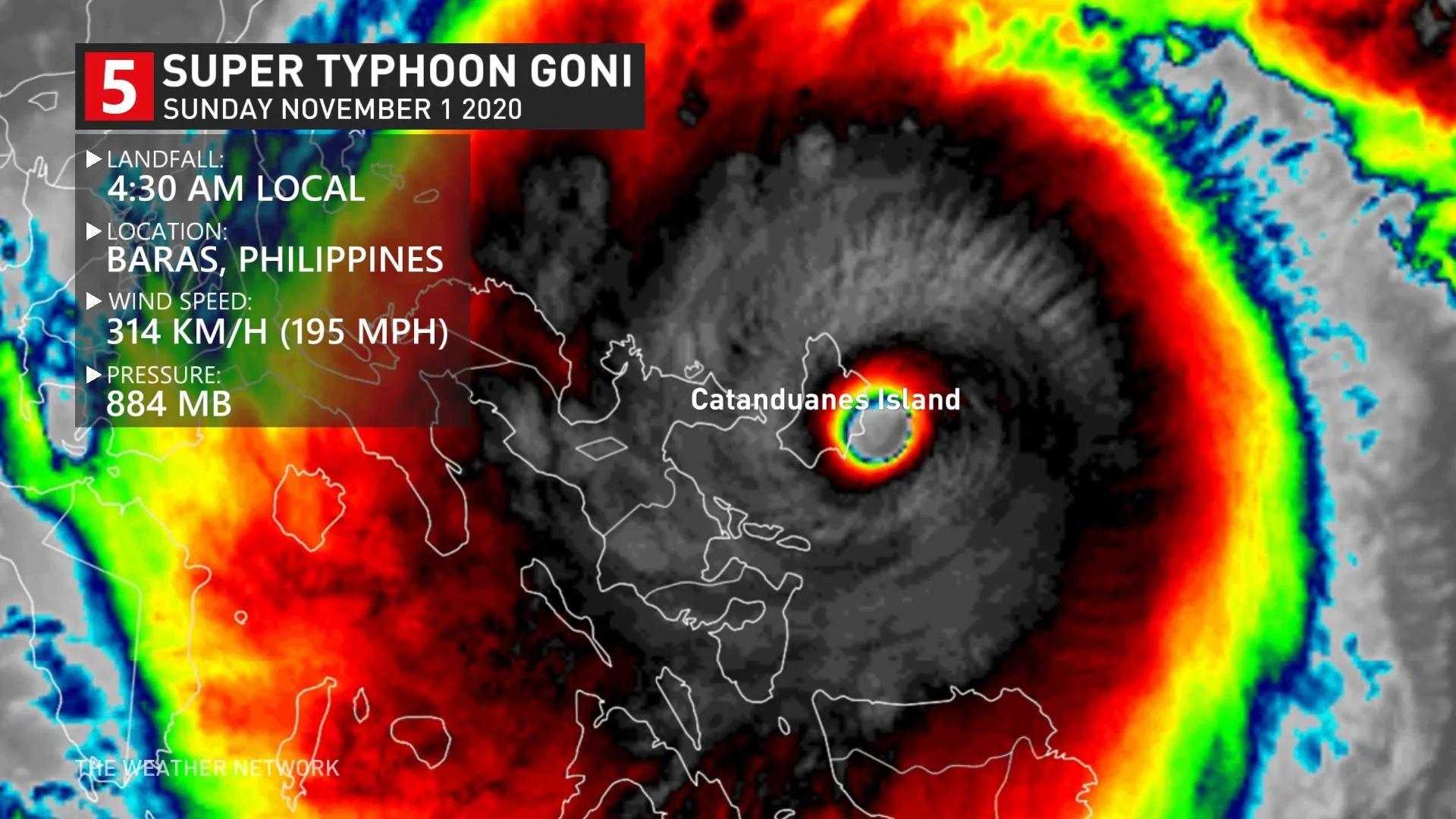
This is an astoundingly powerful storm, and may be the strongest at landfall on record.
The 13 million people inhabiting the Manila area will avoid the brunt of the winds, thanks to sheltering mountains on the east and north side of the city. However, these same mountains will be responsible for flash flooding and landslides.
In preparation for Goni's arrival, Philippine officials on ordered the evacuation of thousands of residents in the southern part of the main Luzon island. As well, pre-emptive evacuations are underway in coastal and communities vulnerable to landslides in Camarines Norte and Camarines Sur. Albay's provincial government will order residents in risky areas to leave their homes, CNN reported.
Though officially named Goni by international sources, the Filipino meteorological agency PAGASA gives its own names to storms that enter its waters, and will refer to the storm as Typhoon Rolly.
Though the Atlantic Basin has been above-average this year, tying 2005 for most number of named storms on record, the Pacific has been far quieter.
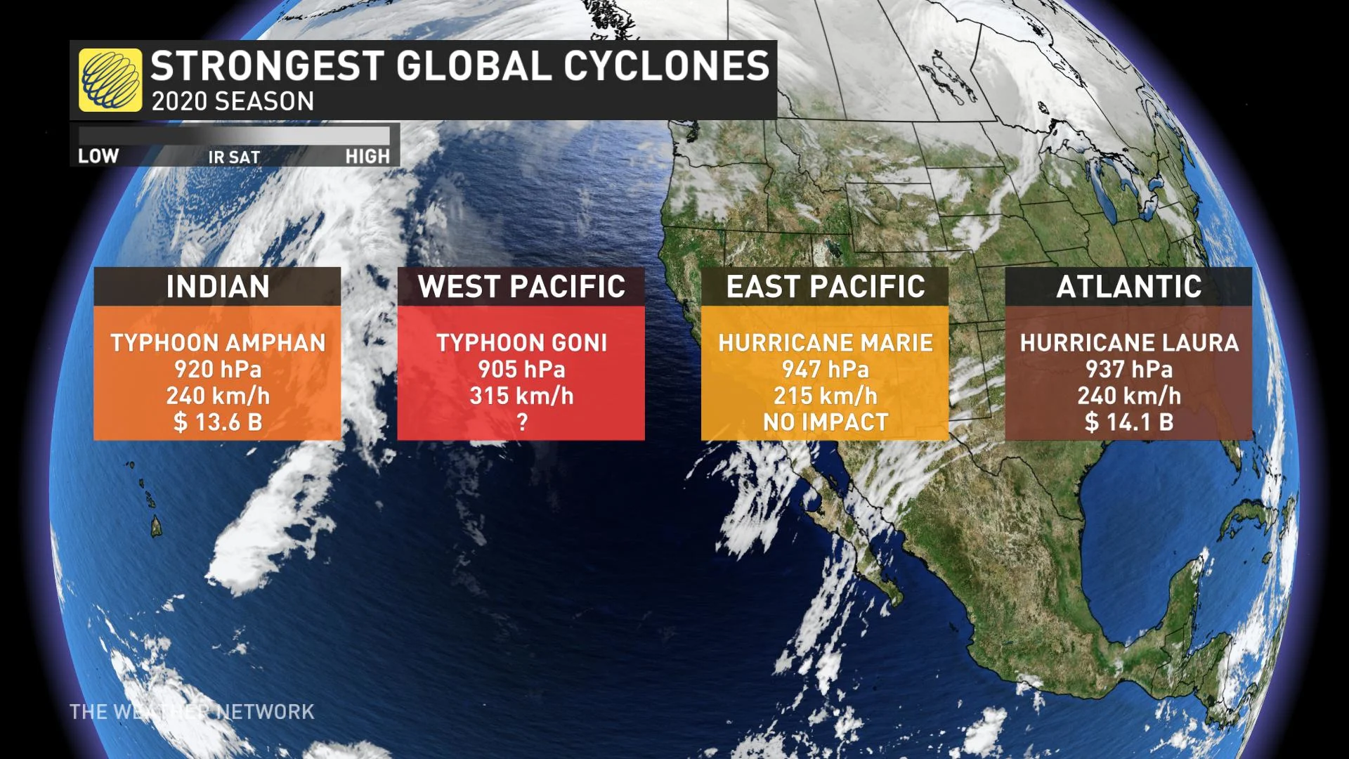
However, it terms of strength, Goni outstrips all of the Atlantic storms so far this season. The strongest, Hurricane Laura, was Category 4 at its peak, and did some US$14 billion in damage to the U.S. Gulf Coast while leaving dozens of people dead.
Still, the 2020 Pacific season has not been storm-free. In recent days, the Philippines and Vietnam were struck by Typhoon Molave, which took a similar track to Goni.
In addition to Goni impacting the same areas affected by Molave, the "strongest storm in 2020" will be interacting with landscapes that will carry the same risks as its predecessor: Mountainous terrain prone to mudslides and flash flooding. The area is also rich in volcanic sediment, worsening some of those risks.
"Due to its trajectory, current severe intensity and potentially high-volume rainfall, “ROLLY” can be expected to generate volcanic sediment flows or lahars, muddy streamflows or muddy run-off in rivers and drainage areas on the monitored active volcanoes of Mayon, Pinatubo and Taal," the Filipino volcanology agency says.
Because the mountainous landscape is expected to rob the storm of much of its strength, Goni will be a weaker storm when it makes a second landfall in southern Vietnam early next week.
Though nowhere near Canada, its effects on the atmosphere will influence our weather somewhat, according to Weather Network meteorologist Dr. Doug Gillham.
"Opposite to the impact of a recurving typhoon, this should reinforce our warm pattern, which will begin during the middle of next week and continue well into the following week and possibly beyond," Gillham says.
Typhoons and hurricanes are both tropical cyclones, and form in the exact same way. The only difference is the naming convention: 'typhoon' for storms in the Northwestern Pacific, 'hurricane' for those in the Atlantic Basin and in the eastern Pacific.
Their wind speeds are also calculated slightly differently. Typhoon strengths are based off of 10-minute sustained wind speeds, while hurricanes go by one-minute sustained speeds.


