Atmospheric river headed for B.C. could bring 100+mm of rain
A dip in the jet stream arriving this weekend will herald the start of a particularly wet pattern encroaching on the West Coast through the end of September
A major pattern change is coming to the B.C. South Coast beginning this weekend.
The change will continue through the end of September with multiple systems tracking in. While there are some differences in the timing and precipitation totals from individual systems, there is consensus that the region will see a rather wet ending to September.
DON'T MISS: Wildfire season not over yet: Some B.C. blazes might burn into winter
A dip in the jet stream arriving this weekend will herald the start of this wet pattern encroaching on the West Coast through the end of September.

Ahead of the first system's arrival, special weather statements are in place for the region, warning of strong wind gusts that could bring down tree branches and cause localized power outages, along with heavy rainfall.
This weekend through next week
Areas: South Coast
Timing: Through next week
Weather: Multiple rainy systems could offer much-needed rain to southern B.C. where the highest drought level Environment and Climate Change Canada (ECCC) can give has held on for the majority of the summer. Even still, some still may miss out.

Although the summer is climatologically B.C.’s driest period, 2023 has been exceptionally drier than normal. For perspective, September normally records 60 mm in Vancouver, but as of the 20th, only 9.8 mm has been recorded...quite literally a drop in the bucket.
The below-average precipitation stretch may finally reprieve next week.

A dip in the jet stream will usher in an unsettled trough, accompanied by a series of systems tracking in from Sunday through the work week.
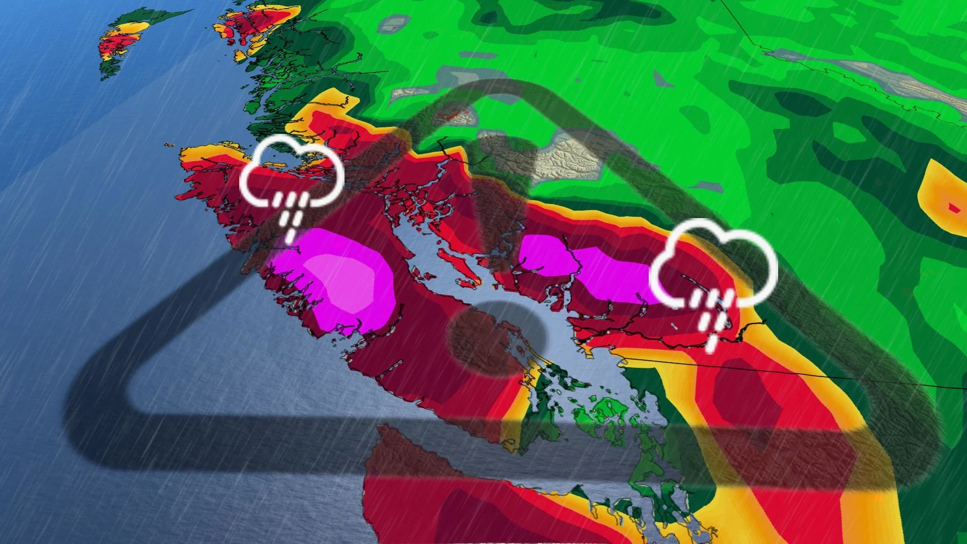
Tapping into some higher Pacific moisture, seven-day rainfall totals could bring 50-100 mm to the Lower Mainland, even as high as 200 mm in higher elevations. Elevations above 2000 m will see snowfall on the alpines.

The swing and a miss is felt as we head east into the Interior. These Pacific systems rain out over the coast, and will not offer much benefit to the Okanagan Valley and areas east.
Confidence: High in pattern change, medium on exact totals
WATCH: Rain heads to B.C., but will it help the most parched regions?
Atmospheric river ranked as Category 3
An atmospheric river streaming in from the Pacific will give these systems plenty of moisture to work with.

The impending slug of moisture will rank as a Category 3 on the University of California San Diego’s atmospheric river scale, which ranks the duration and magnitude of these plumes of moisture as they stream into the West Coast.
RELATED: Why we see floods following fires: A tale of two extremes
Category 3 atmospheric rivers are both beneficial and hazardous, bringing quenching rains that could also lead to localized flooding if it falls too quickly.
Stay with The Weather Network for all the latest on conditions across B.C.


