Fall warmth continues for Canada in November, but will it last?
We expect winter will step onto the playing field across Central and Eastern Canada well before the end of the month
November is typically the month when winter weather begins to settle in across most of Canada. Will that be the case this year? Please read on to find out what we can expect during the upcoming month.
So far during the fall season, much warmer-than-normal temperatures have dominated across most of Canada. This makes it difficult to believe that we have reached the time of year when winter should be lurking just around the corner.
DON'T MISS: Will winter redeem its reputation? A sneak peek at winter 2024-25
The various shades of orange and red on the temperature anomaly map below highlight how widespread the warmer-than-normal weather has been during September and October. Only parts of B.C. and the Yukon have seen near-normal or cooler-than-normal temperatures for the fall season thus far.

We expect that a similar pattern will continue for at least the first half of November with warmer-than-normal temperatures dominating across most of Canada. However, we expect that most of B.C. and parts of Atlantic Canada will see near-normal temperatures and Newfoundland and Labrador should even tip to the cool side of normal.

RELATED: What does a classic fall storm look like in your part of Canada?
However, keep in mind that “normal” temperatures continue to steadily fall through the month, so periods of warmer-than-normal weather will feel like mid-fall rather than late summer.
This time of year is well known for its classic fall storms, but so far the season has been relatively quiet across most of Canada. The notable exception has been the B.C. coast, including the historically heavy rain and flooding event that inundated the South Coast region during mid-October.
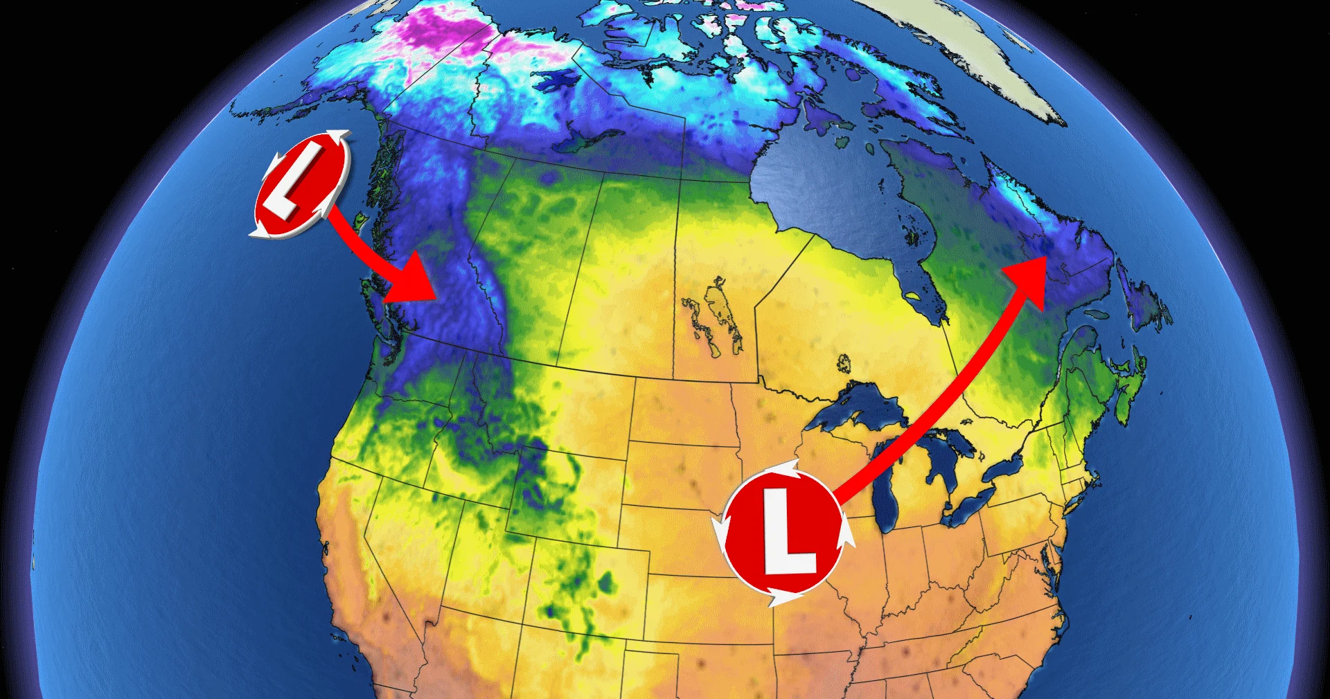
However, we are now in the midst of a transition to a more widespread active pattern. The dominant storm track for November is expected to be from the south-central U.S. into the Great Lakes region. This will bring near-normal or above-normal precipitation totals to most of Ontario and Quebec, including Toronto, Ottawa, Sault Ste. Marie, Thunder Bay and Montreal.

While southern areas will see primarily rain, parts of northern Ontario are kicking off the month with snow and ice.
We also expect an active pattern to continue into the B.C. coast, including Vancouver and Victoria. This is the wettest time of the year for this region and we expect near-normal or above-normal precipitation totals for the month. This should allow the alpine snowpack to get off to a strong start as we head into the winter season.
While mild temperatures will dominate deep into the month of November, we are closely watching signs that this pattern could break down during the second half of the month. If this occurs, we will see a transition to a more typical late-November pattern across Central and Eastern Canada with the potential for a period of colder-than-normal temperatures before the end of the month.

The exact timing is still uncertain and it is possible that the pattern change will get delayed into December. However, at this point we expect that winter will at least step onto the playing field well before the end of November across Central and Eastern Canada. This would also bring a period of mild (but not warm) weather and less precipitation to Western Canada.
So, if you enjoy warm weather, be sure to take advantage of the milder conditions during the next few weeks, but don’t procrastinate too long in getting yourself prepared for winter.


