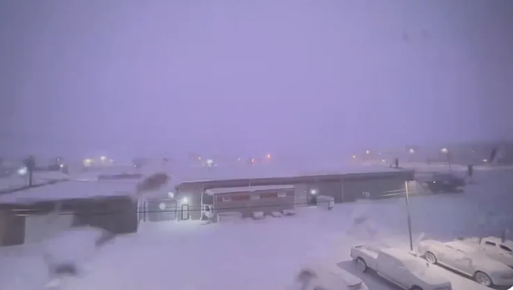
Epic thundersnow captured amid 'electrically active' snow squall
Rounds of thundersnow rumble through Buffalo as the region braces for 100+ cm of snow this weekend
An early but potent winter-like storm has swept into western New York state, threatening to blast 100+ cm of snow over Buffalo through the weekend. The setup across the Great Lakes was a red flag for meteorologists that a perfect lake-effect storm could be brewing. It’s going to be a widespread, high-impact event for the region.
MUST SEE: Why this ‘perfect lake-effect storm’ could produce 100+ cm of snow
Erie County, which encompasses Buffalo, declared a state of emergency on Thursday and a driving ban is in effect for all but authorized emergency vehicles.
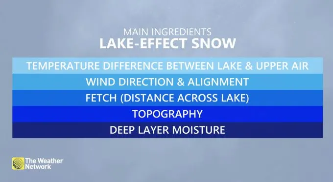
The cold winds, unusually warm water temperatures, and high moisture are all lining up to allow the lake-effect snow machine to fire up at full blast. Conditions are also ripe for thundersnow to develop.
The Weather Network's Storm Hunter, Mark Robinson was in the dead centre of a squall on Thursday night as thundersnow rumbled through the nearly whiteout conditions.
"This is the most electrically active snow squall I have ever seen," Robinson said.
DID YOU KNOW: Lake-effect snow and summertime thunderstorms are cousins
Lake-effect snow lands its characteristic punch because it’s born from the same process that creates a towering thunderstorm on a humid summer afternoon.

Snow squalls off the lakes are a product of convection. We experience most lake-effect snow during the fall and early winter months because there’s still a sharp temperature difference between the surface of the lakes and the much chillier winds blowing over the water.
RELATED: Buried: Why the Great Lakes produce some of the world’s heaviest snow
Some of that air comes in direct contact with those warmer waters, heating up that shallow layer of air like a camper holding their hands over a fire to stay warm. This air becomes warmer than its surroundings, allowing it to begin rising through the atmosphere.
A bigger difference between the temperature of the lake and the atmosphere above will cause the air to rise even more quickly, feeding the formation of snow showers similar to the way we’d see thunderstorms bubble up on a hot July day.
Here's a closer look at the thundersnow and lake-effect squalls currently taking aim at the Buffalo region:
WATCH: Powerful Buffalo squalls put into perspective as car completely buried
With files from Dennis Mersereau - The Weather Network.


