Sneaky freezing drizzle threat follows Ontario's ice and snowstorm
School closures and power outages mount as a dangerous, icy storm moves through Ontario.
Travel conditions quickly deteriorated Wednesday evening as a strong Colorado low moved through southern Ontario, dropping periods of heavy snow followed by freezing rain and ice pellets.
The icy mix continued through the overnight hours, with about 10-20 cm of snow and ice reported across the Greater Toronto Area (GTA) before dawn on Thursday. That prompted several schools across the region to pull buses first thing, with school closures announced for the Halton board.
"Travel is especially difficult on untreated residential roadways for Thursday morning commuters," warns Rachel Modestino, a meteorologist at The Weather Network.
The Toronto Transit Commission (TTC) cancelled bus service at dozens of stops beginning at 5 p.m. on Wednesday because of their "known icy trouble spots on hills."
Those with air travel plans are also urged to plan and check ahead, with some flight delays and cancellations due to lingering storm impacts at Toronto's Pearson airport.
At the airport, 17.4 cm of snow was recorded, making Wednesday (February 22) the snowiest day of the year so far. That beat out the 13.8 cm that fell on January 20. Peak snowfall rates of several centimetres per hour were observed.
RELATED: Here's how to stay safe during a winter power outage
WATCH: Icy roads result in cars in the ditch across southern Ontario
Highway 402 acted as a rough dividing line between heavy snow and ice pellets to the north, and a significant crust of ice from freezing rain along the highway and to the south.
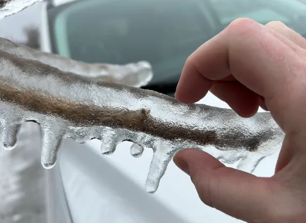
Icy precipitation quickly coated trees and power lines late Wednesday, with significant damage and outages reported across the Lake Erie shorelines. The highest ice accretion amounts fell from Windsor - Essex County and just south of London to southern portions of the Niagara Peninsula.
Hydro One reported about 29,000 customers in southwestern Ontario were left without power due to the storm.
Widespread freezing drizzle threat remains
Although the potent system is now making its way into Quebec and Atlantic Canada, the threat for freezing drizzle and light icing remains across southern Ontario as temperatures hover below 0°C for Thursday. A widespread freezing drizzle advisory covers the region.
"Surfaces such as highways, roads, walkways and parking lots may become icy and slippery," says Environment and Climate Change Canada (ECCC) in the advisory. "Freezing drizzle can produce thin, hard-to-detect layers of ice. Take extra care when walking or driving in affected areas."
MUST SEE: Blizzard near Los Angeles? Bizarre pattern spawns historic heat, ice storm
Heavy snow continues to batter eastern Ontario
Meanwhile, periods of snow continue to affect parts of eastern Ontario, including the City of Ottawa.
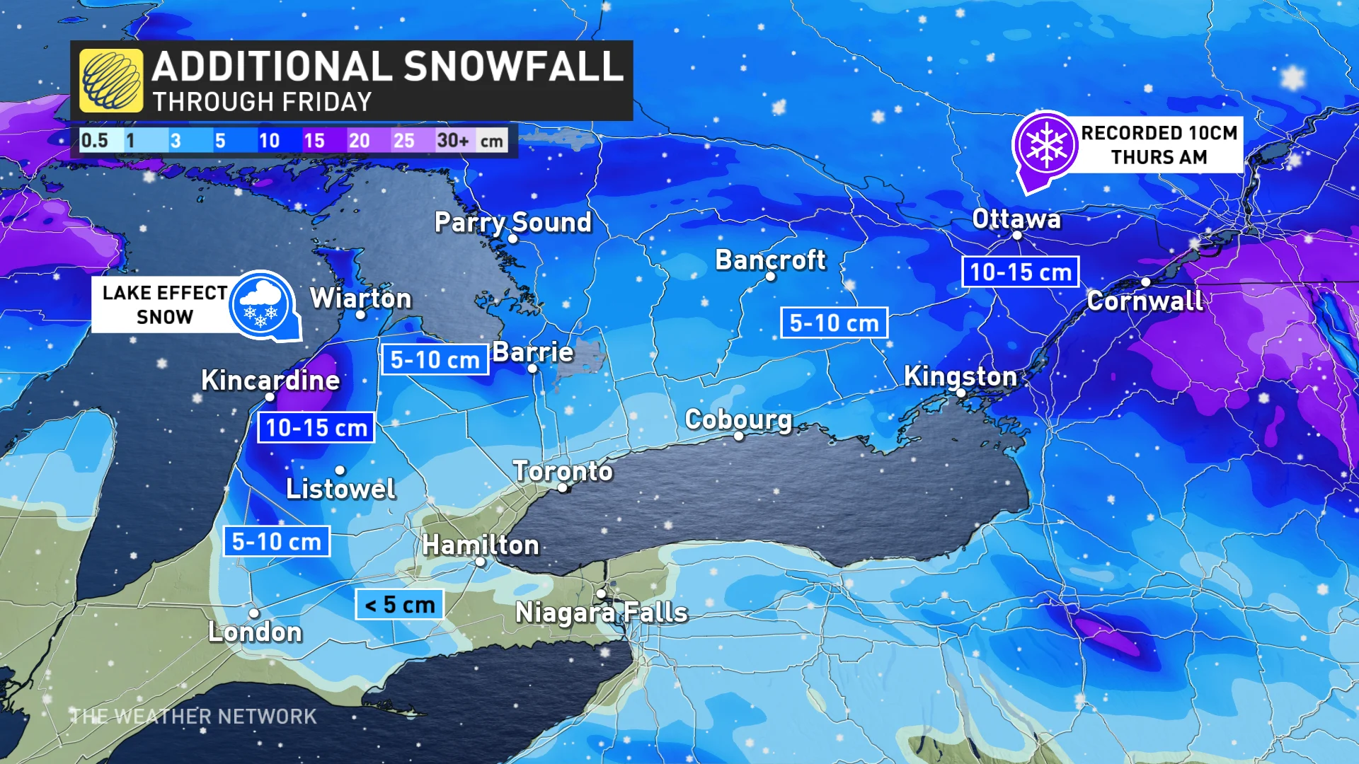
"The bitter cold air and high moisture content of the storm had already produced 10 cm in Ottawa early Thursday, with possibly another 10 to go," Modestino says.

Exact measurements will vary and be difficult to record because of its light and fluffy nature. Thursday morning commuters will battle heavy snowfall and blowing snow conditions until later in the day. As a result, all school buses across Ottawa were cancelled Thursday morning, though schools did opt to remain open.
RELATED: 'Common sense driving tips to help steer through Canada's winter'
Behind the system, will be a classic lake-effect snow set up, with 5-10 cm, or locally higher, possible through Friday.
Eyes on another messy Colorado low next week
Forecasters are eyeing another messy Colorado low that will track into the Great Lakes region later Monday and into Tuesday of next week.
This storm is currently expected to bring substantial snow, ice and possibly some rain to the GTA and Niagara region. Primarily snow is expected for areas north and east of the GTA, including cottage country and eastern Ontario, with between 10-20+ cm possible in the hardest hit areas.
Overall, the first week of March is expected to have changeable temperatures that should balance out to near normal. There is the potential however, for a colder pattern to return for the second and third week of March.
WATCH: Cars and tree limbs coated in ice as potent Colorado low hits
Check back to The Weather Network for more updates and information on the impacts of this winter storm in Ontario.


