Historic warmth en route to southern Ontario with gusty winds, rain
Millions of folks across southern Ontario are likely in for a historically warm night as a storm whips across the Great Lakes this week
A stretch of historic November warmth is on tap for parts of southern Ontario this week as potent southerly winds blow record temperatures into the region.
Forecasters are monitoring a developing Texas low that’ll help drag unseasonably warm air north of the border, bringing temperatures 15+ degrees above seasonal to portions of Ontario.
Gusty winds and bouts of heavy rain will accompany this brief but intense warmup.
DON’T MISS: What if Ontario's looming November warmth was cold instead? Imagining 30 C flip
Historically warm night possible this week
The storm system will drag a warm front across the region Monday evening, forcing temperatures to grow more than 15 degrees above seasonal behind the boundary.
Windsor will likely push to 23 or 24 degrees Tuesday afternoon, with 20-degree readings extending to the Georgian Bay and Ottawa areas.
Although these daytime highs are well above normal, we’ve had recent November with similar or even slightly warmer temperature readings.
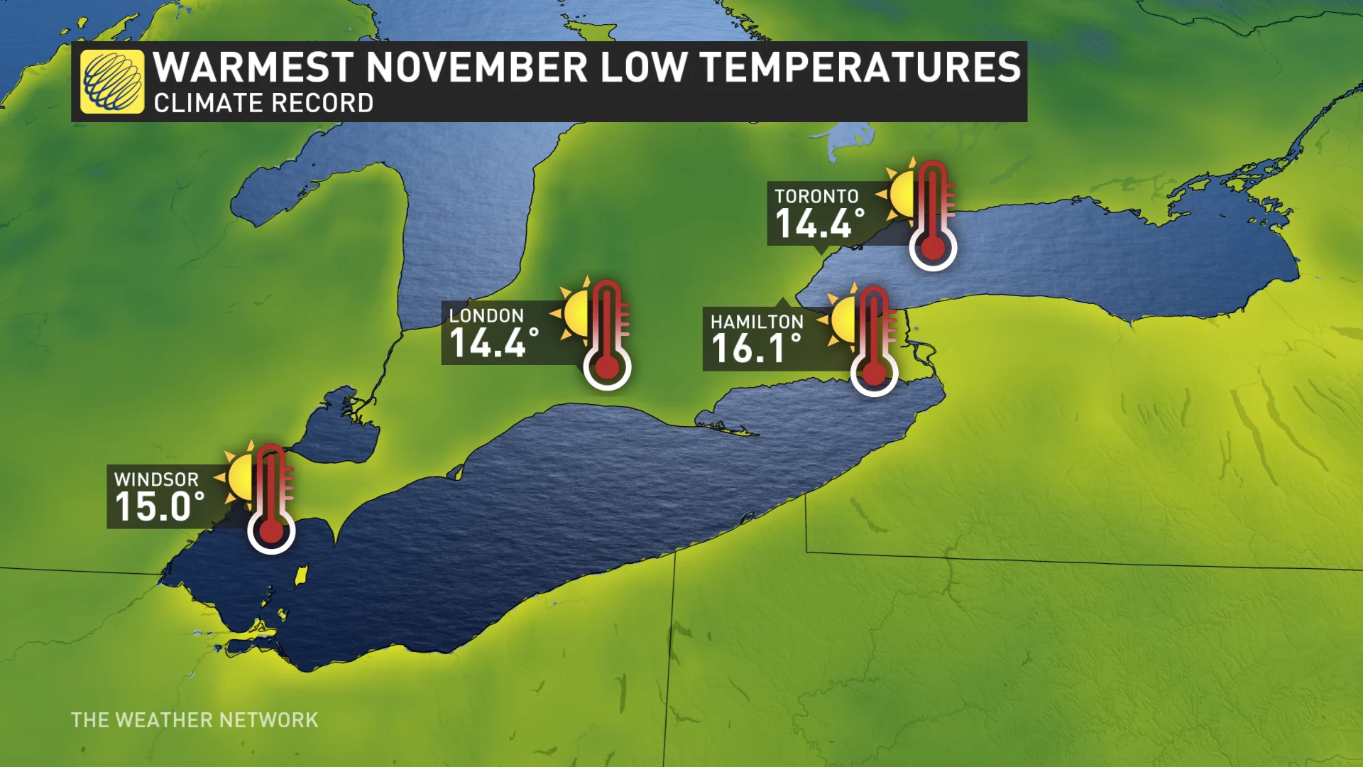
Where this event becomes unprecedented is the minimum temperature from the pre-dawn hours Tuesday morning to the pre-dawn hours Wednesday morning.
During similar spells of unseasonable warmth in 2020 and 2022, the temperature still managed to dip to 12 or 13 degrees through the overnights.
Based on computer model guidance, we have the confidence to say that the warmest night in November history is likely going to occur from Tuesday into Wednesday. It’s possible that the temperature won’t fall below 15 degrees, or even 17 degrees, for a 24-hour period across the Niagara Peninsula and extreme southwestern Ontario.
Blustery conditions and wind to accompany the warmth
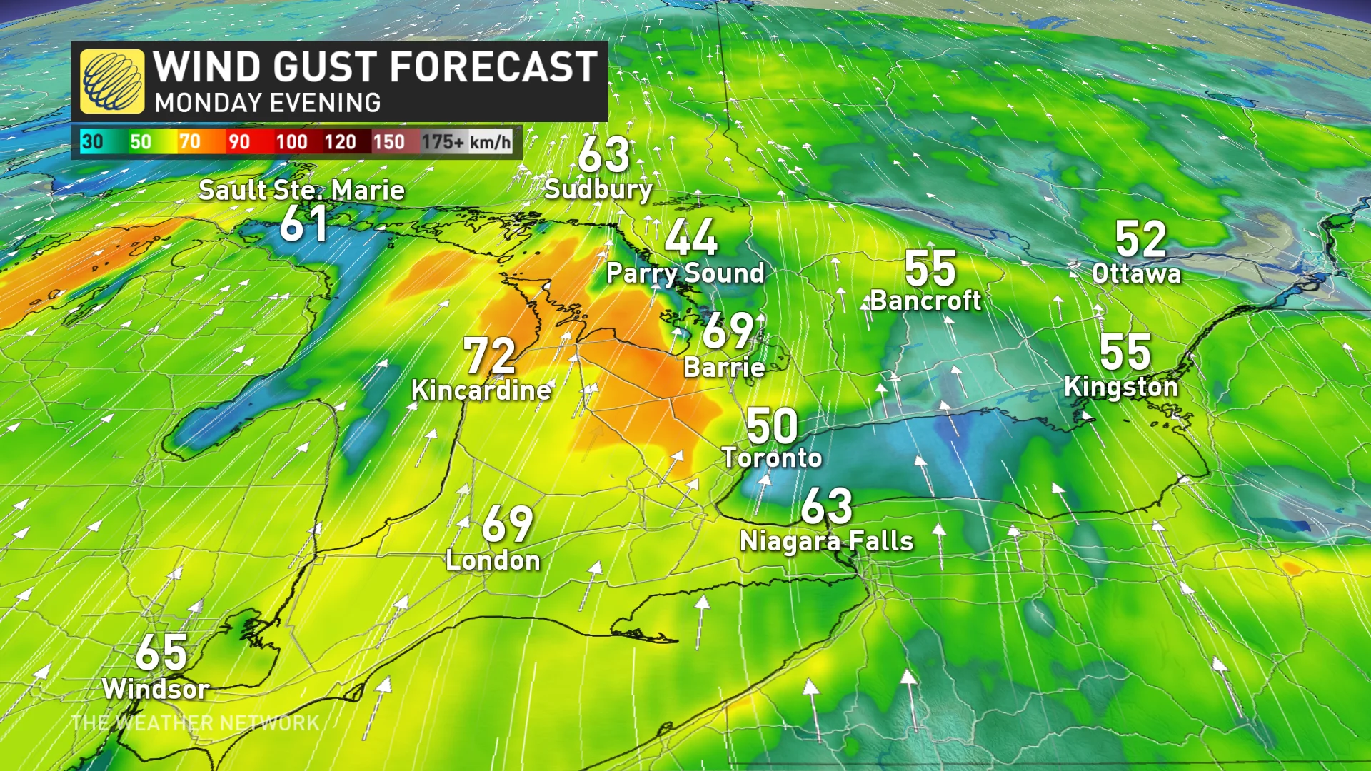
This kind of warmth doesn’t happen on its own this time of year. Exceptionally warm air has to be imported from down south, so it’ll be very windy at times as the Texas low pushes through the region.
Sustained wind speeds will likely peak across the Huron shores at more than 50 km/h on Tuesday. These wind speeds are strong enough to cause isolated power outages, making driving a little more challenging and creating large waves over the Great Lakes.
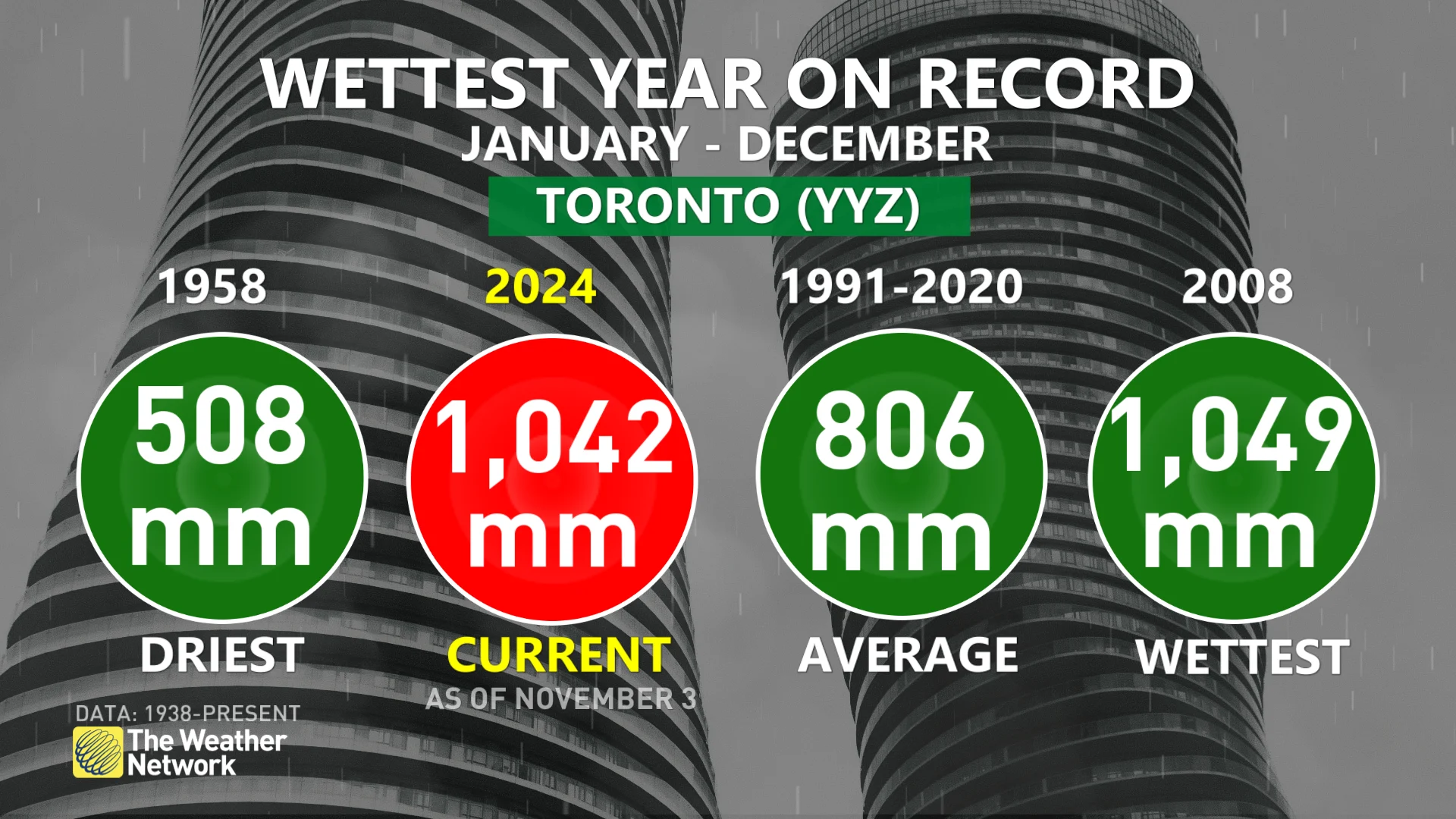
Many communities across southern Ontario saw one of their driest Octobers on record this year, an unusual spell of dry weather that arrived amid one of Toronto’s wettest years in history.
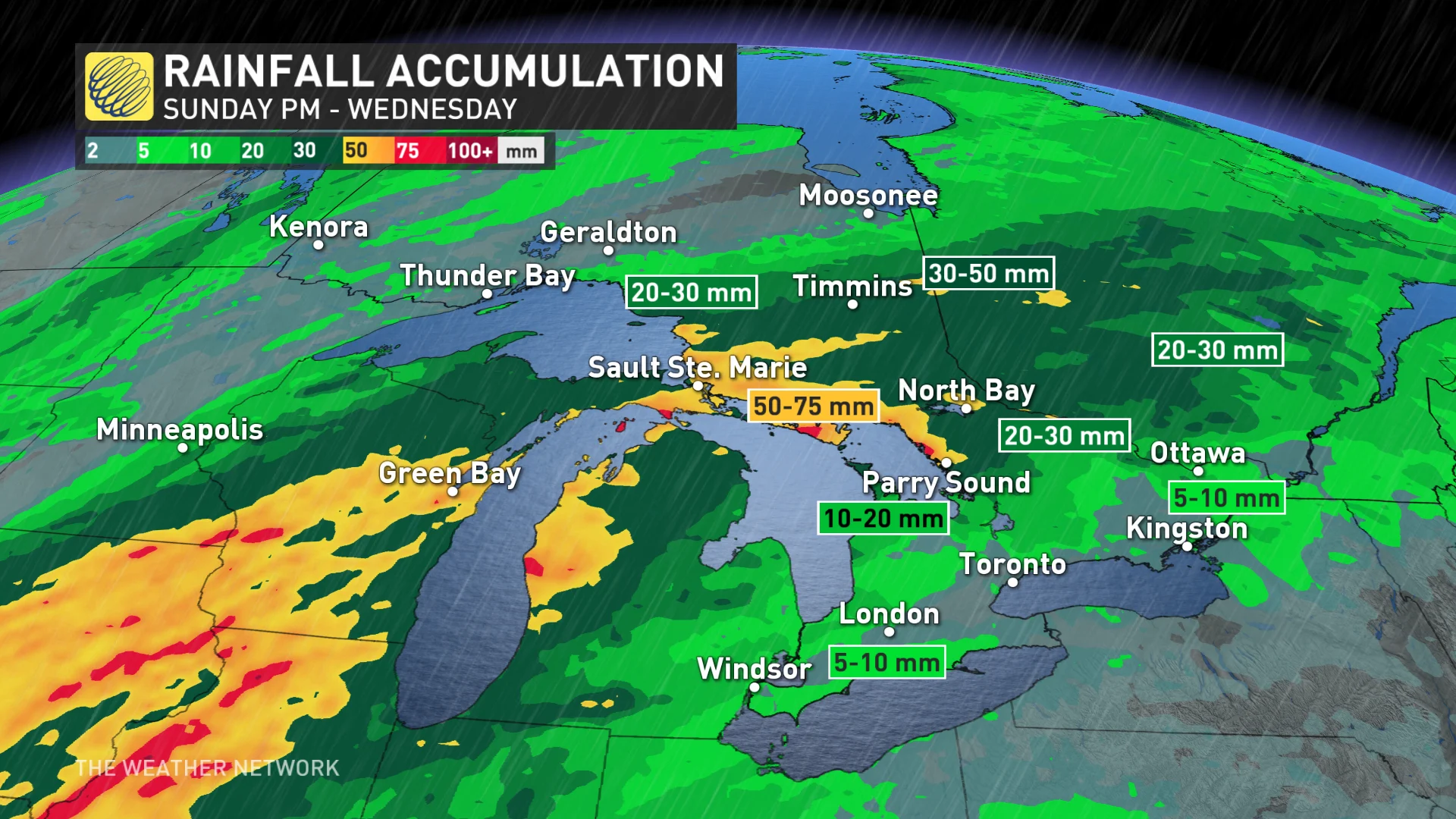
As Toronto crawls to the finish line on the wettest year on record, not much rain is forecast for the Greater Toronto Area (GTA), with just a couple of millimetres at most.
It’s a different story up in Sault Ste. Marie, however, where over 50 mm is likely, including in Sudbury, as well. It’s possible Timmins and Sudbury record one of their wettest November days on record, where upwards of 40 mm is forecast just on Tuesday alone.
Don't get too attached to the warmth. We could see a brief dose of chilly weather at the end of next week and into the weekend, but above-seasonal temperatures will dominate through the middle of the month. An active pattern is also expected to return for the second week of November with a storm track into the upper Great Lakes, helping to keep southern Ontario warmer than normal.
Stay with The Weather Network for all the latest forecast updates for Ontario.


