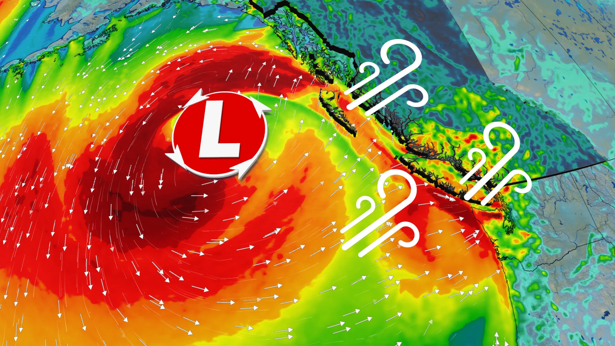
More than 100K customers in the dark in B.C. as wild winds knock out power
Travel issues, ferry delays, and power outages arose in B.C. as blustery winds accompanied a rainy, snowy storm that arrived on Monday
British Columbia is in the grips of a classic and disruptive fall storm that is bringing blustery winds, heavy rain, and alpine snow to much of the province.
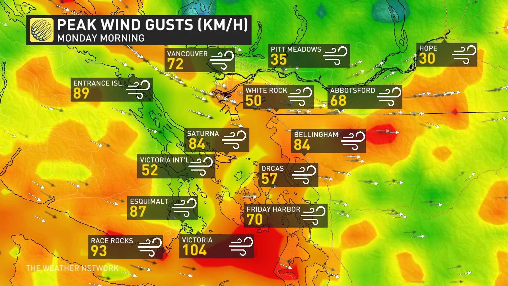
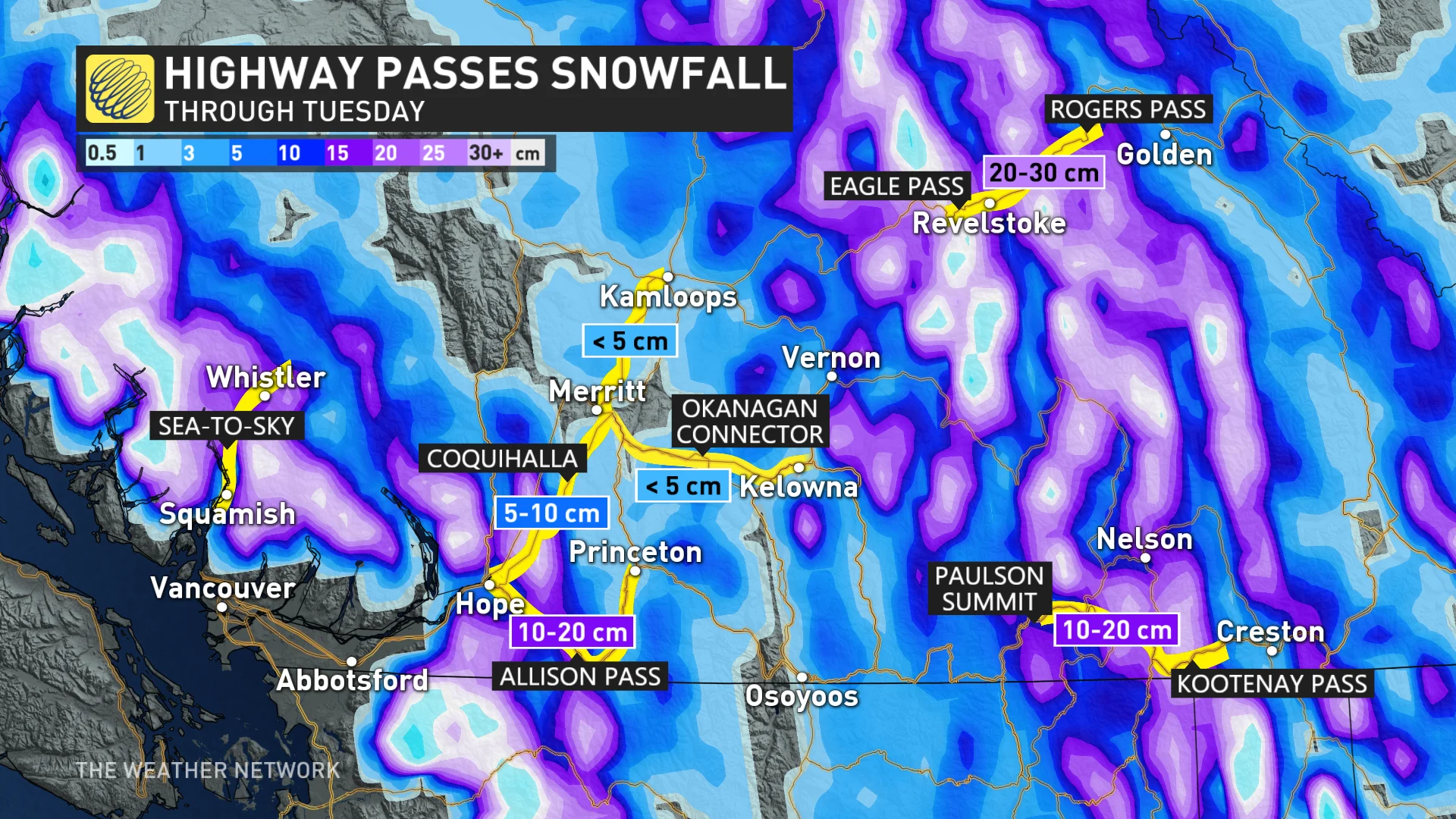
Wind gusts reached over 100 km/h in some coastal locales. Rainfall totals in excess of 50 mm are possible for parts of Vancouver Island, while snowfall totals could range from 5-30 cm for the mountain passes.
Power outages peaked with more than 150,000 customers on Monday, according to BC Hydro.
DON'T MISS: Fall warmth continues for Canada in November, but will it last?
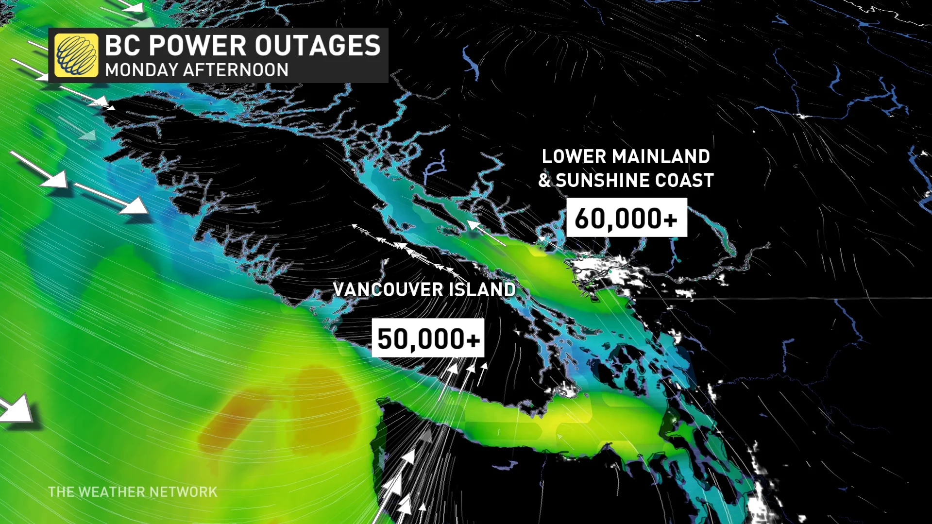
Reported by CBC, BC Ferries said several sailings have been delayed due to weather conditions.
Be sure to stay updated on the warnings in your area, as conditions can change quickly when significant fall storms hit.
The storm isn’t all bad news. The cooler air that arrived at the beginning of November couldn’t be more optimal for the ski resorts. In just three days, Lake Louise will see Canada’s first ski resort opening of the season.
Winds increased as storm pushes ashore
A storm pushing onto the B.C. coast is dragging cooler air into the region from up north.
Heavy rainfall and snowfall rates pushed inland Monday morning, with snow occurring along most highway passes, creating challenging driving conditions.

This temperature contrast has created a rapidly developing low off the tip of northwestern Vancouver Island. Heavy alpine snow is anticipated across the Coast Mountains.
The associated cold front is bringing gusty, westerly winds across exposed coastal sections.
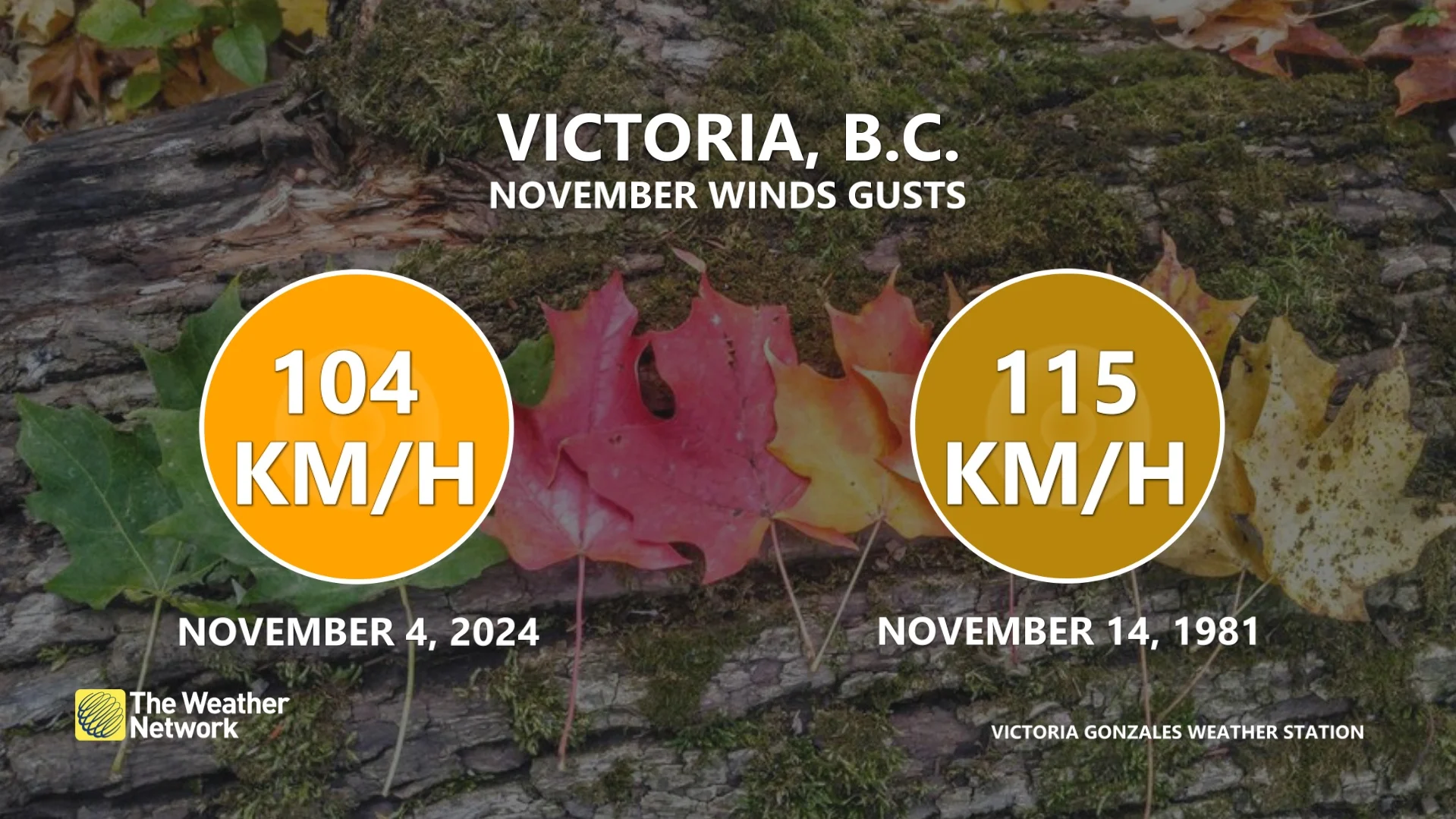
Victoria’s strongest winds developed into Monday afternoon as the low drives inland, resulting in very blustery conditions. A Victoria weather station recorded its strongest November wind gust since November 1981.
SEE ALSO: Canada's 2024-25 ski season is almost here! When do resorts open?
Other than Victoria, Here are the some of the reported wind gusts documented so far:
Winter driving conditions are expected for those travelling along the mountain passes, so keep those dangers in mind if your plans take you through the region.
Winds will ease in the pre-dawn hours Tuesday as the low-pressure system moves inland.
An active pattern is expected to continue for the B.C. coast, including Vancouver and Victoria, through November. This is the wettest time of the year for the region, with near-normal or above-normal precipitation totals forecast for the month. This should allow the alpine snowpack to get off to a strong start as we head into the winter season.
Be sure to check back for the latest weather updates across British Columbia.


