Jammed-up jet stream stalls Canada’s weather, but for how long?
What you see is what you get this weekend as a poky pattern locks in conditions across the country
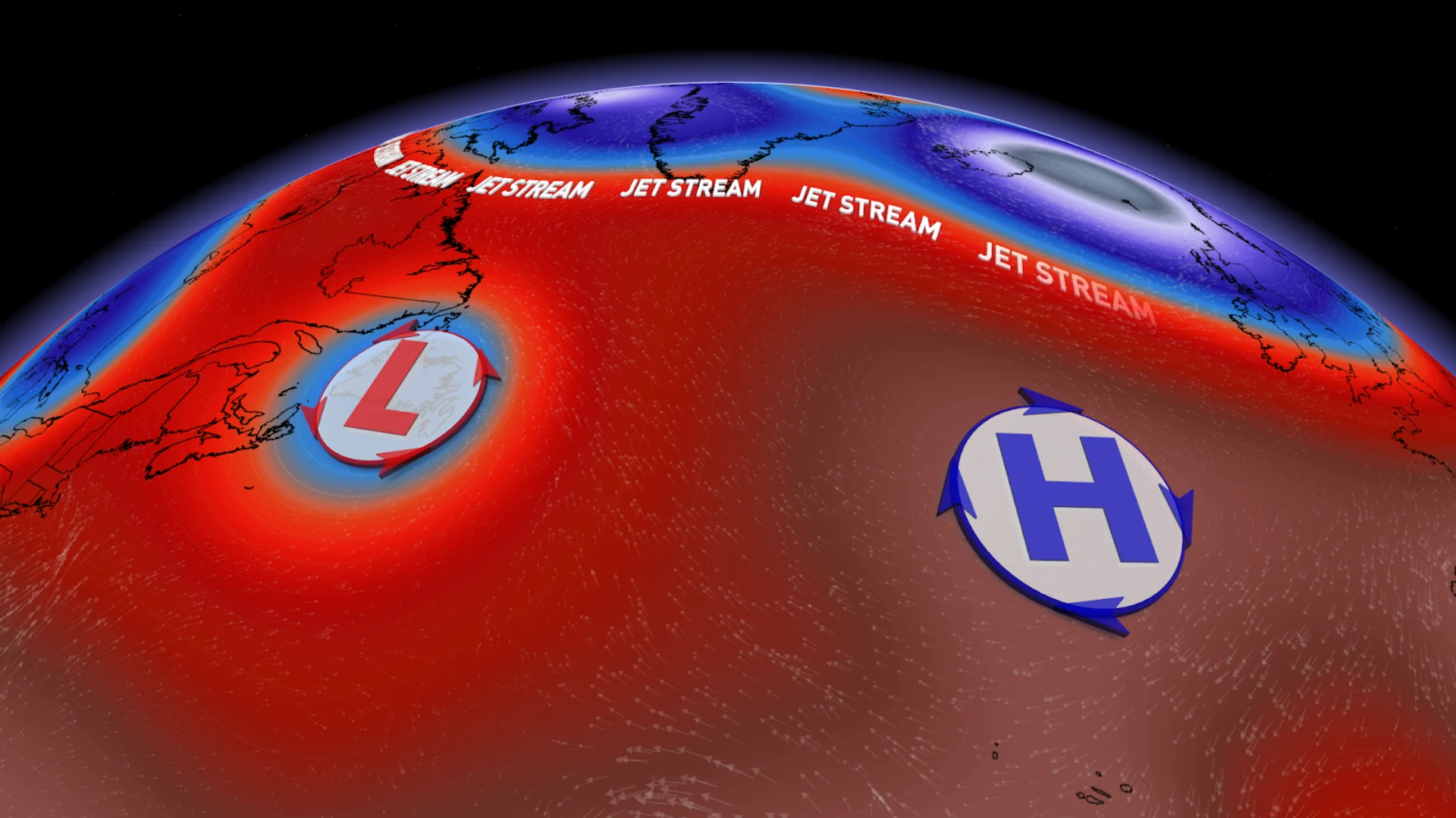
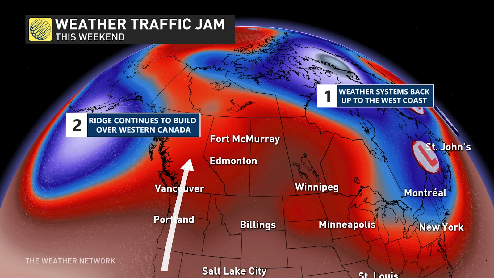
Like an indecisive shopper blocking the busiest aisle in the supermarket, a stalled system over the Atlantic will back up the weather pattern across the rest of Canada.
This atmospheric traffic jam will ‘lock’ our weather in place through the weekend, meaning that you shouldn’t expect any big surprises—what you see right now is what you’ll get until early next week.
DON’T MISS: If Canada's tornado alley is shifting east, how can we better prepare?
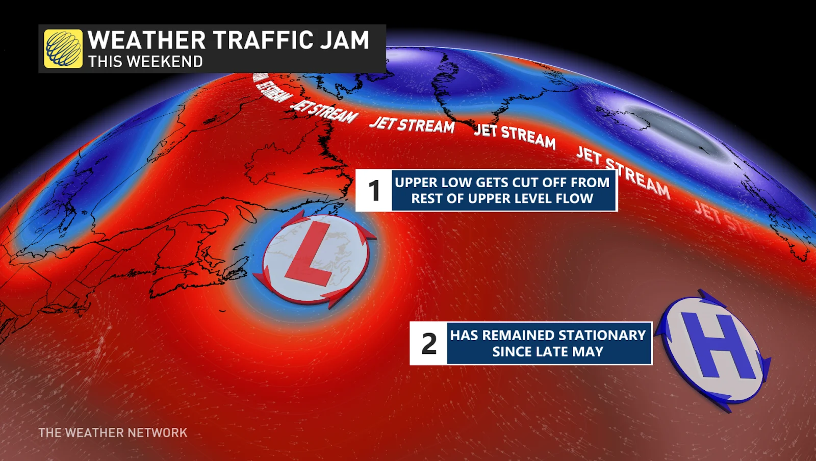
A strong high over the Atlantic Ocean is responsible for the upper-level back-up we’re experiencing across the country this weekend. This high acts sort of like a dam that keeps the pattern from progressing downwind toward Europe.
As a result, troughs and ridges over Canada right now will have trouble moving anywhere in a hurry. Conditions will largely remain the same through the weekend, with folks seeing unsettled weather or warm and sunny conditions for another couple of days.
Atlantic Canada’s gloom continues
Gloomy conditions over portions of Atlantic Canada will keep on rolling into the weekend as we continue dealing with an upper-level low that’s been stuck over the region for more than a week.
How rainy has it been lately? St. John’s has seen 85 percent of its normal precipitation in just the first five days of the month. The airport has picked up 83.5 mm of rain since the start of June, where the average rainfall for the entire month is 97.5 mm.
SEE ALSO: The Atlantic Ocean’s high fever could fuel an ugly hurricane season
That foul weather will stick around for a while yet. Folks across Newfoundland will see clouds and occasional rain persist into the weekend, with some areas possibly seeing a short-lived break of sunshine on Saturday before the next area of low pressure moves in.
Unsettled conditions persist in Ontario, Quebec
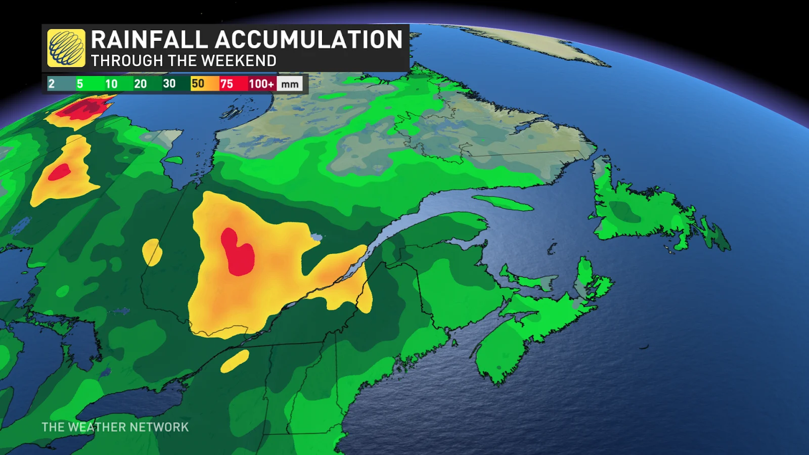
Things aren’t looking much better over Ontario and Quebec as another upper-level low meanders over the region throughout the weekend. Rounds of showers will pinwheel through the region as the centre of low pressure dips over the Great Lakes.
MUST SEE: How a U.S. heat dome could bring severe summer storms to Canada
We had thunderstorms flourish in the warmth and tropical humidity around Ottawa and Montreal on Thursday. The muggy conditions will erode as cooler air filters into the region behind that low.
Plenty of rain is on the way for the region. Rainfall totals of 40-80 mm are on tap through Sunday for portions of southern Ontario and southern Quebec.
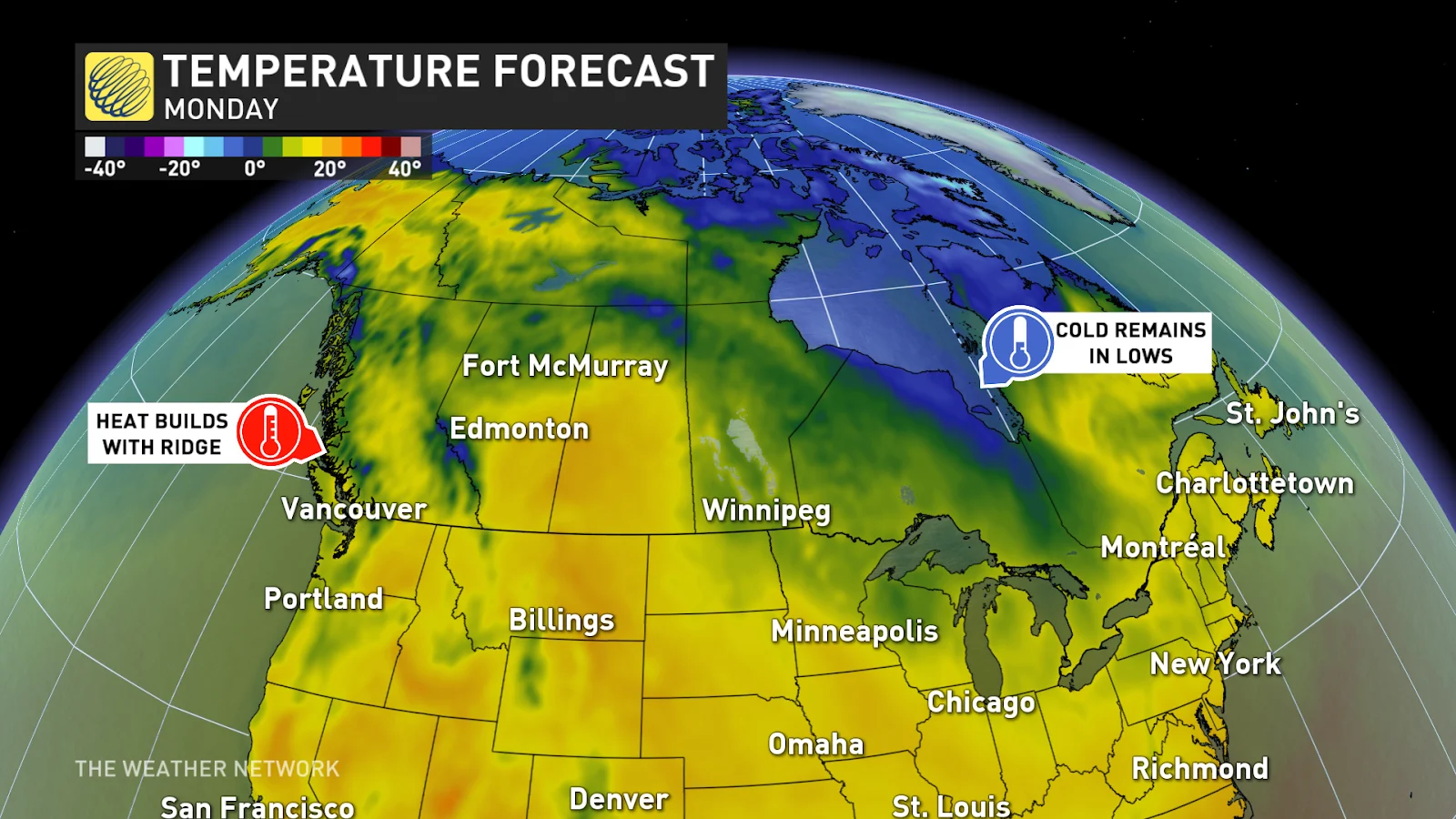
Heat builds across Western Canada
Extremes beget extremes, and the hot ridge of high pressure building over the West Coast certainly offsets the gloomy troughs we’re dealing with back east.
Air sinks beneath ridges, drying out and warming up as it descends toward the ground. This will bring a stretch of calm and relatively hot conditions to southern British Columbia heading into the weekend.
CANADA'S WILDFIRES: Visit The Weather Network's wildfire hub to keep up with the latest on the active start to wildfire season across Canada.
Seasonably warm daytime high temperatures will exceed the 30-degree mark for some communities across B.C. this weekend. The warmth will nudge east into Alberta in time to kick off the new work week.
This ridge will deflect the active storm track far to the north, pushing systems into the Northwest Territories where they’ll dip southeast toward the northern Prairies. Folks on the southern Prairies will stay dry with seasonable temperatures as a result of this pattern.
Stay with The Weather Network for all the latest on your forecast through the weekend.