Mild air surges into Atlantic Canada as windy low set to blow through

Aside from lingering snow in western Newfoundland, Sunday will be rather quiet for Atlantic Canada, with daytime highs set to get a nice boost come Monday. But, the warmth will be accompanied by a potent low that will bring howling wind gusts and wintry precipitation.
Most of Atlantic Canada will get a tranquil conclusion to the weekend, but western Newfoundland will be dealing with lingering snow squalls, which could dump an additional 15 cm locally by the time they wind down. On the doorstep for Monday is the region's next system, a Montana low that is trekking through Central Canada. It will bring similar impacts, though not nearly as much snow. Still, the region can expect to see heavy rain, freezing rain and ice pellets, depending on locale, through Tuesday. The biggest impact will be the intense southerly winds, strong enough to send temperatures into the teens for parts of the region. Beyond, daytime highs will cool off by mid-week, preceding the next weather-maker for Thursday. More on Sunday's snow in Newfoundland, and timing and impacts with Monday's storm, below.
Visit our Complete Guide to Winter 2022 for an in-depth look at the Winter Forecast, tips to plan for it, and much more!
MONDAY/TUESDAY: WINDS RAMP UP, WINTRY PRECIPITATION, BRIEF SURGE OF WARMTH PUSHES IN
Sunday will be pleasant for most of Atlantic Canada. However, snow squalls will continue for much of western Newfoundland, bringing up to 15 cm locally within the bands. Snow squall warnings are in place. They will diminish come Monday morning, just as the next weather-maker moves into the Maritimes.

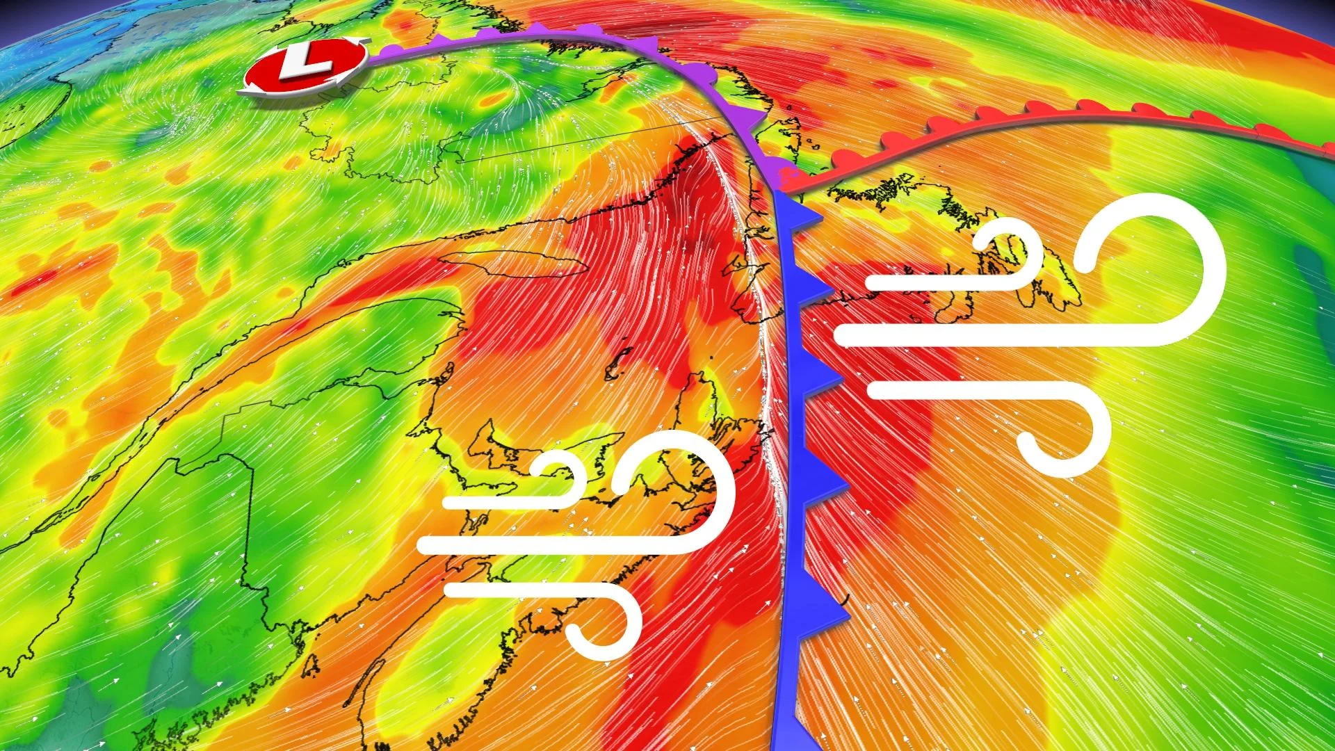
The system originating pushing through the Great Lakes and Quebec will spread light snow across the Maritimes early Monday morning.
Meanwhile, a band of freezing rain and ice pellets will push along the leading edge of a warm front stretching across central New Brunswick, Gaspé Peninsula, and up towards central and northern Newfoundland throughout the day.
Rainfall will then initiate and become more widespread across the southern Maritimes by Monday afternoon. It will intensify for Newfoundland in the overnight hours, leading into Tuesday morning.
Rainfall amounts will be heaviest along southern Nova Scotia shores and western Newfoundland coast. Amounts could hit 50 mm in the former and 50-75 mm in the latter through Tuesday.
The main story, however, will be the strong southerly winds through the day, with gusts of 60-80 km/h. The southerly flow will pump in milder air, with the potential to reach the low teens late Monday evening across southern Maritimes and in Newfoundland on Tuesday.

However, the warmth will be fleeting. Conditions will turn colder as the storm departs the region mid-week.
LOOK AHEAD: COLORADO LOW ON DECK
Beyond, a Colorado low is expected to impact parts of the region late Wednesday through Thursday.
The storm track is still uncertain, but this has the potential to bring a swath of heavy snow across southern parts of the region -- possibly including Halifax and around the Bay of Fundy. It is still early, but this could be the first significant winter storm of the season for many of the larger population centres.
Be sure to check back for updates on the storm parade across Atlantic Canada.