Move aside, spring sunshine: April showers move into southern Ontario
We hope you enjoyed a beautiful weekend of sunshine and warm temperatures, southern Ontario, because that very weather pattern has set the stage for a risk of thunderstorms on Tuesday.
While it appears a lot of folks got their wish for at least fair skies for Monday's solar eclipse, the amicable weather won't be sticking around for long. A rainy pattern is setting up for the rest of the week, making April live up to its showery, changeable reputation.
A ridge of high pressure parked itself over southern Ontario over the weekend, shifting slightly north to also bring clear skies to Quebec and New Brunswick on Monday for the eclipse. Folks across the region were treated to a beautiful weekend of sunny skies and warm temperatures—perfect weather for spending time outdoors.
DON'T MISS: IN PHOTOS: Millions gather around the world to witness the total solar eclipse
Unfortunately, it's the sunshine and warm temperatures that have caused some atmospheric instability and may give way to thunderstorms in southern Ontario on Tuesday.
Risk for some thunder on Tuesday
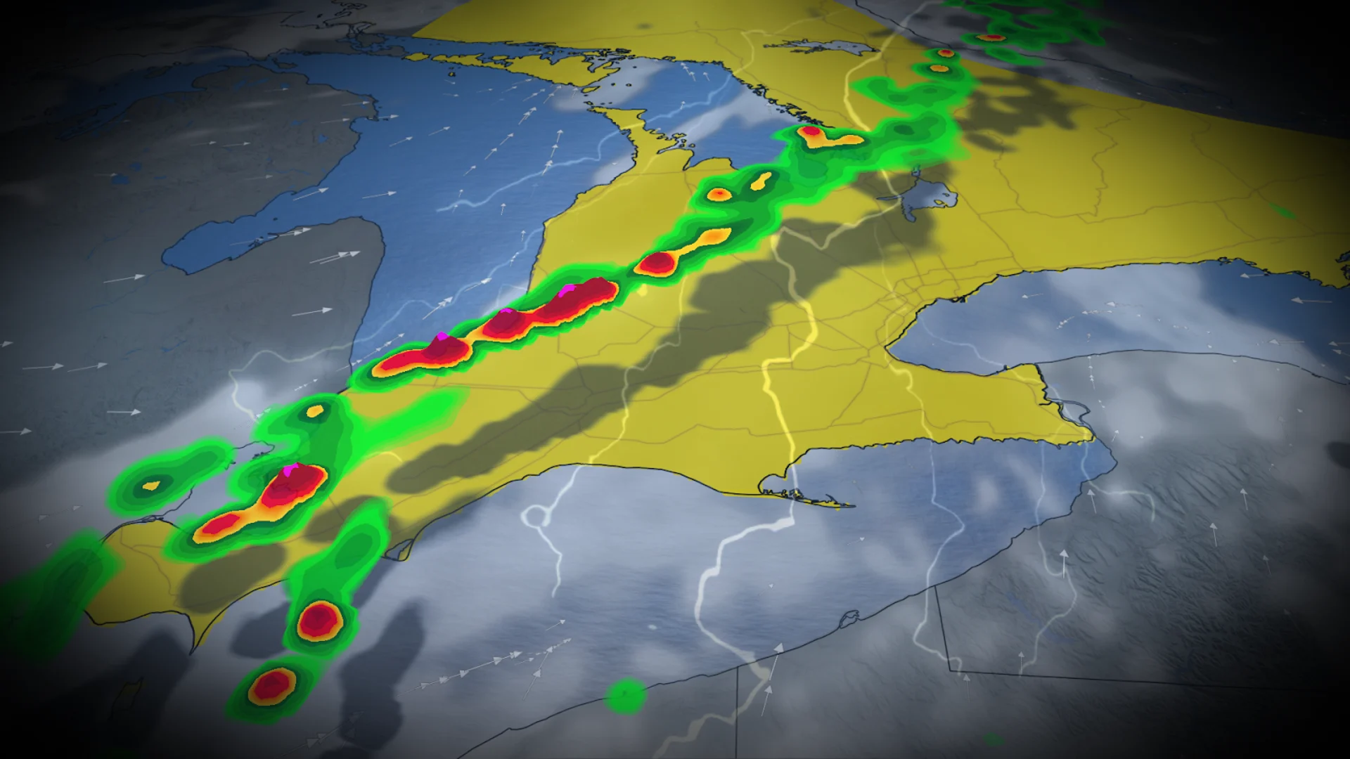
A cold front will sweep into southern Ontario on Tuesday, triggering rain and increasing the risk of isolated thunderstorms. Blustery winds will precede the oncoming system, and there is even a risk for some folks to see small hail from these storms.

This system will first reach Windsor and the rest of southwestern Ontario on Tuesday afternoon before heading northeast to London later on and into the early evening, possibly interrupting the evening commute. Hamilton and the Greater Toronto Area (GTA) won't be seeing any rainfall until after the dinner hour.
Some areas could see heavy rainfall or downpours, increasing the risk for localized power outages before the system moves out of the province Tuesday night.

Soggy end to the work week
Unfortunately, the rainy setup doesn't stop on Tuesday. A Texas low is brewing in the south and will make its way up to southern Ontario by Thursday morning, bringing soaking rains to the province through Friday.
SEE ALSO: Smoky summer is expected in parts of Canada as wildfire season begins

This low-pressure system will slurp up a stream of moisture from the Gulf of Mexico, resulting in this prolonged period of rain.
While embedded thunderstorms may be a possibility with this system, the greatest risk will be localized flooding caused by the consistent, and sometimes heavy, rain.

Stay with The Weather Network for more forecast information and updates as we continue to monitor your weather in southern Ontario.