Ontario's blast of late-summer-like heat comes with wet, unsettled conditions
Ontarians will be treated to a blast of late-summer-like warmth for much of this week, but Thursday's Halloween forecast may require some extra attention, with rain chances looming across the region
This last full week of October will feature exceptional warmth across much of Ontario, with an unusual bout of late-summer-like temperatures splashing through the region. By midweek, nighttime lows will actually be as warm as what you'd feel throughout July!
An upper ridge centred over the southeastern U.S. will send the warmth surging as far north as the shores of James Bay and western Quebec in time for Halloween on Thursday.
RELATED: July-like warmth surges toward Ontario to end October
With the temperature treat, however, comes a bit of a trick, as two rounds of wet and potentially stormy weather take aim at parts of the region. Last minute costume plans may require a bit of water proofing, with rain showers likely through Thursday afternoon and evening.
The warmth won't last long, either, with a big change on the way to start out the month of November.
Strong, southerly winds push daytime highs into the low 20s
The week starts out with a big, upper-level trough over western portions of the U.S. and Canada, while a significant ridge of high pressure moves east over the Great Lakes. The ridge will keep conditions unseasonably warm across southern Ontario through the beginning of the week.
The ridge of high pressure over the eastern United States will combine forces with a Colorado low to push southerly winds over southern Ontario, helping to enhance the remarkably warm temperatures. Daytime highs will near or exceed the 20-degree mark from Tuesday through Thursday.

The surge of warmth also comes at the cost of some unsettled weather, however, with two episodes of rain pushing through midweek.
Rain showers will spread across southern Ontario on Tuesday, picking up across the Greater Toronto Area (GTA) from mid-morning through to the early afternoon. Parts of northern Ontario could also see embedded thunderstorms along the cold front on Tuesday afternoon, with that same risk stretching into Wednesday, as well. A general 10-15 mm of rain is forecast, with 20-30 mm falling across the north.

Temperatures will soar into the 20s on Thursday, challenging records set on Oct. 31. In Toronto, a high of 22°C is forecast, with the record high for that day currently sitting at 22.8°C from 1971.
Poorly timed rain showers
The second round of rain will be poorly timed for Halloween on Thursday.
While Halloween will be warm and windy, with gusts between 40-70 km/h, trick-or-treaters may need a rain-proof costume, as showers are likely Thursday late afternoon to early evening.

There is still some uncertainty with the timing of Thursday's rain, so you'll want to be sure to continue to check back for updates.
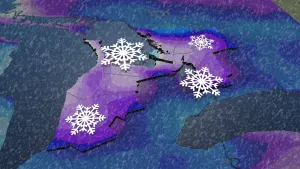
Meanwhile, a swath of snow threatens areas across northeastern Ontario. Highway 101, from Wawa to Timmins, looks to be the dividing line for precipitation types, with rain to the south and snow to the north.

By Friday, it's back to reality for everyone, with much more seasonal temperatures moving in behind the front. Daytime highs will remain in the single-digits to round out the week.
DON'T MISS: What does a ‘missing’ La Niña mean for Canada’s winter?
Changeable temperatures are expected during early November, though should tip to the warm side of seasonal. A colder pattern change is likely as we get deeper into November.


