Severe thunderstorms likely to hit parts of Ontario and Quebec Thursday
Along with the humidity, comes the possibility for severe thunderstorms. Ontario has the potential to see the most severe weather of the season so far on Thursday
Muggy air will return to the province with the warm temperatures, and while folks may get a chance to soak up some sun, it won't last all week.
With building heat and high humidity comes instability in the atmosphere. A cold-front moving through the province will trigger a risk for thunderstorms, with the chance for some to become severe.
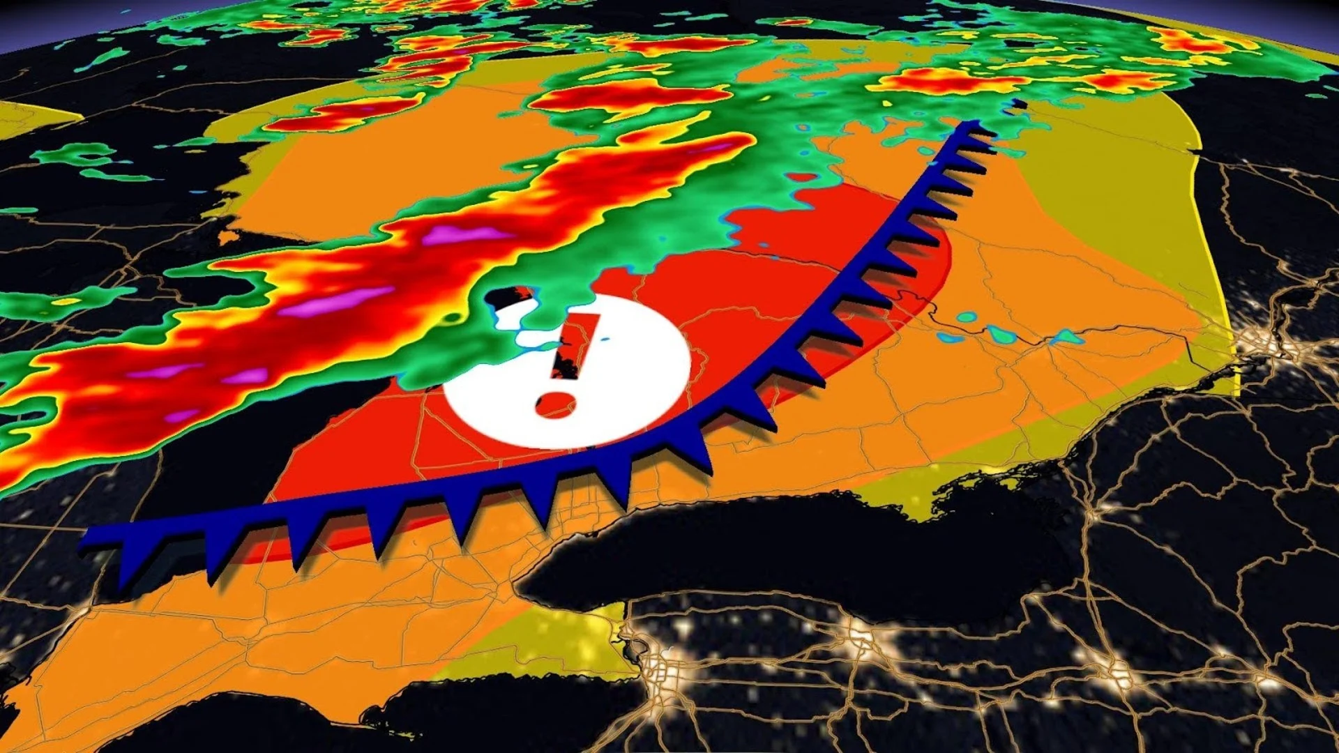
Thursday has the potential to be the most severe day of the season so far for southern Ontario and western Quebec, so it will be important to stay on top of the weather watches and warnings in your area, as conditions can change quickly when severe weather hits.

DON'T MISS: What really happens inside you when you're hit by lightning
Thursday: Severe weather to bubble up across the province
A strong cold-front pushing eastward through the lower Great Lakes region this week will clash with the warm, humid air, triggering widespread rain and embedded thunderstorms in its path.
While northern Ontario could see some showers and thunderstorms on Wednesday and Thursday as this system tracks by, the real risk comes to southern and eastern Ontario later Thursday.
SEE ALSO: The Great Lakes may have a thunderous effect on your summer weather

Temperatures in the mid- to high-20s will feel like the mid-30s with the humidity on Thursday across southern and eastern Ontario. Folks in Toronto will be seeing an already scorching 27°C, but the humidex will make it feel like a stifling 33. This will create enough energy in the atmosphere for strong storms to develop upon the cold-front's arrival later in the day.
The hot and humid air mass settling over the region will bring copious amounts of thunderstorm energy for storms to develop from.
Torrential rain, strong wind gusts, large hail, and even a tornado or two are strong possibilities for Thursday. BE sure to be weather aware on Thursday as damage is possible given the severity of this upcoming system.
The dreary, stormy weather will stick around through the overnight Thursday, giving Friday a less-than-ideal start.

Stay with The Weather Network for more forecast information and updates on your weather across Ontario.