U.S tornado outbreak anticipated following major damage Friday
After a destructive tornado outbreak was reported across parts of the U.S. Friday, a similar threat continues Saturday with more damaging, severe weather, including additional strong twisters.
The expansive threat for severe weather south of the border isn't over, yet, as more storms and tornadoes could come to fruition on Saturday.
On Friday, scores of tornado warnings were issued as powerful storms bubbled from Texas to Nebraska amid a multi-day, severe weather outbreak that unfolded over the centre of the country.
RELATED: PHOTOS: Highway camera captures stunning tornado on the horizon
Dramatic scenes played out in Nebraska as multiple supercell thunderstorms produced large and damaging tornadoes.
A long-track, tornadic storm grazed the state capital of Lincoln before slicing through communities just west of Omaha, a city of nearly half a million residents.
There were multiple injuries reported, but no fatalities at the time of the publication of this article.
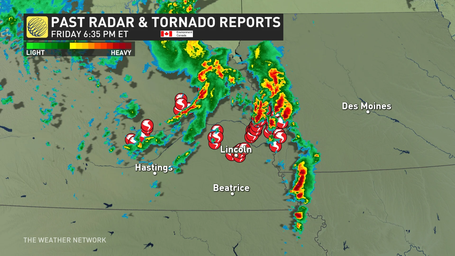
According to Rachel Modestino, a meteorologist at The Weather Network, 100 tornado reports were submitted to the National Weather Services' Storm Prediction Center (NWSSPC), including activity in Missouri and Texas.
"A tornado outbreak took place across Nebraska and Iowa. Very large and significant tornadoes we're captured, causing devastating damage in communities like Lincoln, Elkhorn, Council Bluffs, and Minden," said Modestino. "Communities were levelled into lumber. Tornado assessments will be underway in the coming days, but cleanup will likely take weeks."
Saturday: New day, fresh threat of severe storms and tornadoes
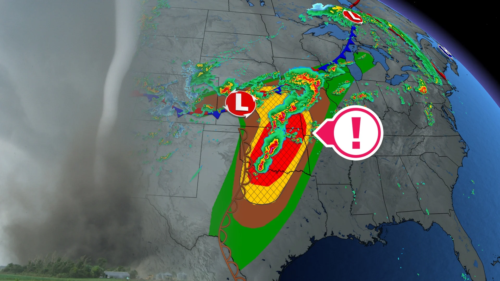
Another dangerous day is ahead across the U.S. southern Plains, including populated areas like Wichita Falls, Kan., Oklahoma City, Okla., and Kansas City, Mo.
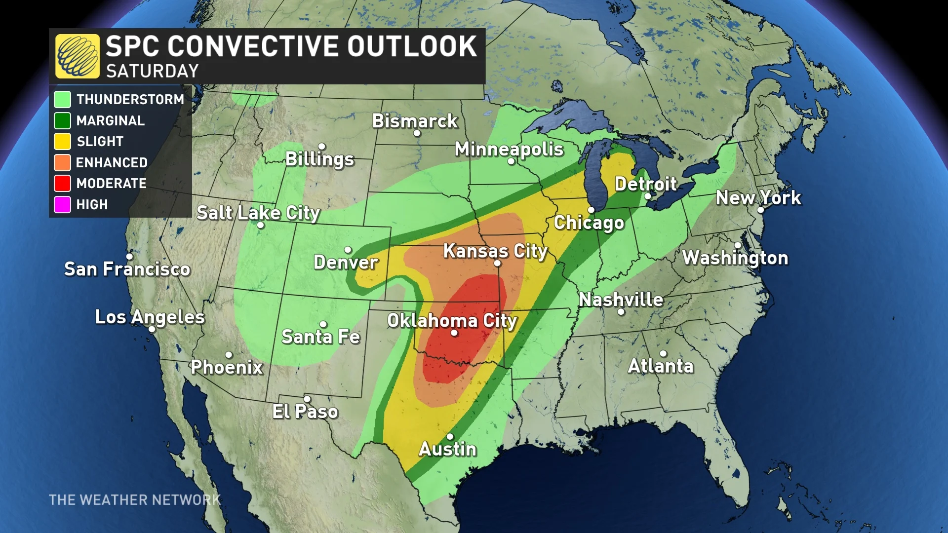
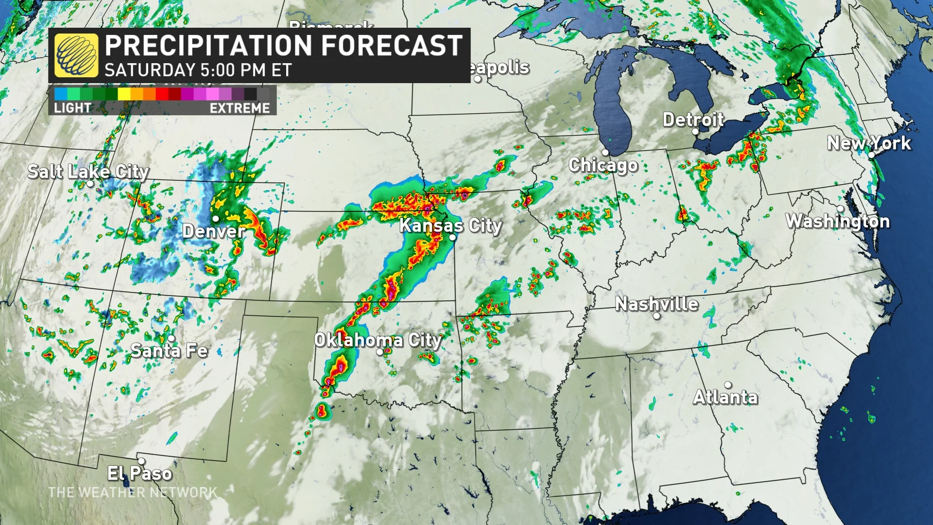
The dynamic system of yesterday will still be in place in the U.S. on Saturday, with another tornado outbreak forecast. The low-pressure system, paired with moisture and a dry line that is mostly positioned in Texas and Oklahoma, will trigger severe storms and supercells.
There will also be significant tornado potential Saturday afternoon and evening across the southern and central Plains, stretching into the lower to mid-Missouri Valley, according to the NWSSPC.
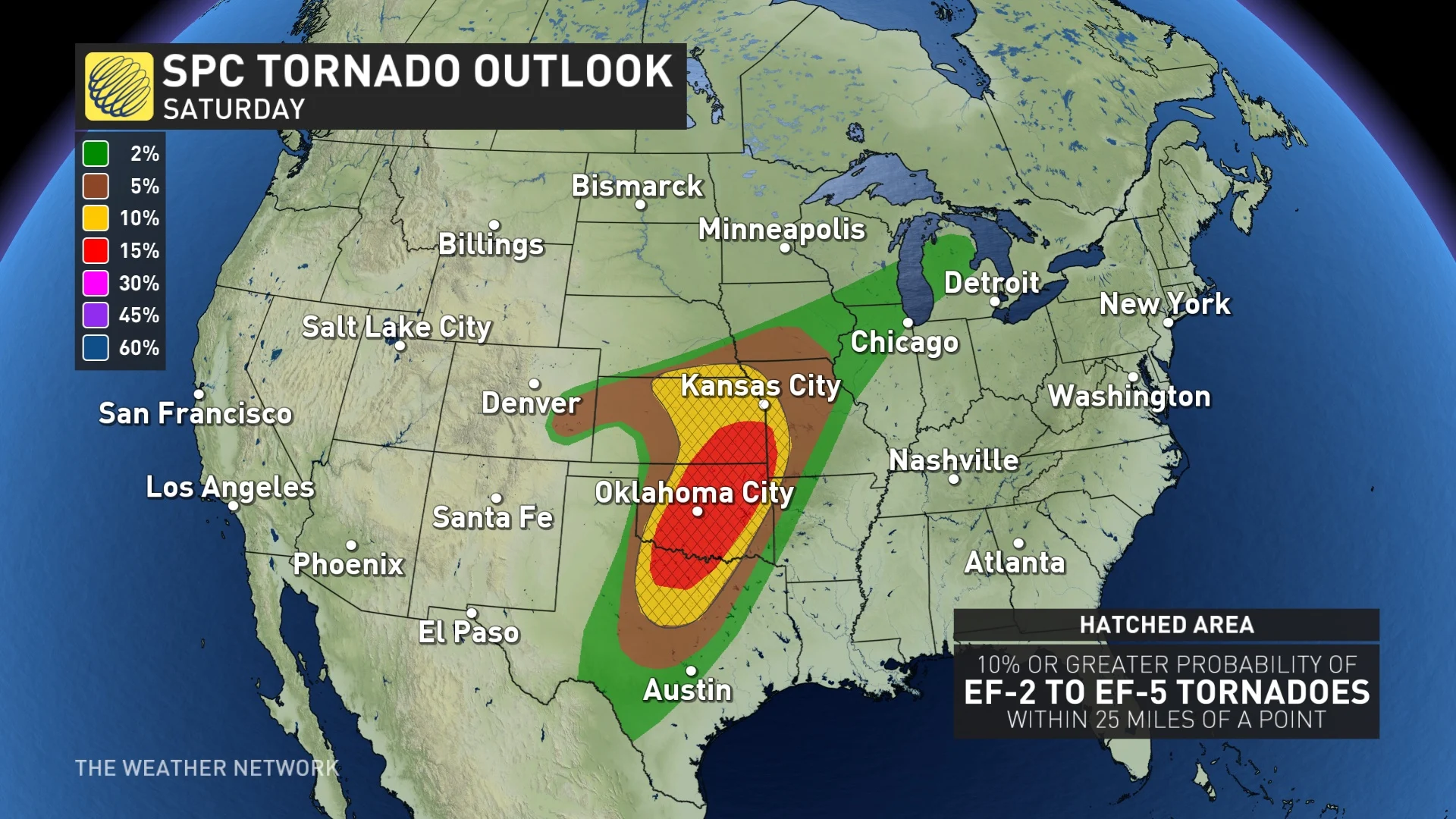
The most numerous/intense storms are expected from north Texas into Oklahoma, as well as southeastern Kansas, where strong tornadoes, very large hail of 2-3 inches (5 cm to 7.6 cm) in diameter and damaging winds of 90-100+ km/h are all possible.
DON'T MISS: Don’t fall victim to these seven dangerous tornado myths
Several strong tornadoes will be likely, with a few long-track EF-2 and EF-3 twisters possible.
"The significant tornado threat will be greatest if semi-discrete supercells can be maintained well into the afternoon/evening," the NWSSPC said in the Day 1 outlook.
The risk for thunderstorms with large hail will even extend up towards the Great Lakes, too, with parts of southern Ontario facing a severe weather chance Saturday evening.
Thumbnail contains file photo of a tornado that isn't associated with Friday's storms in the U.S.
With files from Rachel Modestino, a meteorologist at The Weather Network, and Dennis Mersereau and Nathan Howes, digital reporters at The Weather Network.


