Active weekend ahead as a strong, straight jet stream aims for Canada
Most of our big weather systems form when the jet stream twists and turns over Canada. But a straight jet stream can bring its own set of challenges
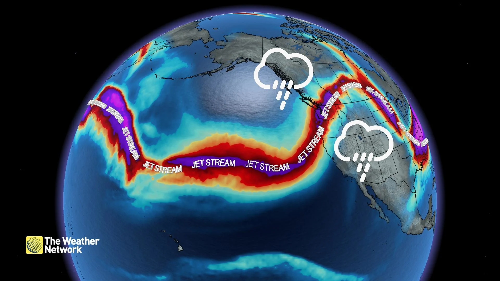
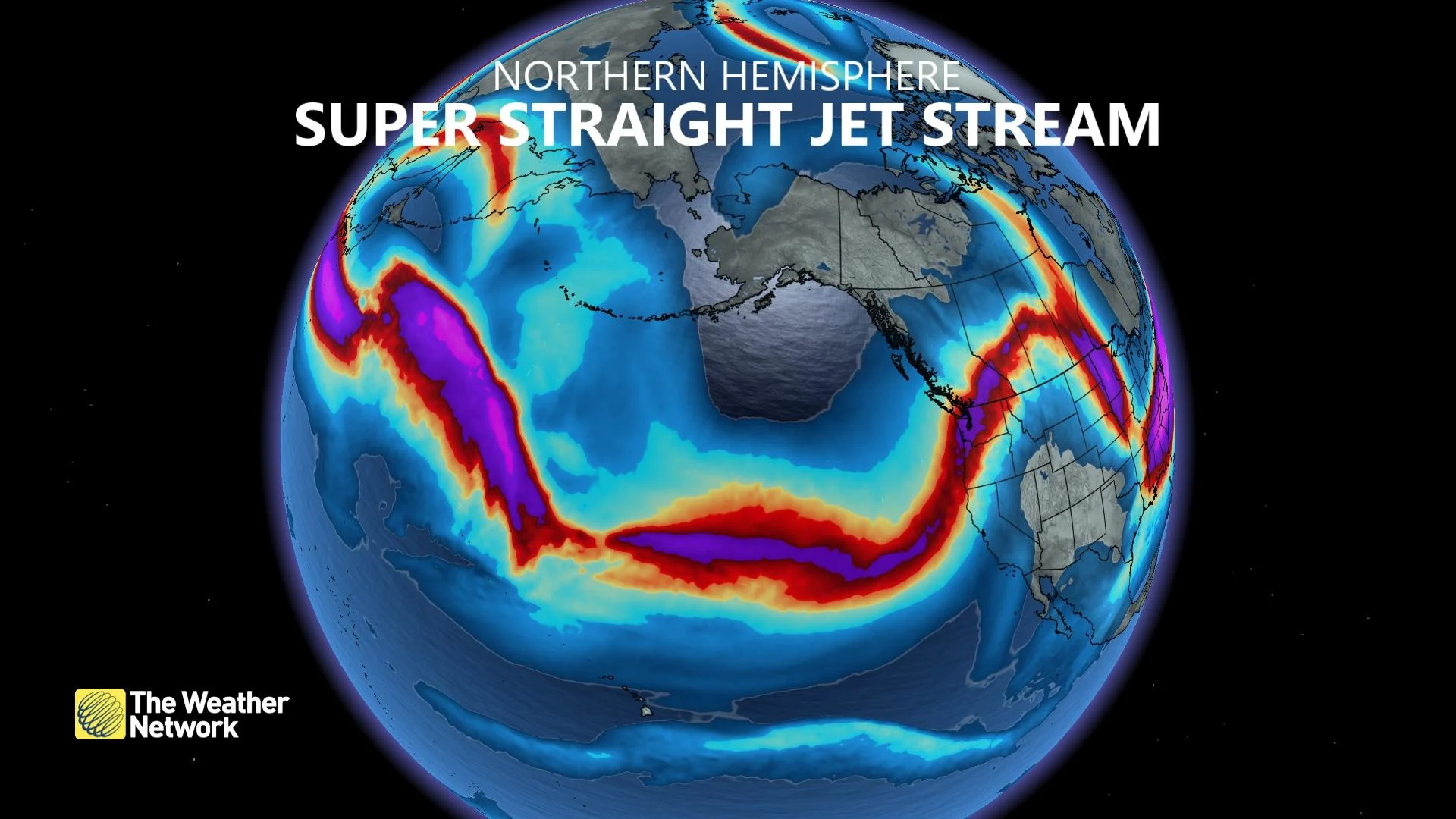
Wiggly, twisty jet streams are the driving force behind some of the largest storms we experience across Canada. But every once and a while, this swift current of winds roaring high above our heads stops squirming around and soars across the Pacific in a straight line.
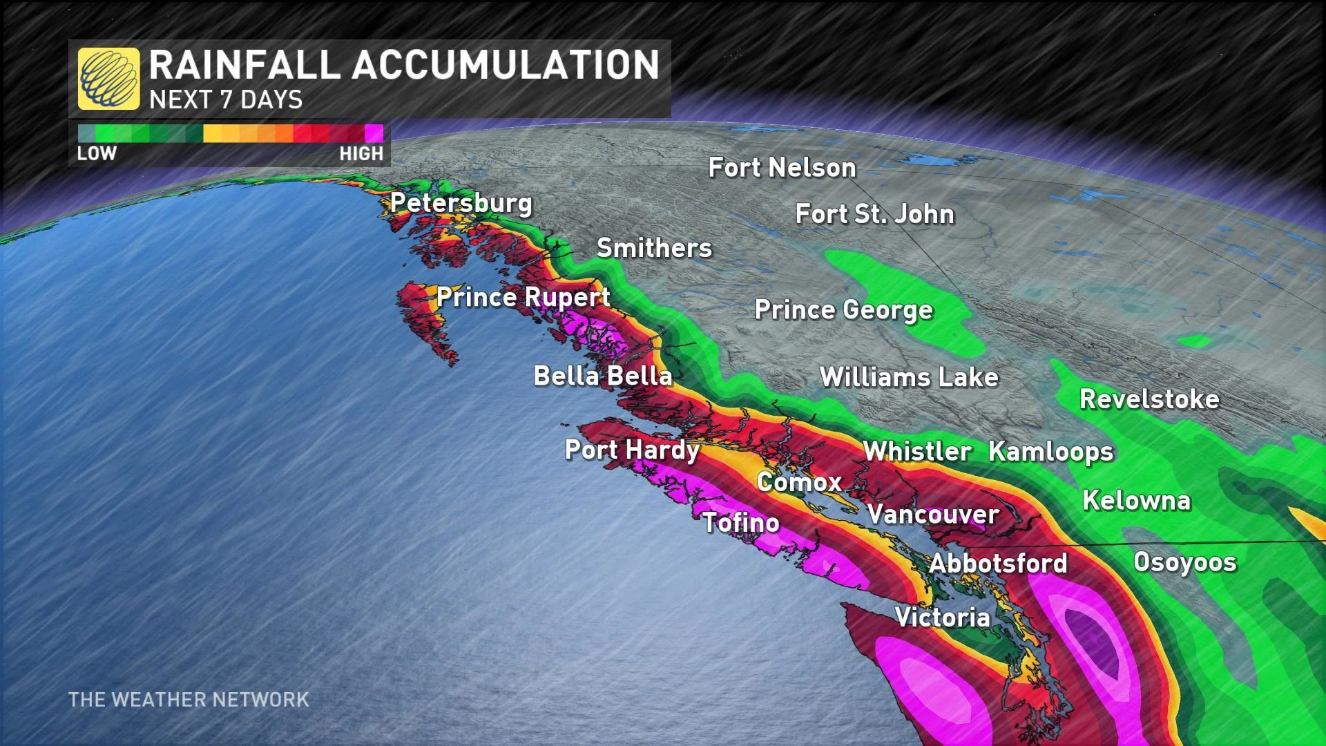
Canada’s West Coast is feeling the influence of a super-straight jet stream blowing over the northern Pacific Ocean this weekend, and it’s partially responsible for the rough weather that’ll wash over British Columbia through early next week.
DON'T MISS: Canada's Winter Forecast: El Niño a critical factor for the season ahead

The jet stream is a critical factor in the conditions we experience here at the surface. Winds in the jet stream frequently roar along at more than 200 km/h. These winds twist and turn as troughs dig toward the south and ridges climb high into northern latitudes.
If you’ve ever put your hand near an open window while you’re soaring down the highway, you’ve felt the powerful rush of wind outside the car pulling on the relatively calm air inside the car.
Air flowing into and out of the jet stream can have a similar effect on a much larger scale. Winds sucking into the jet stream, and winds fanning out away from the jet stream, also push and pull on the surrounding atmosphere. This process leaves less air—and centres of low pressure—near the ground.

That brings us to the super-straight jet stream over the northern Pacific Ocean this weekend.
Westerly winds screaming across the ocean eventually reach the end of this jet stream, fanning out over Canada’s West Coast to fuel a series of low-pressure systems swinging through the region.

MUST SEE: Jet streams can bring Canada wild winters and steamy summers
A round of widespread precipitation will accompany each of these systems into the coast, bringing heavy rains to lower elevations and bountiful alpine snows to the mountain peaks across the South Coast.
But that’s not all. This jet stream is also facilitating an atmospheric river that’ll funnel tropical moisture straight from Hawaii to B.C. Sometimes called a Pineapple express given its origins, this atmospheric river will provide the boost needed for ample rains to wash over B.C. through early next week.

Our smooth jet stream won’t stay like that forever, of course. The atmosphere is a dynamic fluid that’s always sloshing around above our heads. The jet stream will eventually break down and begin sending a series of ridges and troughs over the Rockies again.
One of these ridges will push onto the western Prairies heading into the first full week of December, bringing above-seasonal temperatures to much of the region. Parts of Alberta could see daytime highs coming in 10-15 degrees above seasonal as a result of this impending pattern.
