Hurricane Rafael triggers flood emergencies 800 km away
Some areas saw more than 300 mm of rain in less than 24 hours
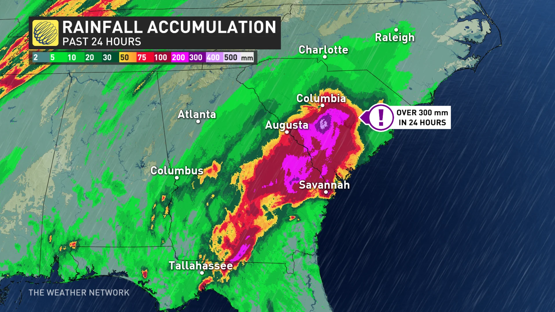
Extensive flash flood warnings were issued in parts of Georgia and South Carolina on Wednesday and Thursday as torrential downpours drenched the region. These flooding rains were fuelled by moisture from Hurricane Rafael, which was more than 800 km away from the region at the time.
How did a hurricane produce flooding so far away? This frightening scenario is one we’ve seen play out several times this hurricane season.
DON'T MISS: Autumn can still produce intense hurricanes across the Atlantic
Rafael slammed into Cuba on Wednesday as a major Category 3 hurricane with maximum winds of 185 km/h. The storm brought damage and immense power outages to the island nation, which is still grappling with the fallout from a major power crisis and another hurricane that hit just a few weeks ago.

Not long after Rafael hit Cuba, tropical downpours bubbled up over the southeastern United States. Rain gauges filled up in a hurry. Parts of central South Carolina recorded more than 300 mm of rain in less than 24 hours between Wednesday and Thursday.
Forecasters issued a rare flash flood emergency for the town of Valdosta in southern Georgia late Wednesday night.
“This is an extremely dangerous and life-threatening situation,” the warning read. “Do not attempt to travel unless you are fleeing an area subject to flooding or under an evacuation order.”
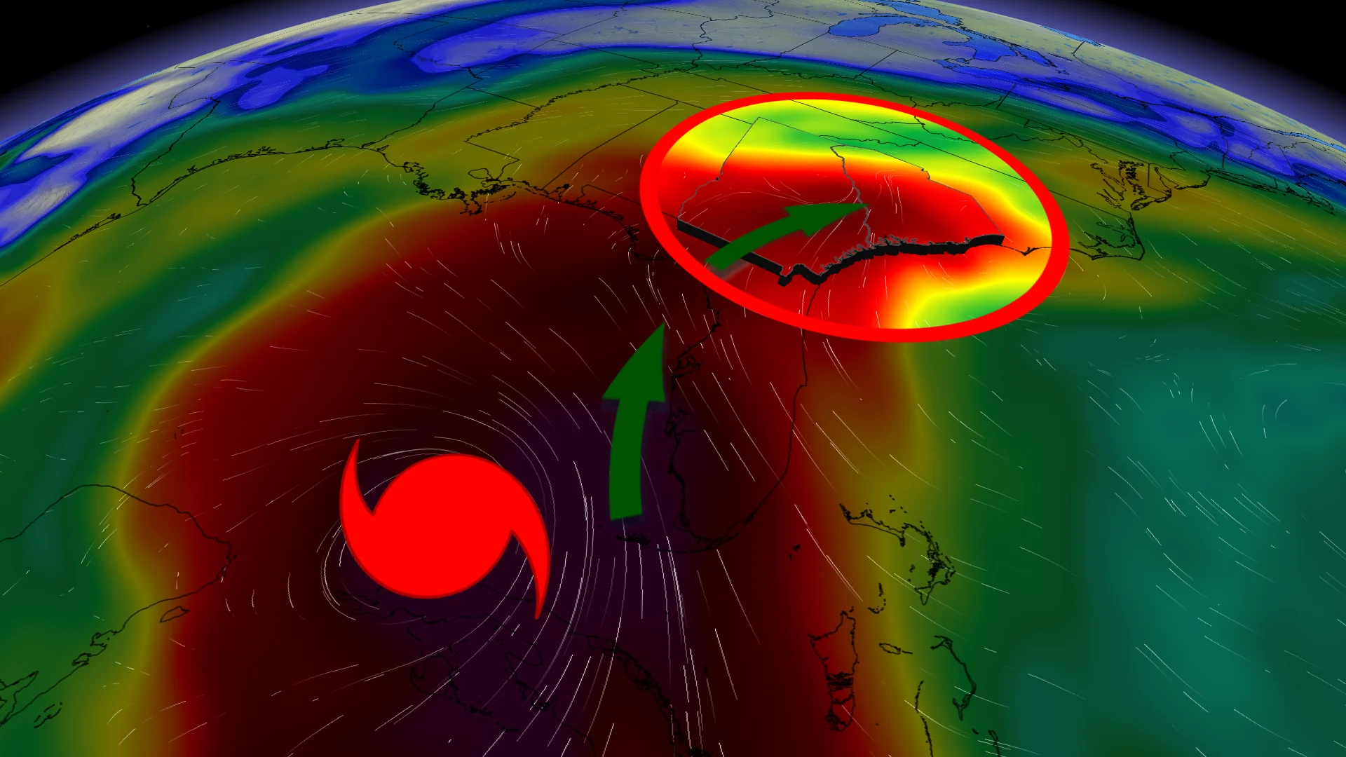
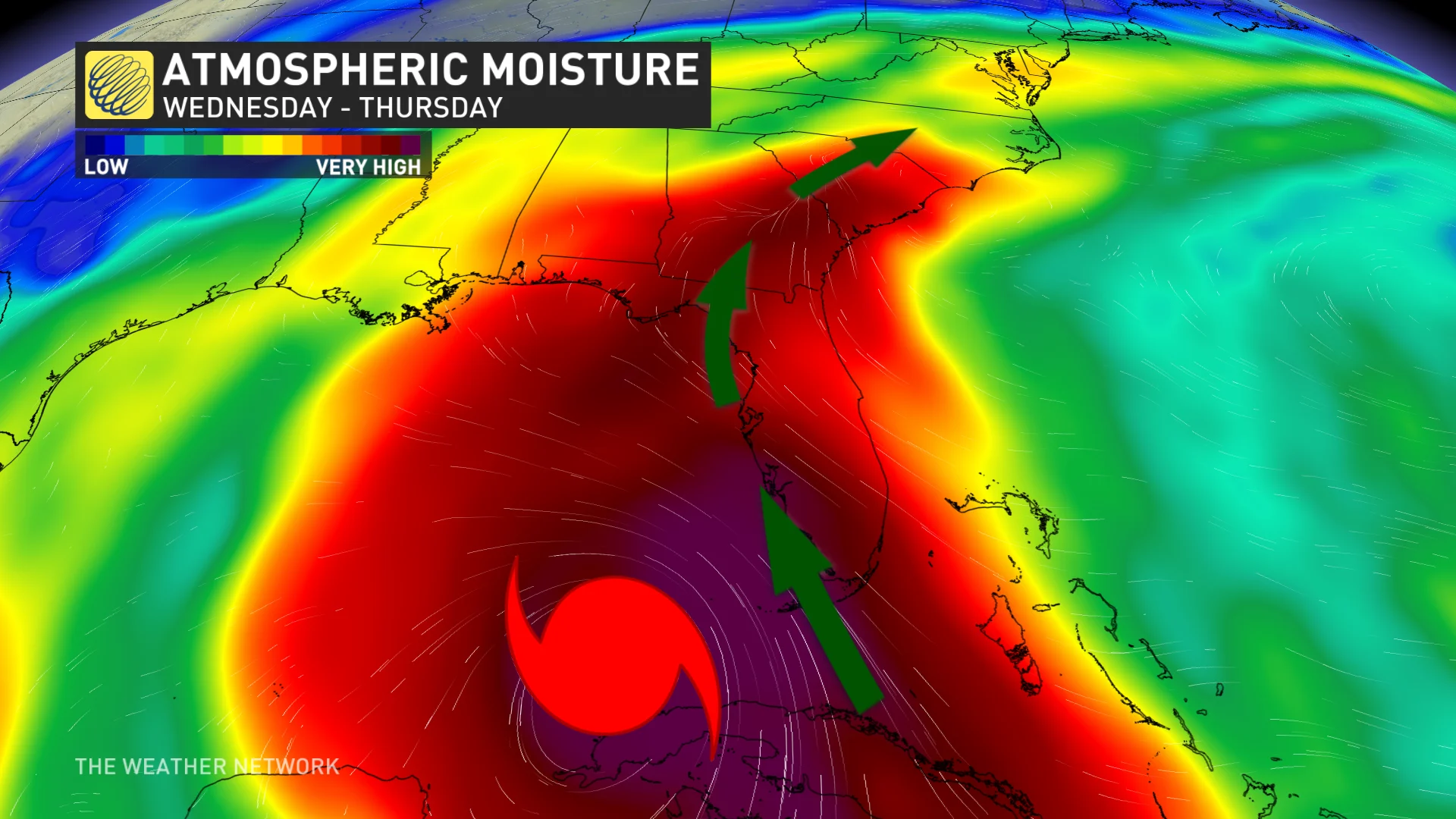
Hurricane Rafael was partially responsible for the deluge that unfolded across the southeastern U.S. this week. A ridge of high pressure over the southwestern Atlantic Ocean pushed the hurricane into the southern Gulf of Mexico after it moved away from Cuba.

RELATED: How Hurricane Helene produced 700+ mm of rain in three days
Even though the storm is expected to remain safely offshore and away from the U.S. Gulf Coast, that same ridge helped funnel excessive amounts of tropical moisture north over the southeastern states. Converging winds created lift that helped wring out all that tropical moisture over portions of Georgia and South Carolina.

Heavy batches of rain sometimes develop ahead of an approaching hurricane. The tragic flooding that gripped western North Carolina during Hurricane Helene was largely fuelled by a phenomenon known as a predecessor rain event (PRE).
While this latest event wasn’t a classic PRE like we saw during Hurricane Helene, the effects weren’t any less disastrous.
In addition to many flooded and washed-out roads throughout the region, several rivers will continue to rise through the end of the week as water runs off. The North Fork Edisto River in Orangeburg, South Carolina, came within 0.3 metres of seeing its all-time highest crest on Thursday.
