More than 2,000 told to evacuate from B.C.'s Tumbler Ridge due to wildfire
Visit The Weather Network's wildfire hub to keep up with the latest on the active start to wildfire season across Canada.
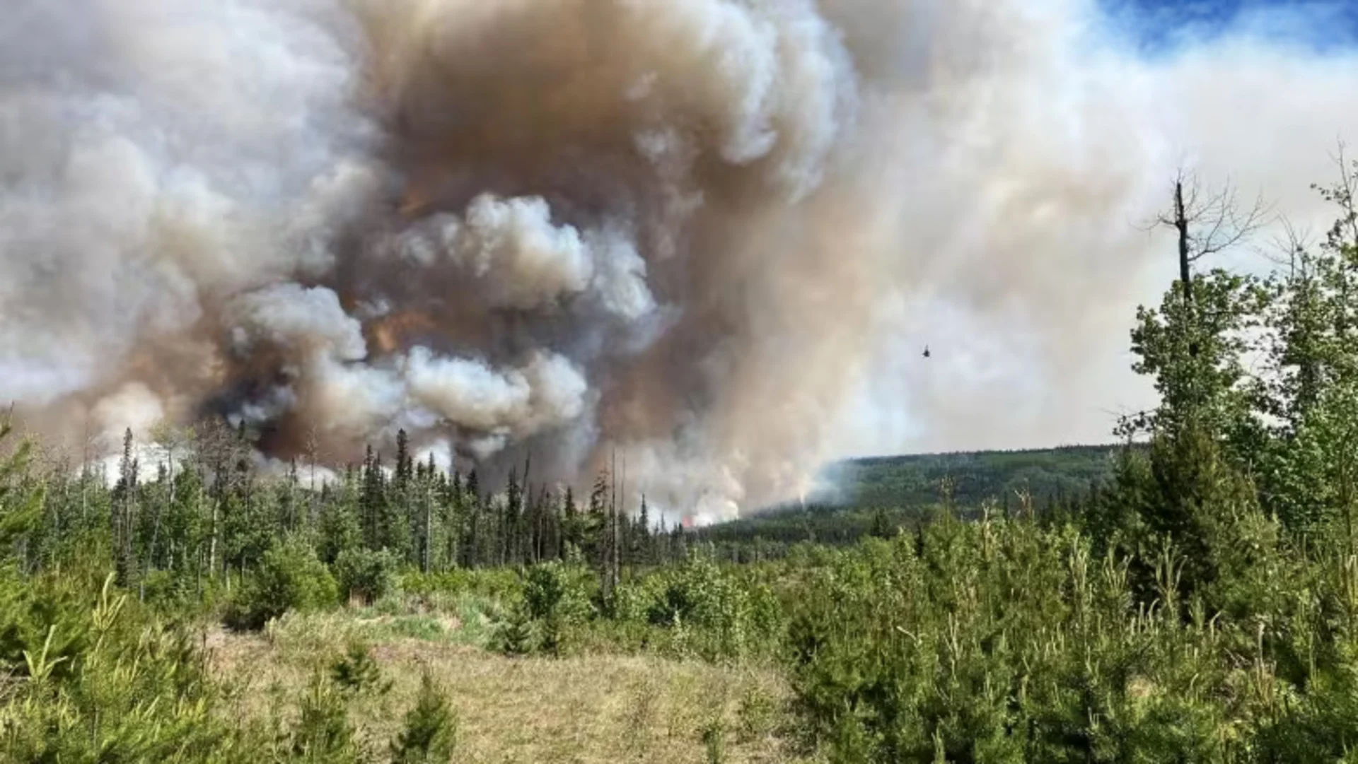
Residents of Tumbler Ridge in B.C. have been ordered to evacuate due to the risk of a nearby uncontrolled wildfire, with a Thursday a notice saying the West Kiskatinaw River wildfire to the east is now a threat to human life.
The order covers the District of Tumbler Ridge, home to roughly 2,400 people in northeast B.C., as well as properties to the east, including homes at Bearhole Lake. The wildfire is an estimated 96 square kilometres in size.
According to the district, Highway 52 East has now been shut down in both directions because the fire is close by.
The Peace River Regional District (PRRD), which includes Tumbler Ridge, is asking those on evacuation order to register at reception centres or online to receive accommodation and other essentials like grocery vouchers.
SEE ALSO: Smoky skies bulletins issued, warning of poor air quality across B.C.
"I'm asking people that they follow the order and leave our community," said Tumbler Ridge Mayor Darryl Krakowka, adding he has seen many residents filling up their tank and leaving town Thursday afternoon.
In a Facebook post, the District of Tumbler Ridge said anyone who needed assistance evacuating should call 911: "The local emergency response team will be able to assist you."
Hotels fully booked
As of 8 p.m. Thursday, hotels were fully booked in both Dawson Creek and Chetwynd, according to the PRRD, although some camping spots were still available in those areas.
Those looking for hotel accommodation are now asked to head to Fort St. John, where they can register at the Pomeroy Sport Centre.
Paul Landrecht says he and his partner left Tumbler Ridge and arrived at the emergency reception centre in Dawson Creek just before 5 p.m.
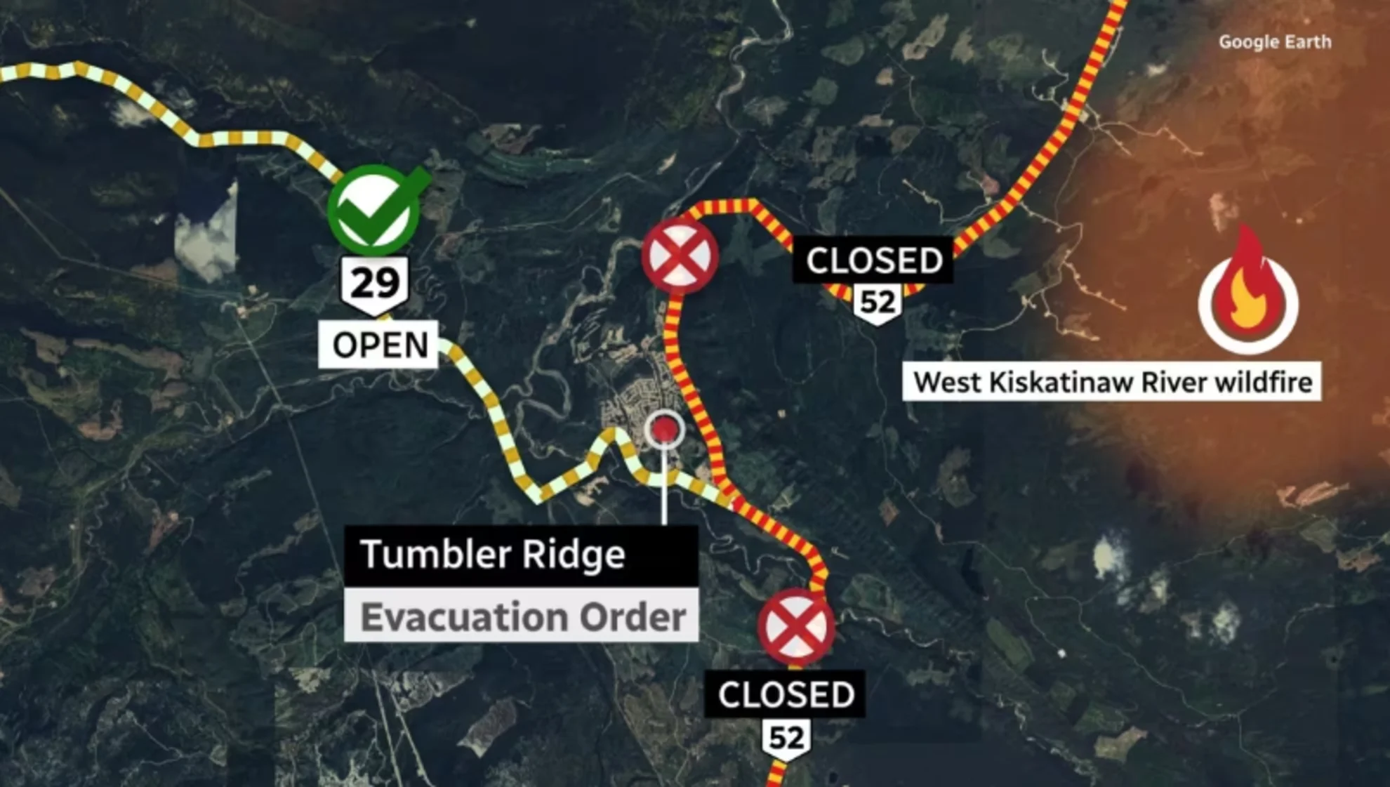
A map shows evacuees to use Highway 29 as the route out of Tumbler Ridge, B.C. Highway 52 and Boundary Road are closed. (CBC News)
But after waiting for three hours, they were told all the reserved hotel rooms were full, and they would have to travel about 75 kilometres north to Fort St. John.
"Everybody's stressed and my animals are all stressed, everybody was not expecting to grab their cats and dogs and run for the hills," said Landrecht, adding he and his partner were household number 106 out of 245 waiting to get registered.
"There's hundreds of people being turned away now," he wrote to CBC later in the evening.
"This is a real failure in the system."
'Here we go again'
"It was kind of like, 'Holy hell, here we go again,'" said resident Judy Proulx, referring to another wildfire evacuation in the community in July 2006.
"I live basically on the main road and you could see a lot of people with their trailers and their campers just heading out. The kids were let out of school, all the businesses closed the doors ... my husband went to gas up and there was quite a few people gassing up to make sure that they can get out.
"But not panicking. Just a lot of people leaving."
The Peace River Regional District expanded its evacuation order around 4:30 p.m. Thursday to include sparsely populated areas north of the Tumbler Ridge municipal boundary, between Highway 29S and Highway 52N, including Moose Lake and Moose Lake Forestry Service Road.
Later Thursday evening, the district issued another evacuation order for the nearby Peavine Creek wildfire, for properties north of Kelly Lake near the Alberta border. The order affects nine homes.
Fire unresponsive: wildfire service
The B.C. Wildfire Service said the fire has been aggressive, out of control and unresponsive to fire crews' work since it was discovered Tuesday.
"We're seeing gusts of 30 kilometres an hour, some higher ... it has driven that wildfire at a pretty significant pace towards both Highway 51 and the community of Tumbler Ridge," said fire information officer Forrest Tower with the B.C. Wildfire Service (BCWS).
"That is what is prompted that evacuation order to be recommended and go into place."
Tower said the flames are about 20 kilometres from the community, which in 2014 was declared a UNESCO Global Geopark, given the discovery of hundreds of dinosaur fossils and footprints in the area.
'Very challenging' fire season ahead
Officials said Tuesday that B.C. is expecting a "very challenging" fire season after a hot, dry spring. Forests have dried out, and snow has melted from higher elevations, leaving the province vulnerable to fires caused by lightning two to four weeks earlier than usual.
"Our fuels are increasingly available to burn and more so than they typically would be this time of year," Neal McLoughlin, superintendent of predictive services for the BCWS, told a news conference.
Environment Canada said the weather is likely to continue through August.
"There's a fairly strong signal right across the country for a warmer-than-normal summer," said Matt MacDonald, lead fire weather forecaster.
B.C. Forests Minister Bruce Ralston said some of the province's firefighting crews are being called from other parts of Canada, including Alberta.
WATCH: What role does climate change truly play in wildfires?
Thumbnail courtesy of B.C. Wildfire Service via Twitter
This article was originally published for CBC News. With files from Wildinette Paul, Betsy Trumpener, Radio West, The Canadian Press