Tornadoes confirmed after wicked long weekend storms in Ontario
At least four twisters were confirmed from the long weekend storms, with some damage reported in Camden East, Oxford Mills and Kinmount.
Though consistently warm, Civic Holiday weekend featured some powerful storms, marked by pounding rains in some areas -- and, it seems, at least four tornadoes.
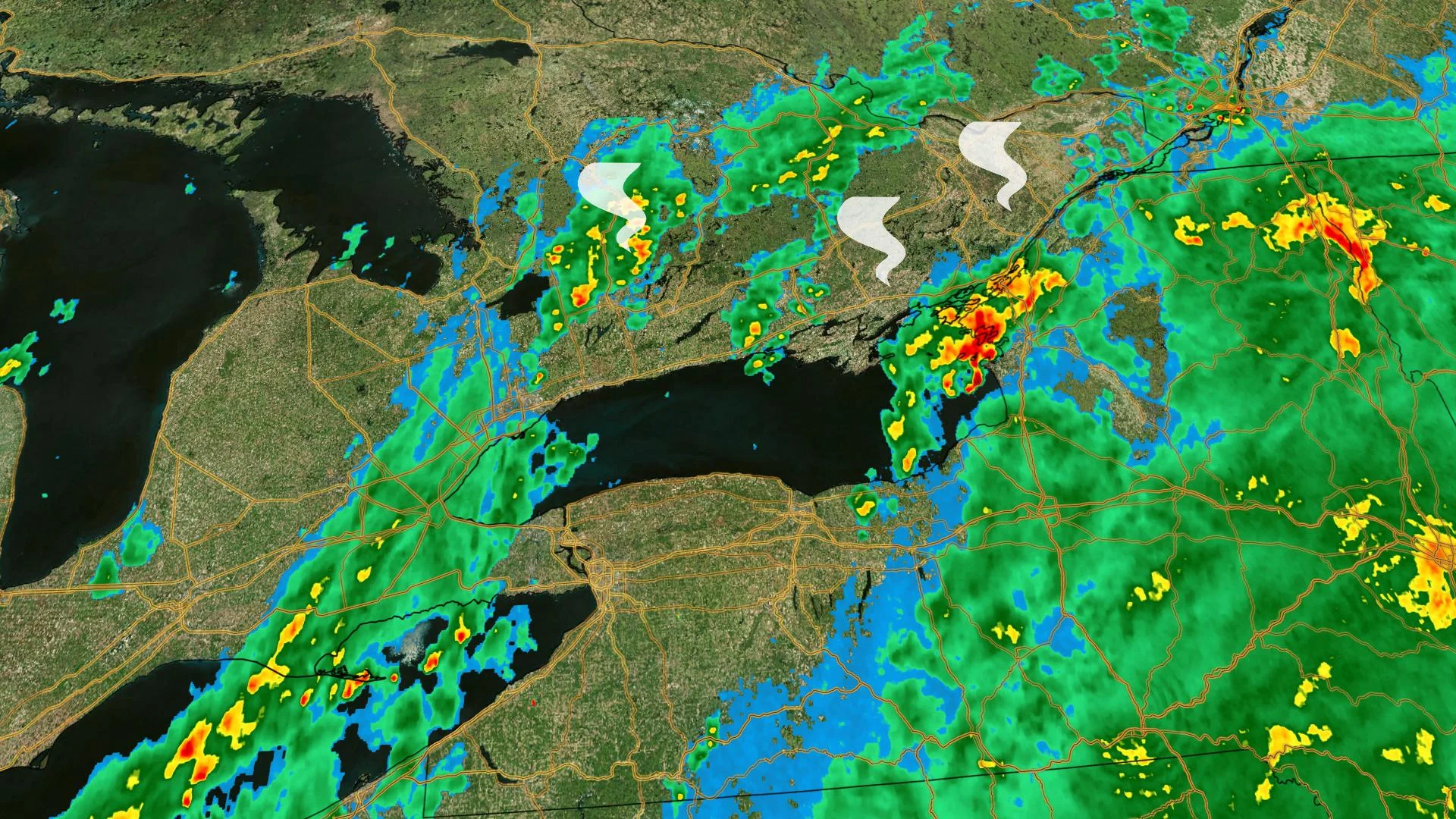
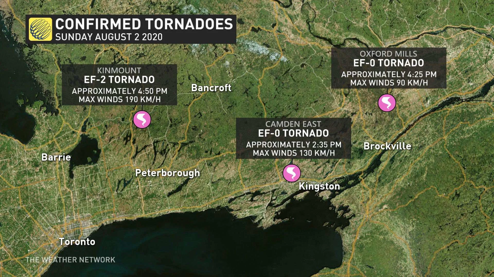
Environment Canada confirmed the tornadoes in a statement late Monday night, beginning with three that took place Sunday afternoon in eastern and central Ontario.
The first, rated a high-end EF-0, was spotted near Camden East at 2:35 p.m., with maximum winds of 130 km/h, and some local damage reported. A second EF-0 twister touched down at 4:25 p.m. near Oxford Mills, with winds near 90 km/h. Damage associated with this tornado was light, so it was given a low-end EF-0 rating.
The third tornado was rated considerably stronger, upgraded to an EF-2 rating after further review of the damage, with maximum winds of 190 km/h, reported at 4:50 p.m. in Kinmount.

The holiday Monday also yieled severe weather, with tornado watches issued as early as the mid-morning.
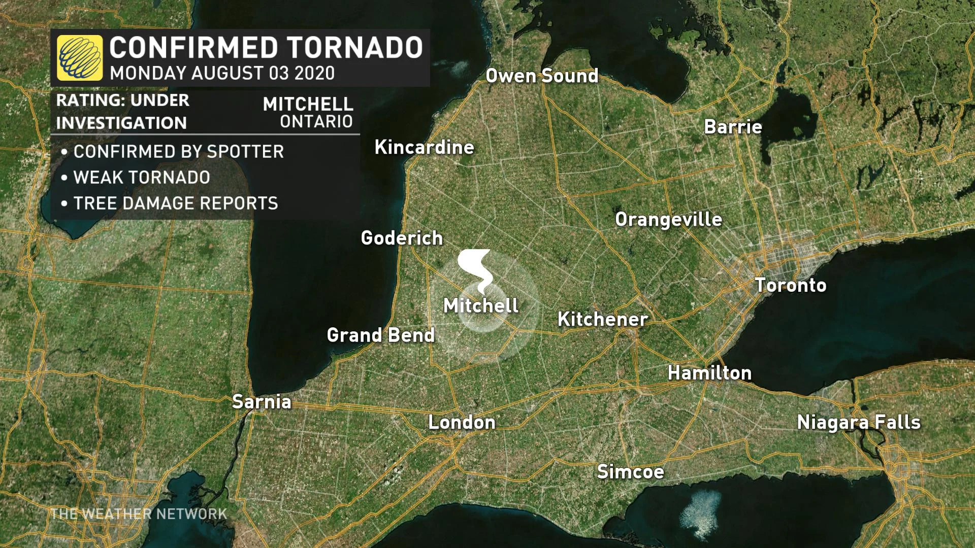
Environment Canada later issued a tornado warning for a weak twister reported by a weather spotter at approximately 12:40 p.m. north of Mitchell. Some tree damage has been reported, and the tornado is under investigation, and has not yet been assigned a rating on the Enhanced Fujita Scale.

If the Mitchell tornado is confirmed, that would bring the number of confirmed twisters to 24 so far this season, around double the province's annual average, with plenty of summer left to go.
On Tuesday, the International Centre for Waterspout Research confirmed there were at least 19 waterspouts/funnels over Lake Erie and southern Lake Huron, as conditions were favourable over parts of the Great Lakes.
A waterspout is a non-supercell tornado that forms beneath a rapidly growing cumulus cloud. They may occasionally come ashore as a weak landspout tornado.
Monday's severe weather was triggered by a stationary boundary that was enhanced by the lake breeze convergence off of Lake Huron and Lake Erie.
Areas from Windsor to the shores of Lake Huron also saw severe thunderstorms that brought thunder, lightning and tornado-warned cells.
By the time the storms reached the GTA, they featured a stunning rain shaft, a column of precipitation that is found underneath a convective storm.
See below for a look at how those storms played out on social media.

Credit: Scottvmace


