Hurricane Lee forecast to rapidly become strongest storm of the year so far

Lee has gained hurricane status, with rapid intensification to a major hurricane expected by the weekend in the Atlantic basin
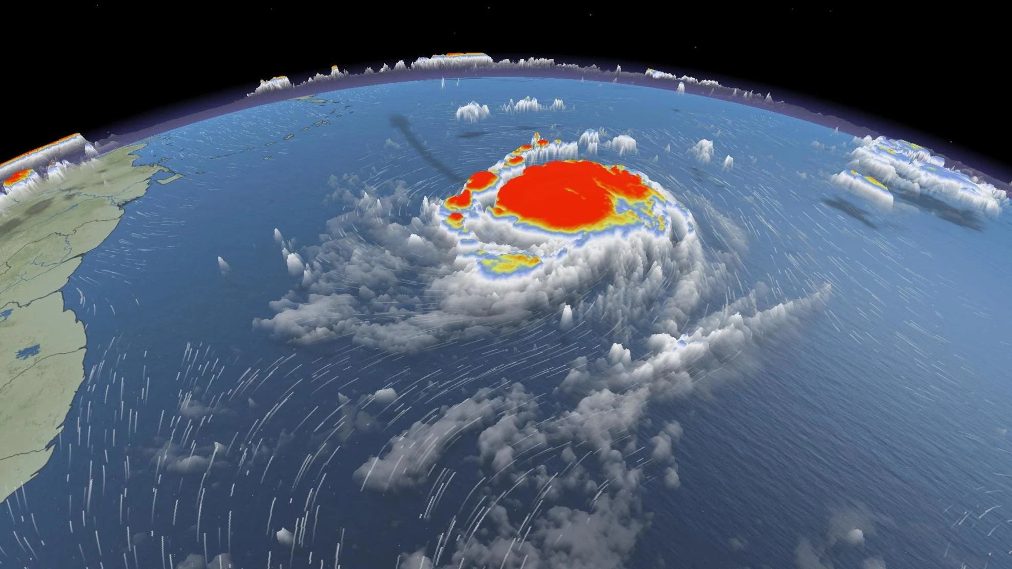
Lee quickly moved up the ranks, becoming the 14th named storm of the season, then strengthening into a hurricane in the Atlantic Ocean on Wednesday. According to the U.S. National Hurricane Center (NHC), this will be an "extremely dangerous" hurricane to watch.
Although there is little to no impact to land in the short term, Lee's development is interesting. Rapid intensification has been a topic with hurricanes over the past couple of years and this one is doing just that.
Visit The Weather Network's hurricane hub to keep up with the latest on tropical developments in Canada and around the world

Early Tuesday, Lee was a tropical depression with a projection to become a Category 4 hurricane within five days –– the first time since five-day forecasts started in 2000 that a storm will intensify that quickly from a tropical depression. That is just a forecast statistic, so we will see how quickly Lee develops with time.
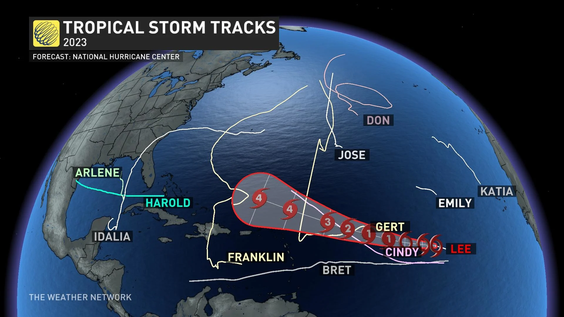
Lee is forecast to reach major storm status by Friday.
It will become a long-lasting storm as it tracks north of the British Virgin Islands towards the western Atlantic. Swells generated by Lee are likely to cause life-threatening surf and rip current conditions.
Lee will be a storm to watch as it has the potential to bring impact to land into late next week. It is still too early to predict how and if this hurricane will impact parts of the Atlantic coast of the United States and Canada, but The Weather Network is closely monitoring its development.
Stay tuned to The Weather Network for the latest forecast updates on Tropical Storm Lee.